
Florencia, Caquetá facts for kids
Quick facts for kids
Florencia
|
|||
|---|---|---|---|
|
Municipality and city
|
|||
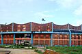
     Top: View of Plaza Pizarro, Second: A sightseeing boat at Biblioteca River, Third: House of the Episcopal Curia, Four: Gustavo Artunduaga Paredes Airport Bottom: Piedmont of Florencia
|
|||
|
|||
| Nickname(s):
Golden Gate to the Colombian Amazonia
|
|||

Location of the municipality and town of Florencia in the Caquetá Department of Colombia.
|
|||

Florencia
Location in Colombia
|
|||
| Country | |||
| Region | Amazonas Region | ||
| Department | Caquetá Department | ||
| Founded | 1902 | ||
| Incorporated | 1912 | ||
| Founded by | Doroteo de Pupiales | ||
| Named for | Florence | ||
| Area | |||
| • Municipality and city | 2,548 km2 (984 sq mi) | ||
| • Urban | 20.21 km2 (7.80 sq mi) | ||
| Elevation | 242 m (794 ft) | ||
| Population
(2023)
|
|||
| • Municipality and city | 177,946 | ||
| • Rank | 35th in Colombia | ||
| • Density | 69.838/km2 (180.88/sq mi) | ||
| DANE | |||
| Demonym(s) | Florencian florenciano (m), -na (f) florentino (m), -na (f) |
||
| Ethnicity | |||
| • White/Mestizo | 95.9% | ||
| • Afro | 3.3% | ||
| • Amerindian | 0.8% | ||
| Time zone | UTC-05 (Colombia Standard Time) | ||
| Postal code |
180001–180009
|
||
| Area code(s) | 57 + 8 | ||
| Major airport | Gustavo Artunduaga Paredes Airport | ||
| Website | Official website: http://www.florencia-caqueta.gov.co | ||
.svg)
.svg)
Florencia is a cool city in Colombia! It's the capital of the Caquetá Department and the biggest city in the Amazon Region of Colombia. About 177,946 people live there (as of 2023). The city is located near the Orteguaza River, which flows into the Caqueta River.
Contents
What's in a Name?
Florencia got its name from an Italian businessman named Paolo Ricci. He was involved in the rubber trade and came from the city of Florence in Italy.
A Look Back in Time
The area where Florencia is now was once home to native tribes like the Andaquí, Witoto, and Coreguaje. The first European to explore this land was a Spanish explorer named Hernán Pérez de Quesada in 1542.
Florencia was officially founded on December 25, 1902. It was started by a Capuchin Friar named Doroteo De Pupiales. He was born in Pupiales, Nariño, Colombia.
The city grew because of rubber plantations nearby. It became an important place after a trail was built connecting it to the town of Guadalupe.
Where is Florencia Located?
Florencia is found at the base of the Cordillera Oriental mountain range. It shares borders with different areas:
- To the north: Huila Department and the town of El Paujil.
- To the east: El Paujil and La Montañita.
- To the south: Milán and Morelia.
- To the west: Belén de Andaquies and the Huila Department.
What's the Weather Like?
Florencia has a tropical rainforest climate. This means it gets a lot of rain throughout the year, even in its driest month. The average temperature in Florencia is around 26.1°C (79°F).
January is usually the driest month, while June tends to be the wettest. The city receives about 3,840 mm (151 inches) of rain each year.
How Does Florencia Make Money?
The main ways Florencia makes money are:
- Trade and vehicle repair: This is the biggest part of the economy.
- Public services: Things like government jobs and defense.
- Artistic activities: This includes creative and cultural events.
Cool Places to Visit
El Encanto Petroglyphs
These are ancient rock carvings found near the Hacha River. They are about 16 meters long and show figures of animals and humans. An archaeologist first described them in 1963.
Curiplaya Building
This is a historic building with old-style architecture. It was built in the 1950s and used to be a hotel. Today, it's home to cultural groups and the Palace of Culture and Fine Arts of the Amazon. The building was recognized as an important cultural site in 2000. The name "Curiplaya" means "Golden Beach" in the Witoto language.
Images for kids
-
Santo Domingo bullring

See also
 In Spanish: Florencia (Caquetá) para niños
