Flowerdale River facts for kids
Quick facts for kids Flowerdale |
|
|---|---|

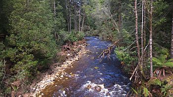
The Flowerdale River at Meunna, North West Tasmania
|
|
|
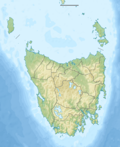
Location of the river mouth in Tasmania
|
|
| Country | Australia |
| State | Tasmania |
| Physical characteristics | |
| Main source | Campbell Ranges West Takone 543 m (1,781 ft) 41°10′36″S 145°34′27″E / 41.17667°S 145.57417°E |
| River mouth | Inglis River Wynyard 16 m (52 ft) 40°58′28″S 145°39′41″E / 40.97444°S 145.66139°E |
| Length | 55 km (34 mi) |
| Basin features | |
| Basin size | 157 km2 (61 sq mi) |
| Tributaries |
|
The Flowerdale River is a waterway located in North West Tasmania, Australia. It stretches for about 55 kilometres (34 mi) (about 34 miles). The river begins in the Campbell Ranges, near a place called West Takone.
It then flows until it joins the Inglis River at Wynyard. The Flowerdale River is the biggest tributary (a smaller stream that flows into a larger river) of the Inglis River. It makes up about one-third of the larger Inglis-Flowerdale catchment area. A catchment area is like a big bowl where all the rain and water collect and flow into a river.
Understanding the Inglis-Flowerdale Catchment Area
The Inglis-Flowerdale catchment area is a large region that collects water for both the Inglis and Flowerdale rivers. It covers about 616 square kilometres (238 sq mi) (about 238 square miles). Even though they don't flow directly into the main rivers, smaller streams like Sisters Creek and Seabrook Creek are also part of this important area.
Rainfall in the Region
The amount of rain that falls in this area changes depending on where you are. Near the coast, it rains about 1,000 millimetres (39 in) (about 39 inches) each year. But further inland, about 26 kilometres (16 mi) (16 miles) from Wynyard, the upper parts of the catchment get much more rain, over 1,600 millimetres (63 in) (about 63 inches) annually.
Land Use and Nature's Protection
The land around the Flowerdale River is used in different ways. In the western parts of the catchment, you'll see many forestry plantations. These are areas where trees are grown to be harvested for wood. In the northern and eastern parts, there's a lot of farming.
The areas around the Inglis and Flowerdale rivers have steep hills and narrow valleys. Because of this, many natural forests have been kept. These native forests act like a natural shield. They help protect the rivers from the effects of farming and tree harvesting nearby.
 | Jewel Prestage |
 | Ella Baker |
 | Fannie Lou Hamer |


