Fordoche, Louisiana facts for kids
Quick facts for kids
Fordoche, Louisiana
|
||
|---|---|---|
|
Town
|
||
| Town of Fordoche | ||
|
||

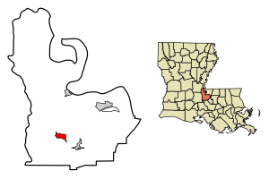
Location of Fordoche in Pointe Coupee Parish, Louisiana.
|
||

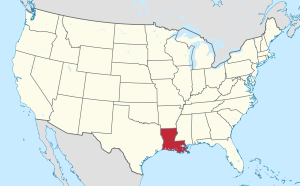
Location of Louisiana in the United States
|
||
| Country | United States | |
| State | Louisiana | |
| Parish | Pointe Coupee | |
| Incorporated | 1961 | |
| Area | ||
| • Total | 2.43 sq mi (6.30 km2) | |
| • Land | 2.43 sq mi (6.30 km2) | |
| • Water | 0.00 sq mi (0.00 km2) | |
| Elevation | 30 ft (9 m) | |
| Population
(2020)
|
||
| • Total | 910 | |
| • Density | 374.02/sq mi (144.43/km2) | |
| Time zone | UTC-6 (CST) | |
| • Summer (DST) | UTC-5 (CDT) | |
| ZIP Code |
70732
|
|
| Area code(s) | 225 | |
| GNIS feature ID | 543211 | |
| FIPS code | 22-26280 | |
Fordoche (say it like "four-DOASH") is a small town in Pointe Coupee Parish, Louisiana, in the United States. In 2020, about 910 people lived there. It's part of the larger Baton Rouge area.
Contents
History of Fordoche
In 1854, Fordoche got its first post office. Thomas Farrar was the first person in charge of it.
How Fordoche Got Its Name
There are two different stories about how Fordoche got its name.
- One idea is that the name comes from a Caddo Indian word. This word meant "wild animal lair," like a cozy spot where a wild animal might rest.
- The other idea is that it comes from a French term used in Louisiana. This term described the thick bushes and plants found at the bottom of a bayou (a slow-moving stream or river).
Fordoche During the Civil War
Fordoche was a site for at least two battles during the American Civil War.
- In September 1863, the Battle of Fordoche Bridge happened. Union soldiers tried to stop Confederate forces in the Atchafalaya River area. But the Confederates won and pushed the Union troops back.
- In May 1864, another fight took place called the "Skirmish on Bayou Fordoche Road." Again, the Confederates were victorious over the Union soldiers.
Becoming a Town
After 1890, many Italian immigrants moved to the Fordoche area. Fordoche is the newest community in Pointe Coupee Parish to become an official town. It started as a village in 1961. Then, in 1994, it officially became a town.
Geography of Fordoche
Fordoche is located at 30°35′29″N 91°36′31″W / 30.59139°N 91.60861°W. The town covers about 2.4 square miles (6.3 square kilometers) of land. There is no water area within the town limits.
Main Roads in Fordoche
- Louisiana Highway 77
- Louisiana Highway 81
Population and People
This section shares information about the people who live in Fordoche.
Population Changes Over Time
The number of people living in Fordoche has changed over the years:
| Historical population | |||
|---|---|---|---|
| Census | Pop. | %± | |
| 1970 | 488 | — | |
| 1980 | 676 | 38.5% | |
| 1990 | 869 | 28.6% | |
| 2000 | 933 | 7.4% | |
| 2010 | 928 | −0.5% | |
| 2020 | 910 | −1.9% | |
| U.S. Decennial Census | |||
As of the year 2000, there were 933 people living in Fordoche. There were 341 households, which are groups of people living together in one home. Most of these (285) were families.
Who Lives in Fordoche?
In 2000, most people in Fordoche were White (about 90.68%). About 8.57% were African American, and a small number were Asian or from two or more races. About 0.75% of the population was Hispanic or Latino.
Many households (37%) had children under 18 living with them. Most households (72.4%) were married couples living together. About 13.8% of homes had just one person living there.
Age and Income
The average age of people in Fordoche in 2000 was 37 years old.
- About 25.3% of the population was under 18.
- About 13.7% of the population was 65 or older.
The average yearly income for a household in Fordoche was about $36,364. For families, the average income was around $40,313.
See also
 In Spanish: Fordoche para niños
 | Anna J. Cooper |
 | Mary McLeod Bethune |
 | Lillie Mae Bradford |


