Fort Barrington facts for kids
Quick facts for kids |
|
|
Fort Barrington
|
|

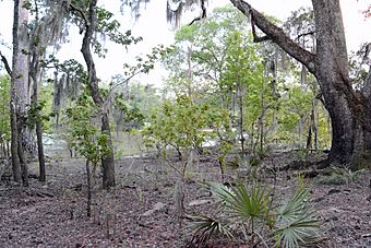
The site of Fort Barrington
|
|
| Nearest city | Darien, Georgia |
|---|---|
| Area | 10 acres (4.0 ha) |
| Built | 1760 |
| Built by | Lieutenant Robert Baillie, of the British Empire |
| NRHP reference No. | 72001447 |
| Added to NRHP | September 27, 1972 |
Fort Barrington was an important old fort built in the mid-1700s. For a short time, it was even called Fort Howe. This fort was used in many big conflicts. These included battles between the British, Spanish, and Native Americans. It was also important during the American Revolutionary War and the American Civil War.
Over the years, much of the fort's original site has been washed away by the river. Even so, it was added to the National Register of Historic Places on September 27, 1972. Today, the area is part of a hunting and fishing club. No major digging or study of the old fort has been done yet.
Contents
History of Fort Barrington
Building the Fort
British soldiers built Fort Barrington in 1751. Lieutenant Robert Baillie was in charge of building it. The fort was named to honor Josiah Barrington. He was a friend of the lieutenant.
Early Use and Conflicts
At first, a group of British Rangers stayed at the fort. It was one of their defenses against Spanish Florida. It also helped protect against attacks from Native American groups.
Fort Barrington in the American Revolution
Later, during the American Revolutionary War, the fort became a main base. It was used by American forces in the southern part of the war. During this time, it was briefly called Fort Howe.
However, British forces captured the fort on March 13, 1778. Colonel Thomas Brown led his Loyalist company. Loyalists were people who supported the British during the war. They attacked the fort and took 23 American soldiers as prisoners. The British then burned the fort.
Fort Barrington During the Civil War
The fort's location was also used later. Confederate soldiers occupied the site during the American Civil War.
A Key Location for Travel
For more than 200 years, the Fort Barrington site was very important. It was a key place for travel and communication. A ferry here was used until the early 1900s. This was because travelers along the coast could avoid crossing four big rivers and swamps. They would pass right by the fort's location.
Fort Barrington Today
The fort was added to the National Register of Historic Places in 1972. Today, you can visit the area where the fort once stood. You can see a clubhouse, small buildings, and trees covered in moss. There is also a sandy beach and a wooden dock.
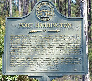
A historical marker about the fort is on Georgia State Route 57. It is located at the line between Long County and McIntosh County. You can still see some signs of the old fort. There are sand walls (called breastworks) and two bastions. These can be seen on the left side of the sandy road. This road leads to the hunting and fishing club that is there now.
Geography of Fort Barrington
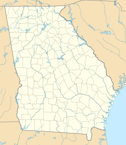
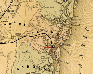
The fort was built on the north side of the Altamaha River. It is about 12 miles (19 km) northwest of the city of Darien, Georgia. What is left of the fort are low ridges or raised areas. These are at the end of a narrow piece of land.
The "sand hills" of Barrington were known long ago. They had been a major trail for Native Americans for hundreds of years. This trail was the main route along the coast. It connected places like Savannah to St. Augustine.
Design of Fort Barrington
Old records from 1762 describe the fort. They say it was a square fort, about 75 feet (23 meters) on each side. It had a special covered passage called a caponier inside. It also had barracks for soldiers.
The fort was built with a strong wooden fence, called a stockade. It had a large central building called a blockhouse. Inside, there was a well for water, a storeroom, and a magazine for gunpowder. There were also barracks where soldiers lived.
The fort had strong towers called bastions at its eastern and southern corners. The southern bastion was right by the river. There were also raised earth walls, called ramparts. These formed a low ridge or embankment. They stretched in a straight line for about 150 yards (137 meters) between the bastions.
 | Charles R. Drew |
 | Benjamin Banneker |
 | Jane C. Wright |
 | Roger Arliner Young |


