Altamaha River facts for kids
Quick facts for kids Altamaha River |
|
|---|---|
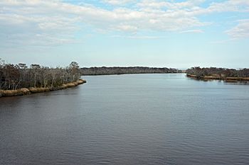
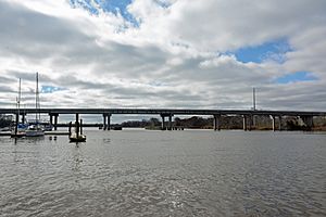
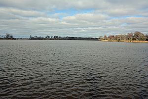
The Altamaha River viewed from the bridge between Glynn County and McIntosh County, Georgia, USA
|
|
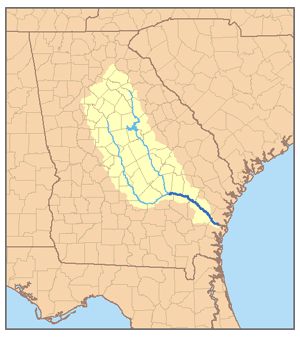
Map of the Altamaha River watershed showing the two main tributaries, the Ocmulgee River and the Oconee River
|
|
| Country | United States |
| State | Georgia |
| Physical characteristics | |
| Main source | near Hazlehurst Georgia 82 ft (25 m) 31°57′33″N 82°32′37″W / 31.95917°N 82.54361°W |
| River mouth | Atlantic Ocean Altamaha Sound 0 ft (0 m) 31°18′57″N 81°17′5″W / 31.31583°N 81.28472°W |
| Length | 137 mi (220 km) |
| Basin features | |
| Basin size | 14,000 sq mi (36,000 km2) |
| Tributaries |
|
The Altamaha River is a big river in the state of Georgia, USA. It flows east for about 137 miles (220 km). The river starts where the Oconee River and Ocmulgee River meet. It then flows into the Atlantic Ocean near Brunswick, Georgia.
There are no dams directly on the Altamaha River itself. However, some dams are on its two main branches, the Oconee and Ocmulgee rivers. The Altamaha River and all its smaller streams cover a huge area of about 14,000 square miles (36,000 km2). This makes it one of the largest river systems on the Atlantic coast of the United States. It is also the biggest river in Georgia.
Contents
Where the Altamaha River Flows
The Altamaha River begins where the Oconee and Ocmulgee rivers join together. This meeting point is close to Lumber City. At its start, the river forms the border between Jeff Davis County and Montgomery County.
The Altamaha River is thought to be the third-largest source of fresh water flowing into the Atlantic Ocean from North America. If you count its longest branch, the Ocmulgee, the Altamaha system is about 470 miles long. This makes it one of the longest rivers entirely within one U.S. state.
The Altamaha River flows through an area where not many people live. There are only a few towns or cities directly along its path. However, some larger cities like Milledgeville (on the Oconee) and Macon (on the Ocmulgee) are on its upper branches.
As the river continues, it forms borders between different counties. The Ohoopee River joins the Altamaha from the north. The Big Hammock Wildlife Management Area is located here. This area is special because it has many rare plants and animals.
Further downstream, Beards Creek joins the Altamaha from the north. The river then flows past Doctortown, near Jesup. This part of the river is surrounded by a wide, swampy area.
Closer to the ocean, many wildlife management areas are found along the river. The Altamaha Wildlife Management Area is on the north side and stretches all the way to the river's mouth. Wolf Island National Wildlife Refuge is on Wolf Island, north of where the river meets the ocean. In its last few miles, the Altamaha River forms the border between McIntosh County and Glynn County.
The town of Darien is just north of the Altamaha River's mouth. The larger city of Brunswick is a few miles to the south. St. Simons Island is also on the south side of the Altamaha's mouth.
The area where the fresh river water mixes with the salty ocean water is called an estuary. The Altamaha River's estuary is about 26 square miles (67 km2) in size. It is one of the largest and most natural estuaries on the Atlantic coast. This area is very important for shorebirds.
Amazing Nature of the Altamaha
Even though the river was used for trade a long time ago, it is mostly still in its natural state. Because of its unique nature, it was named a "bioreserve" by The Nature Conservancy in 1991. This means it's a special place protected for its living things.
The Altamaha River flows through a wide flood plain, which can be up to five miles (8 km) wide. This area has some of the last remaining natural forests and swamps in the Southern United States. As the river gets closer to the ocean, it becomes a wide estuary.
More than 120 types of rare or endangered plants and animals live in the Altamaha River area. This includes 11 types of pearly mussels, with seven of them found only in the Altamaha. The river basin also has the only known example of very old longleaf pine and black oak forests in the United States.
Other important animals found here include shortnose sturgeon, Atlantic sturgeon, and the West Indian manatee. The Eastern indigo snake is also found here. A very rare tree called the Franklin tree (Franklinia alatamaha) was discovered along the Altamaha River in 1765. This tree is now extinct in the wild, but some still grow in gardens from seeds collected long ago.
History of the Altamaha River
The Altamaha River has had many names throughout history, such as A-lot-amaha and Talaxe River.
Long ago, the Timucua people lived in northern Florida and parts of Georgia, reaching as far north as the Altamaha River. The Utinahica tribe lived along the river. A Spanish mission was set up near the river's source around 1610. The Altamaha River also marked the boundary between different Spanish missionary areas along the coast.
Some historians believe that Fort Caroline, built by the French in 1564, was located near the mouth of the Altamaha River. This fort might be the oldest European fort in North America. It was once thought to be near Jacksonville, Florida, but new research suggests the Altamaha location is very likely. This site has not yet been explored by archaeologists. In 1565, Spanish soldiers attacked Fort Caroline.
Later, in the 1600s, a group of Yamasee Native Americans, led by Chief Altamaha, lived near the river's mouth. The Altamaha River was the western border of the Colony of Georgia until the American Revolution. This meant it was the edge of where the English people had settled in North America. The river's name comes from the Yamasee chief, Altamaha.
For hundreds of years, riverboats used the Altamaha as a main way to travel to towns and large farms along the river. In the 1800s, the Altamaha was also important for the timber trade. Large rafts of logs were floated down the river to ports like Brunswick and Darien. From there, the logs were loaded onto ships and sent to other countries.
Rivermen gave colorful names to the different parts of the river. One dangerous spot was called Old Hell Bight. This was a tricky bend with strong currents where pilots could lose their logs or even their lives. The log rafts were very long and wide, but they had to be narrow enough to fit under railroad bridges. Each raft had two long oars for steering. A crew of at least two men would guide the raft. They often had a small shelter and a place for a fire on the raft.
In a poem from 1770 called "The Deserted Village", the Altamaha River is mentioned. The poem talks about people leaving their homes in England and going to new, difficult places. It describes the Altamaha as a wild place with hot sun, thick woods, and dangerous animals.
Industry Along the River
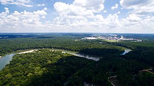
The Plant Hatch nuclear power plant is located on the south bank of the Altamaha River. This plant produces a lot of electricity. A Rayonier paper mill is also on the south bank of the river. This mill makes materials used in plastics and absorbent products like diapers.
Protecting the Altamaha
In 2021, a company related to IKEA bought a large area of land near the Altamaha River. They made an agreement with The Conservation Fund to protect this land. Their goal is to keep the land from being broken up, to help the longleaf pine forest grow back, and to protect the homes of animals like the gopher tortoise.
See also
 In Spanish: Río Altamaha para niños
 | Tommie Smith |
 | Simone Manuel |
 | Shani Davis |
 | Simone Biles |
 | Alice Coachman |


