
Jeff Davis County, Georgia facts for kids
Quick facts for kids
Jeff Davis County
|
|||
|---|---|---|---|
|
County
|
|||

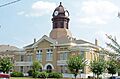
County courthouse
|
|||
|
|||

Location within the U.S. state of Georgia
|
|||
 Georgia's location within the U.S. |
|||
| Country | |||
| State | |||
| Founded | August 18, 1905 | ||
| Named for | Jefferson Davis | ||
| Seat | Hazlehurst | ||
| Largest city | Hazlehurst
|
||
| Area | |||
| • Total | 335 sq mi (870 km2) | ||
| • Land | 331 sq mi (860 km2) | ||
| • Water | 4.7 sq mi (12 km2) 1.4%% | ||
| Population
(2020)
|
|||
| • Total | 14,779 | ||
| • Density | 45/sq mi (17/km2) | ||
| Time zone | UTC−5 (Eastern) | ||
| • Summer (DST) | UTC−4 (EDT) | ||
| Congressional district | 12th | ||


Jeff Davis County is a county in the U.S. state of Georgia. It is located in the southeastern part of the state. In 2020, about 14,779 people lived there.
The main town, or county seat, is Hazlehurst. The county was started on August 18, 1905. It was named after Jefferson Davis, who was the only president of the Confederate States of America.
Contents
Exploring Jeff Davis County's Geography
Jeff Davis County covers a total area of about 335 square miles (868 square kilometers). Most of this area, about 331 square miles (857 square kilometers), is land. The rest, about 4.7 square miles (12 square kilometers), is water.
The county has several important rivers and water basins. The northern and western parts are near the Lower Ocmulgee River. This river is part of the larger Altamaha River basin. The eastern side of the county is also part of the Altamaha River basin.
In the central and southeastern areas, you'll find parts of the Little Satilla River sub-basin. This is part of the bigger St. Marys-Satilla River basin.
Major Roads in Jeff Davis County
Many important roads run through Jeff Davis County. These roads help people travel and transport goods across the county and to other parts of Georgia.
 U.S. Route 23
 U.S. Route 221
 U.S. Route 341
 State Route 19
 State Route 19 Connector
 State Route 27
 State Route 107
 State Route 135
 State Route 135 Connector
 State Route 268
Neighboring Counties of Jeff Davis County
Jeff Davis County shares its borders with several other counties in Georgia. These include:
- Wheeler County (to the north)
- Montgomery County (to the northeast)
- Toombs County (to the northeast)
- Appling County (to the southeast)
- Bacon County (to the southeast)
- Coffee County (to the southwest)
- Telfair County (to the northwest)
Towns and Places in Jeff Davis County
Jeff Davis County has a few towns and communities where people live.
Cities in Jeff Davis County
Census-Designated Place
- Satilla is a special kind of community. It is counted by the census but is not an official city.
Understanding Jeff Davis County's Economy
The economy of Jeff Davis County is quite active. In 2017, the county had about $164 million in retail sales. This means people bought a lot of goods from stores there.
Farming is a very important part of the economy. Farmers grow crops like cotton and peanuts. Timber, which is wood from trees, is also a big product for the county.
Population and People of Jeff Davis County
The number of people living in Jeff Davis County has changed over the years. In 1910, there were about 6,050 people. By 2020, the population grew to 14,779.
| Historical population | |||
|---|---|---|---|
| Census | Pop. | %± | |
| 1910 | 6,050 | — | |
| 1920 | 7,322 | 21.0% | |
| 1930 | 8,118 | 10.9% | |
| 1940 | 8,841 | 8.9% | |
| 1950 | 9,299 | 5.2% | |
| 1960 | 8,914 | −4.1% | |
| 1970 | 9,425 | 5.7% | |
| 1980 | 11,473 | 21.7% | |
| 1990 | 12,032 | 4.9% | |
| 2000 | 12,684 | 5.4% | |
| 2010 | 15,068 | 18.8% | |
| 2020 | 14,779 | −1.9% | |
| 2023 (est.) | 14,906 | −1.1% | |
| U.S. Decennial Census 1790-1880 1890-1910 1920-1930 1930-1940 1940-1950 1960-1980 1980-2000 2010 |
|||
Diversity in Jeff Davis County
The people living in Jeff Davis County come from different backgrounds. Here's a look at the different groups as of 2020:
| Race | Num. | Perc. |
|---|---|---|
| White (not Hispanic) | 9,950 | 67.33% |
| Black or African American (not Hispanic) | 2,293 | 15.52% |
| Native American | 26 | 0.18% |
| Asian | 50 | 0.34% |
| Pacific Islander | 7 | 0.05% |
| Other/Mixed | 406 | 2.75% |
| Hispanic or Latino | 2,047 | 13.85% |
In 2020, there were 14,779 people living in the county. These people lived in 5,279 households, which are like homes or families living together. There were also 3,790 families.
Images for kids
-
County courthouse
See also
 In Spanish: Condado de Jeff Davis (Georgia) para niños
