Fort Riley (CDP), Kansas facts for kids
Quick facts for kids
Fort Riley, Kansas
Fort Riley North
|
|
|---|---|

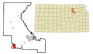
Location within Riley County and Kansas
|
|
| Country | United States |
| State | Kansas |
| Counties | Riley, Geary |
| Area | |
| • Total | 5.05 sq mi (13.07 km2) |
| • Land | 5.03 sq mi (13.04 km2) |
| • Water | 0.008 sq mi (0.02 km2) |
| Elevation | 1,309 ft (399 m) |
| Population
(2020)
|
|
| • Total | 9,230 |
| • Density | 1,829.0/sq mi (706.2/km2) |
| Time zone | UTC-6 (CST) |
| • Summer (DST) | UTC-5 (CDT) |
| Area code | 785 |
| FIPS code | 20-23975 |
| GNIS ID | 2393004 |
Fort Riley is a special kind of community in Kansas, USA. It's called a census-designated place (CDP). This means it's an area identified by the government for counting people, but it's not officially a city or town. It's located on the grounds of a very important U.S. Army base, also called Fort Riley.
Fort Riley is found in both Geary and Riley counties. In 2020, about 9,230 people lived here. This community is also part of the larger Manhattan metropolitan area.
Contents
History of Fort Riley
The area where Fort Riley is located has a long and interesting history. It is sometimes known as "Custer Hill." This name comes from its connection to the famous U.S. Army officer, George Armstrong Custer. The Fort Riley base itself has been an important training and operations center for the United States Army for many years.
Geography and Location
Fort Riley CDP is mainly located in the southern part of Riley County. A small part of the community also extends south into Geary County.
Area and Water Features
According to the United States Census Bureau, the total area of the Fort Riley CDP is about 13.1 square kilometers (about 5 square miles). A very small part of this area, about 0.02 square kilometers (0.008 square miles), is covered by water.
Nearby Cities
Fort Riley is located about 6 miles (10 kilometers) north of Junction City. It is also about 16 miles (26 kilometers) southwest of Manhattan, Kansas.
Population and People
The number of people living in Fort Riley has changed over the years. This information comes from the United States Census Bureau which counts the population every ten years.
- In 2000, the population was 8,114 people.
- In 2010, the population was 7,761 people.
- In 2020, the population grew to 9,230 people.
Education in the Community
The children and families living in Fort Riley are served by a public school district. This district is known as Geary County USD 475. It provides education for students in the area.
See also
 In Spanish: Fort Riley North para niños
 | Bessie Coleman |
 | Spann Watson |
 | Jill E. Brown |
 | Sherman W. White |

