
Fort Union (Utah) facts for kids
Quick facts for kids
Fort Union
|
|
|---|---|
|
Commercial area
|
|

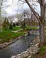
Little Cottonwood Creek in Fort Union
|
|
| Country | United States |
| State | Utah |
| County | Salt Lake |
| Founded by | Jehu Cox |
Fort Union, also known as Union in the past, is a busy shopping and business area in Utah. It's located in the Salt Lake Valley and is now part of three different cities: Midvale, Cottonwood Heights, and Sandy.
This area got its name from a fort built in 1853. The fort was placed in a smart spot near Little Cottonwood Creek. Here, steep hills (called escarpments) on both sides of the valley make a narrow path. This path leads to the upper valley and Little Cottonwood Canyon. This natural pathway has helped Fort Union become a popular place for stores and jobs today.
Contents
A Look Back: Fort Union's History
Early Days and Settlement
The community of Union was first settled in 1849 by a person named Jehu Cox. Eight families lived there that first year. Silas Richards became the leader, called a Bishop, and helped organize the community. By the next year, the number of families had doubled.
In 1850, Silas Richards also taught the first school. About 30 to 35 students attended his classes during the winter months. The area was first called Little Cottonwood, then South Cottonwood.
Building the Fort
The defensive Union Fort was built to protect the early farmers living nearby. It also kept shipments of granite safe. This granite came from Little Cottonwood Canyon and was used to build the famous Salt Lake Temple.
In 1853, there were some problems with Native American groups. Because of this, the settlers decided it was a good idea to build a strong fort. They wanted to live inside its walls for safety. The chosen spot for the village was a square area. The wall was built twelve feet high using rock, clay, and adobe bricks. It even had small openings, called port holes, for defense.
Twenty-three families lived inside the fort in adobe houses. They called their new town "Union." The town was carefully planned with lots and streets. Building the fort was a big and costly project. A large adobe school house was built in the center of Union. This building was used for both school and community meetings.
Times of Change and Return
In July 1857, news arrived that soldiers were coming from the eastern states. This was a surprising and worrying report for the settlers. By November 1857, about twenty men from Union joined a larger group of around 1500 men in the mountains. They aimed to stop the advancing soldiers.
In February 1858, many people in Union became sick with a bad cough and cold, like the flu. This sickness was happening in Salt Lake City and other areas too. On March 22, 1858, the settlers were told to move south because of the approaching army. By May 27, about 40 families from Union had set up a camp south of Payson. This was about 43 miles south of their home.
By July, a peace agreement was made. The families were then able to return safely to Union.
Fort Union Today
The original fort was located near where North Union Avenue and 1000 East Street meet today. You can still see some reminders of this time. The old Jehu Cox house has been moved and is now a shop. There's also a historic marker at the fort's original site. The cemetery for the early settlers is also preserved. It's about half a mile southeast along Creek Road.
For a long time, the Fort Union area stayed mostly rural. It didn't have a very large population. Over time, the name changed from "Union" to "Fort Union."
Getting Around: Transportation

Main Roads
The three most important roads in Fort Union are Utah State Route 71, 1300 East Street, and Fort Union Boulevard. State Route 71 and 1300 East are parallel roads that run north and south. They are usually more than half a mile apart.
However, in Fort Union, these roads come closer together. 1300 East turns west to follow a ridge. State Route 71 turns east, following a canal. Fort Union Boulevard runs east and west. It curves around the northern part of Fort Union on its way from Interstate 15 to Big Cottonwood Canyon.
Other Routes
Other roads in the Fort Union area include 1000 East Street and Creek Road. Union Park Avenue connects Fort Union to Interstate 215. Unlike most of the Salt Lake Valley, which uses a grid pattern, the roads in Fort Union spread out like spokes on a wheel.
Public Transport
The Utah Transit Authority and Wasatch Front Regional Council have talked about adding special bus lines. These lines would connect Fort Union to the TRAX light rail system. They also considered a north-to-south line along 1300 East. However, for now, only regular bus lines are available for public transportation.
Growing Up: Development in Fort Union
Modern Growth
Suburban growth started to affect Fort Union in the mid to late 1900s. But the biggest growth happened in the 1990s. This was after the nearby I-215 highway opened.
The area between State Route 71, Fort Union Boulevard, and North Union Avenue has changed a lot. It is now filled with large stores, often called "big-box stores." These are huge stores that sell many different things. There are also office buildings and lots of parking. Before the 1990s, there were still many open fields. These fields were quickly filled in with new buildings.
Newer Buildings
Since the 1990s, the biggest new developments have been south along 1300 East. This part of Fort Union is within the city of Sandy. More office buildings have been built here. Now, Fort Union has about a dozen large office towers, which are usually 4 to 6 stories tall.
Learning in Fort Union: Education
All of Fort Union is part of the Canyons School District. Hillcrest High School is located on the west side of State Route 71. Mountview Elementary School used to be in the area. It was torn down in 2011. A new park was built in its place. This park is at the northeast corner of the Fort Union shopping district.
Images for kids
-
Little Cottonwood Creek in Fort Union
