Franklin, Maine facts for kids
Quick facts for kids
Franklin, Maine
|
|
|---|---|

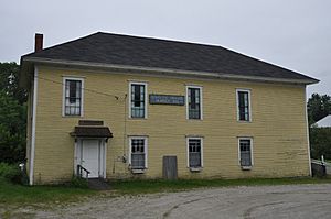
Schoodic Grange Hall
|
|
| Country | United States |
| State | Maine |
| County | Hancock |
| Villages, hamlets, and neighbourhoods | Franklin East Franklin Egypt West Franklin Rabbittown Cards Crossing George’s Pond Franklin Foothills Hog Bay Hills Donnell’s Pond West Blackswoods Macomber Mill Great Pond Schoodic Station Southbay Alderville Shipyard Point Lonely Oaks |
| Government | |
| • Type | New England Town Meeting; Select Board |
| Area | |
| • Total | 41.43 sq mi (107.30 km2) |
| • Land | 36.45 sq mi (94.41 km2) |
| • Water | 4.98 sq mi (12.90 km2) |
| Elevation | 200 ft (61 m) |
| Population
(2020)
|
|
| • Total | 1,567 |
| • Density | 43/sq mi (16.6/km2) |
| Time zone | UTC-5 (Eastern (EST)) |
| • Summer (DST) | UTC-4 (EDT) |
| ZIP code |
04634
|
| Area code(s) | 207 |
| FIPS code | 23-26350 |
| GNIS feature ID | 0582479 |
Franklin is a small town located in Hancock County, Maine, in the United States. In 2020, about 1,567 people lived there. The town is named after the famous American inventor and statesman, Benjamin Franklin.
Contents
Exploring Franklin, Maine
Franklin is a beautiful town with lots to see. It's known for its many hills, clear lakes, and pretty ponds. You can also find large areas of blueberry bushes and amazing views of Hog Bay and the Schoodic Foothills.
Early Settlers and Main Products
The very first person to settle in Franklin was Moses Butler in 1764. A place called Butler's Point is named after him. Over the years, the town has been important for different products.
- At first, people harvested large trees for ship masts.
- Later, they made railroad ties.
- Granite was also a big product.
- Today, Franklin is well-known for its blueberries and Christmas trees.
Where is Franklin Located?
Franklin is next to other towns like Hancock, Eastbrook, and Sullivan. It's also near a wild area called the Blackswoods District. The town is part of the Schoodic Foothills area. This area gets its name from Schoodic Mountain and the nearby Schoodic Peninsula.
Franklin is made up of several smaller villages and neighborhoods. These include Franklin Village, East Franklin, West Franklin, and Egypt. Other areas are Hog Bay Hills, Shipyard Point, and Donnell Pond.
How Franklin is Governed
The town of Franklin is run by its citizens through an annual open town meeting. This is where people gather to make decisions for the town. There is also a board of selectpersons who help manage things day-to-day.
Schools in Franklin
Students in Franklin are part of the Schoodic Communities School District. Younger students, from elementary to junior high, go to Mountain View School in Sullivan. High school students can attend Sumner Memorial High School in East Sullivan.
Size of the Town
Franklin covers a total area of about 41.43 square miles (107.30 square kilometers). Most of this area is land, with about 4.98 square miles (12.90 square kilometers) being water.
Population Over Time
The number of people living in Franklin has changed quite a bit over the years. Here's a look at how the population has grown and shrunk since 1830:
| Historical population | |||
|---|---|---|---|
| Census | Pop. | %± | |
| 1830 | 382 | — | |
| 1840 | 502 | 31.4% | |
| 1850 | 736 | 46.6% | |
| 1860 | 1,004 | 36.4% | |
| 1870 | 1,042 | 3.8% | |
| 1880 | 1,102 | 5.8% | |
| 1890 | 1,264 | 14.7% | |
| 1900 | 1,201 | −5.0% | |
| 1910 | 1,161 | −3.3% | |
| 1920 | 925 | −20.3% | |
| 1930 | 820 | −11.4% | |
| 1940 | 742 | −9.5% | |
| 1950 | 709 | −4.4% | |
| 1960 | 627 | −11.6% | |
| 1970 | 708 | 12.9% | |
| 1980 | 979 | 38.3% | |
| 1990 | 1,141 | 16.5% | |
| 2000 | 1,370 | 20.1% | |
| 2010 | 1,483 | 8.2% | |
| 2020 | 1,567 | 5.7% | |
| U.S. Decennial Census | |||
In 2010, there were 1,483 people living in Franklin. There were 652 households, which are groups of people living together. The average age of people in the town was about 44.6 years old.
See also
 In Spanish: Franklin (Maine) para niños
 | Selma Burke |
 | Pauline Powell Burns |
 | Frederick J. Brown |
 | Robert Blackburn |


