Franksville, Wisconsin facts for kids
Quick facts for kids
Franksville, Wisconsin
|
|
|---|---|

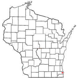
Location of Franksville, Wisconsin
|
|
| Country | United States |
| State | Wisconsin |
| County | Racine |
| Area | |
| • Total | 4.3 sq mi (11.2 km2) |
| • Land | 4.3 sq mi (11.2 km2) |
| • Water | 0.0 sq mi (0.0 km2) |
| Elevation | 728 ft (222 m) |
| Population
(2000)
|
|
| • Total | 1,789 |
| • Density | 412.4/sq mi (159.2/km2) |
| Time zone | UTC-6 (Central (CST)) |
| • Summer (DST) | UTC-5 (CDT) |
| ZIP Code |
53126
|
| Area code(s) | 262 |
| FIPS code | 55-27425 |
| GNIS feature ID | 1565278 |
Franksville is a small community located in Racine County, Wisconsin, in the United States. It used to be called a "census-designated place" (CDP), which is a special area defined for gathering population data. In the year 2000, about 1,789 people lived there.
Contents
Exploring Franksville: A Wisconsin Community
A Look at Franksville's Past
Long ago, the land where Franksville is now was home to the Potawatomi Native American tribe. The first European settlers arrived in the 1830s. At that time, the area was known as Skunk Grove.
By the 1850s, special roads called plank roads were built. These roads were made of wooden planks. Later, in the 1870s, a railroad company called the Chicago, Milwaukee and St. Paul Railway laid train tracks through the area. Today, these tracks are used by the Canadian Pacific Railway.
How Franksville Got Its Name
In 1907, a company called the Frank Pure Food Company started in Franksville. They built a factory to make sauerkraut, which is fermented cabbage. Many people think the town was named after this company, but that's not true! The name "Franksville" was already in use.
It's believed the name came from either Frank Brandecker, who helped map out the area, or Frank Drandieker, who was in charge of the crew that laid the railroad tracks.
The Kraut Festival Fun
The Frank Pure Food Company started a fun event called the Kraut Festival in 1949. It began as a simple picnic for employees and their friends. Over time, it grew into a big four-day event for everyone! The festival stopped in 2002, but it was brought back in 2015 as the Kraut Music Fest.
On March 20, 2006, Franksville became part of a new village called Caledonia.
Where is Franksville Located?
Franksville is located in southeastern Wisconsin. Its exact location is 42°45′40″N 87°54′19″W / 42.76111°N 87.90528°W.
According to the United States Census Bureau, the area of Franksville is about 4.3 square miles (11.2 square kilometers). All of this area is land.
Notable People from Franksville
Some important people have connections to Franksville:
- Walter Goodland: He lived on his farm in Franksville. He later became the Governor of Wisconsin, which is the leader of the state government.
- Elmer A. Morse: He was born in Franksville. He became a member of the United States House of Representatives, which is part of the U.S. government that makes laws.
 | Toni Morrison |
 | Barack Obama |
 | Martin Luther King Jr. |
 | Ralph Bunche |

