
Frederick, South Dakota facts for kids
Quick facts for kids
Frederick, South Dakota
|
|
|---|---|

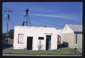
Main Street in Frederick, August 2017
|
|

Location in Brown County and the state of South Dakota
|
|
| Country | United States |
| State | South Dakota |
| County | Brown |
| Incorporated | 1882 |
| Area | |
| • Total | 1.35 sq mi (3.51 km2) |
| • Land | 1.35 sq mi (3.51 km2) |
| • Water | 0.00 sq mi (0.00 km2) |
| Elevation | 1,378 ft (420 m) |
| Population
(2020)
|
|
| • Total | 215 |
| • Density | 158.79/sq mi (61.29/km2) |
| Time zone | UTC-6 (Central (CST)) |
| • Summer (DST) | UTC-5 (CDT) |
| ZIP code |
57441
|
| Area code(s) | 605 |
| FIPS code | 46-22860 |
| GNIS feature ID | 1267395 |
Frederick is a small town located in the northwestern part of Brown County, South Dakota, in the United States. In 2020, about 215 people lived there. Frederick is known for its yearly Frederick Finn Fest, a celebration of Finnish culture. It is also part of the larger Aberdeen Micropolitan Statistical Area.
Contents
History of Frederick

Frederick started as a railway town. This means it was created and developed because a railroad was built through the area. The Chicago, Milwaukee & St. Paul Railroad laid its tracks here on September 12, 1881. The railroad then sold plots of land to people who wanted to settle there.
The town's streets were laid out in a grid pattern, like a checkerboard. Avenues run north and south, and streets run east and west. Main Street and Railway Avenue are at the very center of this grid. Frederick officially became a town on June 21, 1882. It was named after Kustaa "Frederick" Bergstadius, who was a Finnish agent for the railroad. He helped many Finnish people move to the area.
On July 2, 1921, a strong tornado hit the downtown area of Frederick. Almost every building in the town was destroyed. Sadly, one person died when their home was ripped from its foundation during the storm.
Frederick's Geography
Frederick covers a total area of about 3.51 square kilometers (1.35 square miles). All of this area is land, with no water.
The town is located along U.S. Route 281, which is a major highway. The Maple River also flows through or near Frederick, helping to drain the land.
Population and People
| Historical population | |||
|---|---|---|---|
| Census | Pop. | %± | |
| 1890 | 281 | — | |
| 1900 | 251 | −10.7% | |
| 1910 | 433 | 72.5% | |
| 1920 | 424 | −2.1% | |
| 1930 | 461 | 8.7% | |
| 1940 | 422 | −8.5% | |
| 1950 | 408 | −3.3% | |
| 1960 | 381 | −6.6% | |
| 1970 | 359 | −5.8% | |
| 1980 | 307 | −14.5% | |
| 1990 | 241 | −21.5% | |
| 2000 | 255 | 5.8% | |
| 2010 | 199 | −22.0% | |
| 2020 | 215 | 8.0% | |
| U.S. Decennial Census 2017 Estimate |
|||
How Many People Live Here?
In 2010, there were 199 people living in Frederick. These people made up 101 households, with 56 of them being families. The town had about 510 people per square mile.
Most of the people living in Frederick were White (98.5%). A small number were Asian (0.5%), and 1.0% were from two or more racial backgrounds.
Age and Households
About 22.8% of the households in Frederick had children under 18 years old. Many households (47.5%) were married couples living together. Some households had a single parent, either a mother (2.0%) or a father (5.9%).
About 41.6% of all households were made up of just one person. Of these, 18.8% were people aged 65 or older living alone. The average household had about 1.97 people, and the average family had about 2.66 people.
The average age of people in Frederick was 51.4 years old. About 19.6% of residents were under 18. About 27.1% were 65 years or older. The town had slightly more males (55.3%) than females (44.7%).
Famous People from Frederick
- Edward John Thye: He was a well-known politician who served as the governor of Minnesota from 1943 to 1947.
See also
 In Spanish: Frederick (Dakota del Sur) para niños
