Fremont, North Carolina facts for kids
Quick facts for kids
Fremont, North Carolina
|
|
|---|---|
 |
|
| Country | United States |
| State | North Carolina |
| County | Wayne |
| Area | |
| • Total | 1.36 sq mi (3.51 km2) |
| • Land | 1.36 sq mi (3.51 km2) |
| • Water | 0.00 sq mi (0.00 km2) |
| Elevation | 148 ft (45 m) |
| Population
(2020)
|
|
| • Total | 1,196 |
| • Density | 882.01/sq mi (340.49/km2) |
| Time zone | UTC-5 (Eastern (EST)) |
| • Summer (DST) | UTC-4 (EDT) |
| ZIP code |
27830
|
| Area code(s) | 919 |
| FIPS code | 37-24900 |
| GNIS feature ID | 2406524 |
| Website | Town of Fremont |
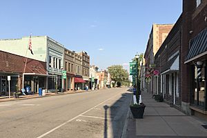
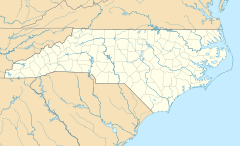
Fremont is a small town located in Wayne County, North Carolina, in the United States. In 2020, about 1,196 people lived there. Fremont is part of the larger Goldsboro area.
Contents
Discovering Fremont's Past
Fremont was first called Nahunta. It got its new name in 1869. The town was named after Colonel Sewall Lawrence Fremont. He was an important engineer for a railroad company from 1854 to 1871.
Some special places in Fremont are listed on the National Register of Historic Places. This means they are important buildings or sites that are worth protecting. These include the Aycock Birthplace, the Barnes-Hooks Farm, and the Dred and Ellen Yelverton House.
Understanding Fremont's Geography
Fremont is a small town that covers about 1.4 square miles (3.51 square kilometers). All of this area is land. There are no large bodies of water within the town limits.
Who Lives in Fremont?
The number of people living in Fremont has changed over many years. Here is how the population has grown and shrunk:
| Historical population | |||
|---|---|---|---|
| Census | Pop. | %± | |
| 1880 | 246 | — | |
| 1890 | 377 | 53.3% | |
| 1900 | 435 | 15.4% | |
| 1910 | 951 | 118.6% | |
| 1920 | 1,294 | 36.1% | |
| 1930 | 1,316 | 1.7% | |
| 1940 | 1,264 | −4.0% | |
| 1950 | 1,395 | 10.4% | |
| 1960 | 1,609 | 15.3% | |
| 1970 | 1,596 | −0.8% | |
| 1980 | 1,736 | 8.8% | |
| 1990 | 1,710 | −1.5% | |
| 2000 | 1,463 | −14.4% | |
| 2010 | 1,255 | −14.2% | |
| 2020 | 1,196 | −4.7% | |
| U.S. Decennial Census | |||
Fremont's Population in 2020
In 2020, there were 1,196 people living in Fremont. These people lived in 426 households. About half of the people were White, and about half were Black or African American. There were also smaller groups of Asian, mixed-race, and Hispanic or Latino people.
| Race | Number | Percentage |
|---|---|---|
| White (not Hispanic) | 534 | 44.65% |
| Black or African American (not Hispanic) | 551 | 46.07% |
| Asian | 3 | 0.25% |
| Other/Mixed | 44 | 3.68% |
| Hispanic or Latino | 64 | 5.35% |
Learning in Fremont
The schools in Fremont are part of the Wayne County Public Schools system. Students can attend Fremont STARS Elementary School for younger grades. Older students go to Norwayne Middle School and Charles B. Aycock High School. If students want to continue their education after high school, Wayne Community College is nearby in Goldsboro.
Getting Around Fremont
There are several ways to travel to and from Fremont.
Passenger Travel Options
- By Air: The closest big airport is Raleigh-Durham International Airport. It offers flights to many places. A smaller airport, Goldsboro-Wayne Municipal Airport, is nearby for private planes.
- By Car: I-795 is a major highway close to Fremont. Interstate 95 is about 15 miles away.
- By Train: Fremont does not have its own train station. The closest Amtrak train station is in Wilson.
- By Bus: You can catch a Greyhound bus in nearby Goldsboro.
Main Roads in Fremont
The two main roads that go through Fremont are US 117 and NC 222. These roads help people get around town and connect to other areas.
See also
 In Spanish: Fremont (Carolina del Norte) para niños
 | Lonnie Johnson |
 | Granville Woods |
 | Lewis Howard Latimer |
 | James West |


