Fryingpan Glacier facts for kids
Quick facts for kids Fryingpan Glacier |
|
|---|---|

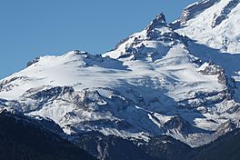
Fryingpan Glacier and Little Tahoma Peak in 2007
|
|
| Type | Mountain glacier |
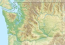
| Coordinates | 46°50′32″N 121°41′27″W / 46.84222°N 121.69083°W |
| Length | 1.10 mi (1.77 km) |
| Terminus | Icefall |
| Status | Retreating |
The Fryingpan Glacier is a cool river of ice located on the eastern side of Little Tahoma Peak. This peak stands tall at 11,138-foot (3,395 m) and is a neighbor to the famous Mount Rainier in Washington State, USA.
Where is the Fryingpan Glacier?
The Fryingpan Glacier sits high up, almost like it's on a cliff. It is located above the Emmons Glacier to its north. A small ridge usually keeps it separate from the Whitman Glacier to the south. But sometimes, a little snowfield connects these two glaciers!
Glacier's Elevation and Flow
Most of this glacier's ice rests on a wide, flat area called a plateau. This plateau is very high up, between 8,000 to 8,600 feet (2,400 to 2,600 m) (about 2,400 to 2,600 meters) above sea level. The very top of the Fryingpan Glacier, called its "head," is found at the base of Little Tahoma Peak. Here, the elevation ranges from 9,100 to 9,800 feet (2,800 to 3,000 m) (about 2,800 to 3,000 meters).
The glacier slowly flows downhill towards the east. Because the ground underneath is uneven, the glacier's surface has many deep cracks called crevasses. These cracks form as the ice moves over bumps and dips in the land.
The Glacier's End and Meltwater
The Fryingpan Glacier eventually ends on slopes that can be gentle or quite steep. This happens at an elevation of about 7,100 to 7,500 feet (2,200 to 2,300 m) (around 2,200 to 2,300 meters).
Near the bottom and to the east of the glacier, you can find many snowfields. There are also beautiful alpine meadows, which are open areas with small plants that grow in cold, high-altitude places. The ice from the Fryingpan Glacier melts and forms water. This meltwater then flows into the White River.
 | Lonnie Johnson |
 | Granville Woods |
 | Lewis Howard Latimer |
 | James West |


