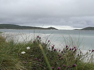
Fuday facts for kids
| Gaelic name | Fùideigh |
|---|---|
| OS grid reference | NF736082 |
| Coordinates | 57°03′N 7°23′W / 57.05°N 07.39°W |
| Physical geography | |
| Island group | Uists and Barra |
| Area | 232 ha (0.90 sq mi) |
| Area rank | 101 |
| Highest elevation | Mullach Neacail, 89 m (292 ft) |
| Administration | |
| Sovereign state | United Kingdom |
| Country | Scotland |
| Council area | Na h-Eileanan Siar |
| Demographics | |
| Population | uninhabited since 1901 |
Fuday (which is Fùideigh in Scottish Gaelic) is an island in Scotland. It is part of the Outer Hebrides, a group of islands off the west coast. Fuday is a small island, about 232 hectares (or 573 acres) in size. It is one of ten islands found in an area called the Sound of Barra.
Fuday is located just east of Barra island and west of Eriskay island. The Scottish Government owns Fuday. No one has lived on the island since 1901. The most people ever recorded living there at one time was just seven.
Life on Fuday
Even though no people live on Fuday, the island is still used. Farmers bring their cattle to Fuday during the summer so they can graze. In the past, these cattle were swum across the Caolas Fuideach. This is a strait (a narrow stretch of water) that is about 1 mile (1.6 kilometers) wide but not very deep. The cattle would swim from Eoligarry on Barra to Fuday.
When cattle were first brought to the island, a sad thing happened. The farmers who left the cattle there did not show them where to find water. There was only one place on the island with fresh drinking water, a loch (lake) far inland. Because the cattle could not find this water, they died of thirst.
See also
 In Spanish: Fuday para niños
- Islands of the Sound of Barra
- Uninhabited islands of the Outer Hebrides
 | Toni Morrison |
 | Barack Obama |
 | Martin Luther King Jr. |
 | Ralph Bunche |


