Furley, Kansas facts for kids
Quick facts for kids
Furley, Kansas
|
|
|---|---|

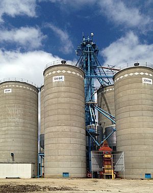
Furley CO-OP (2015)
|
|

|
|
| Country | United States |
| State | Kansas |
| County | Sedgwick |
| Township | Lincoln |
| Elevation | 1,411 ft (430 m) |
| Population
(2020)
|
|
| • Total | 39 |
| Time zone | UTC-6 (CST) |
| • Summer (DST) | UTC-5 (CDT) |
| Area code | 316 |
| FIPS code | 20-24975 |
| GNIS ID | 473703 |
Furley is a very small community in Sedgwick County, Kansas, in the United States. It is called a "census-designated place" (CDP). This means it's an area the government counts for population, but it's not an official city.
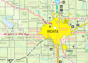
In 2020, only 39 people lived in Furley. You can find it northwest of where Greenwich Road and 101st Street N meet. It's also right along the Union Pacific Railroad tracks.
Contents
History of Furley
Railroad and Post Office Beginnings
In 1887, a railroad company called the Chicago, Kansas and Nebraska Railway built tracks through Furley. These tracks went from Herington, Kansas, all the way south to Caldwell, Kansas. By 1893, the line stretched even further to Fort Worth, Texas.
Over the years, this railroad changed owners many times. It became the Chicago, Rock Island and Pacific Railway. Even though it's now part of the Union Pacific Railroad, many local people still call it the "Rock Island" line.
Also in 1887, a post office opened in Furley. This allowed people in the community to send and receive mail. The post office served the area for many years before it closed down in 1953.
Where is Furley? (Geography)
Furley is located in Kansas. Its exact spot on a map is 37°52′45″N 97°12′46″W / 37.87917°N 97.21278°W. This helps people find it using coordinates, which are like an address for any place on Earth.
Who Lives in Furley? (Demographics)
"Demographics" is a fancy word for studying the people who live in a place. It looks at things like how many people there are, how old they are, and how many families live there.
According to the 2020 United States census, 39 people lived in Furley. There were 18 households, which means 18 different homes where people lived. Out of these, 15 were families.
- Population Details:
- 12.8% of the people were under 18 years old.
- Most people, about 56.4%, were between 45 and 64 years old.
- The average age in Furley was about 54.5 years.
Education in the Area
Students in Furley attend schools that are part of the Remington USD 206 public school district. The mascot for Remington High School is a Bronco.
- High School: Frederic Remington High School is located north of Brainerd.
- Middle School: Remington Middle School is in Whitewater.
- Elementary School: Remington Elementary School is in Potwin.
Community Services (Infrastructure)
"Infrastructure" refers to the basic systems and services that a community needs to function. This includes things like roads, railways, and utilities.
Getting Around (Transportation)
- Highways: I-135 is a major highway about 6 miles west of Furley.
- Railroad: The Union Pacific Railroad tracks run right through the community.
Utilities and Services
- Internet: People in Furley can get internet service through wireless providers like Pixius Communications or satellite providers like HughesNet and WildBlue.
- Television: TV is available through satellite services like DirecTV and Dish Network, or from local digital TV stations.
- Water: Water for the community comes from rural water districts, including Sedgwick County RWD #2 and Harvey County RWD #1.
 | DeHart Hubbard |
 | Wilma Rudolph |
 | Jesse Owens |
 | Jackie Joyner-Kersee |
 | Major Taylor |


