Brainerd, Kansas facts for kids
Quick facts for kids
Brainerd, Kansas
|
|
|---|---|

|
|
| Country | United States |
| State | Kansas |
| County | Butler |
| Township | Milton |
| Platted | 1885 |
| Named for | Elisha B. Brainerd (landowner) |
| Elevation | 1,385 ft (422 m) |
| Time zone | UTC-6 (CST) |
| • Summer (DST) | UTC-5 (CDT) |
| ZIP code |
67154
|
| Area code | 316 |
| FIPS code | 20-08200 |
| GNIS ID | 473721 |
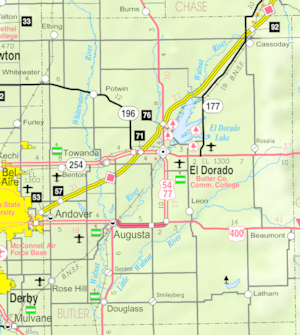
Brainerd is a small, unincorporated community in Butler County, Kansas, United States. An unincorporated community means it's not an official city with its own government. Brainerd is located on the north side of the K-196 highway. It sits between the cities of Whitewater and Potwin.
Contents
History of Brainerd
For thousands of years, the Great Plains of North America were home to nomadic Native American tribes. These groups moved around, often following animal herds.
Kansas Becomes a State
In the early 1800s, the United States bought a huge amount of land from France. This was called the Louisiana Purchase in 1803. This purchase included most of what is now Kansas. In 1854, the Kansas Territory was created. Then, in 1861, Kansas officially became the 34th U.S. state.
Butler County, where Brainerd is located, was established in 1855.
Founding of Brainerd
Brainerd was first known as Holden. It had a post office that opened in 1870. In 1886, its name changed to Brainerd. The post office eventually closed in 1907.
The community of Brainerd was officially planned out in 1885. It grew around a train station along the Missouri Pacific Railroad line. Brainerd was named after Elisha B. Brainerd, who owned the land there. The community grew quickly, with some businesses and homes moving from a nearby place called Plum Grove.
Modern Brainerd
In 1961, Frederic Remington High School was built just north of Brainerd. This new school brought together students from several smaller towns and communities. These included Whitewater, Potwin, Brainerd, and Elbing. People voted to build the new school in a central spot, not in any of the main towns. This led to the school being built near Brainerd.
In 2006, a monument called the Remington Rock was built near the high school.
Geography
Brainerd is located at 37°57′4″N 97°5′43″W / 37.95111°N 97.09528°W. This spot is on the north side of the K-196 highway. It is situated between the towns of Whitewater and Potwin.
Education
Students in Brainerd attend schools in the Remington USD 206 public school district. The mascot for Remington High School is a Bronco.
- Frederic Remington High School is located just north of Brainerd.
- Remington Middle School is in Whitewater.
- Remington Elementary School is in Potwin.
Local News
People in Brainerd can read several regional newspapers.
- The Newton Kansan is a newspaper from Newton.
- Butler County Times-Gazette is from El Dorado.
- The Wichita Eagle is a larger newspaper from Wichita.
Transportation
The K-196 highway runs along the south side of the Brainerd community. This highway helps people travel to and from Brainerd.
 | Delilah Pierce |
 | Gordon Parks |
 | Augusta Savage |
 | Charles Ethan Porter |


