
Potwin, Kansas facts for kids
Quick facts for kids
Potwin, Kansas
|
|
|---|---|

Potwin water tower (2015)
|
|

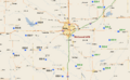
Location within Butler County and Kansas
|
|

|
|
| Country | United States |
| State | Kansas |
| County | Butler |
| Founded | 1880s |
| Incorporated | 1885 |
| Named for | Charles Potwin |
| Government | |
| • Type | Mayor-Council |
| Area | |
| • Total | 0.23 sq mi (0.61 km2) |
| • Land | 0.23 sq mi (0.61 km2) |
| • Water | 0.00 sq mi (0.00 km2) |
| Elevation | 1,345 ft (410 m) |
| Population
(2020)
|
|
| • Total | 421 |
| • Density | 1,830/sq mi (690/km2) |
| Time zone | UTC-6 (CST) |
| • Summer (DST) | UTC-5 (CDT) |
| ZIP code |
67123
|
| Area code | 620 |
| FIPS code | 20-57300 |
| GNIS ID | 2396263 |
Potwin is a small city in Butler County, Kansas, United States. It was named after Charles Potwin, who owned the land where the town was built. In 2020, about 421 people lived in Potwin.
Contents
History of Potwin
How Potwin Began
Long ago, the Great Plains of North America were home to Native American tribes. Later, from the 1500s to the 1700s, France claimed much of this land. In 1762, France gave the land to Spain.
In 1803, the United States bought a huge area, including modern-day Kansas, from France. This was called the Louisiana Purchase. Kansas became a U.S. state in 1861.
Potwin's Founding in the 1800s
Potwin was officially made a town on April 8, 1885. It was named after Charles Potwin, who owned the land. The town became a stop for the Missouri Pacific Railroad.
A man named William I. Joseph helped make this happen. He came from West Virginia and worked hard to bring the railroad to the area. Joseph opened a land office and helped the town grow. A post office, which was once in a nearby town called Ayr, moved to Potwin in 1885.
Potwin in the 1900s
In the early 1900s, Potwin grew because of the oil fields nearby. In 1920, John Vickers built the Vickers Oil Refinery in Potwin. This refinery processed a lot of oil, especially in the 1950s. However, the refinery closed down in the 1960s and was later taken apart.
In 1961, several local schools joined together to create Frederic Remington High School. This new school was built north of Brainerd.
From the 1960s to the 1980s, a special defense site was located north of Potwin. It was a Titan II missile site, part of a network overseen by the 381st Strategic Missile Wing at McConnell Air Force Base.
Potwin in the 2000s
In 2010, the Keystone-Cushing Pipeline was built near Potwin. This pipeline carries oil across the country.
There was also a strange computer issue where a farm near Potwin became the default location for millions of IP addresses online. This happened because a mapping company changed its default location for unknown addresses.
Geography and Climate
Where is Potwin?
Potwin is a small city. According to the United States Census Bureau, it covers about 0.24 square miles (0.61 square kilometers) of land.
Potwin's Weather
Potwin has a humid subtropical climate. This means it has hot, humid summers and winters that are usually mild to cool.
People of Potwin (Demographics)
| Historical population | |||
|---|---|---|---|
| Census | Pop. | %± | |
| 1910 | 249 | — | |
| 1920 | 415 | 66.7% | |
| 1930 | 427 | 2.9% | |
| 1940 | 487 | 14.1% | |
| 1950 | 465 | −4.5% | |
| 1960 | 635 | 36.6% | |
| 1970 | 497 | −21.7% | |
| 1980 | 563 | 13.3% | |
| 1990 | 448 | −20.4% | |
| 2000 | 457 | 2.0% | |
| 2010 | 449 | −1.8% | |
| 2020 | 421 | −6.2% | |
| U.S. Decennial Census | |||
Potwin's Population in 2020
The 2020 United States census showed that 421 people lived in Potwin. There were 168 households and 113 families. Most people living in Potwin were white (about 90%). About 5% of the population identified as Hispanic or Latino.
About 23% of the people were under 18 years old. The average age in Potwin was 39.4 years.
Potwin's Population in 2010
In 2010, the city had 449 people. There were 181 households. About 92% of the people were White. About 5.6% were Hispanic or Latino.
About 25% of the people were under 18 years old. The average age was 39.4 years.
Education in Potwin
The schools in Potwin are part of the Remington USD 206 public school district. The mascot for Remington High School is a Bronco.
- Frederic Remington High School is located north of Brainerd.
- Remington Middle School is in Whitewater.
- Remington Elementary School is located in Potwin.
Potwin used to have its own high school, but it closed when the school districts combined. The mascot for Potwin High School was the Greyhounds.
Media and News
Newspapers
People in Potwin can read several newspapers:
- The Newton Kansan
- Butler County Times-Gazette
- The Wichita Eagle
Radio and TV
Potwin gets its radio and television channels from the Wichita-Hutchinson area. This includes local radio stations, cable TV, and satellite TV.
Transportation
K-196 is a highway that runs along the south side of Potwin.
Images for kids
-
Map showing the locations of Titan II missile sites, including one near Potwin.

See also
 In Spanish: Potwin (Kansas) para niños
