Galchutt, North Dakota facts for kids
Quick facts for kids
Galchutt, North Dakota
|
|
|---|---|

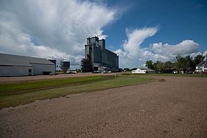
Looking north at Galchutt
|
|
| Country | United States |
| State | North Dakota |
| County | Richland |
| Elevation | 951 ft (290 m) |
| Time zone | UTC-6 (Central (CST)) |
| • Summer (DST) | UTC-5 (CDT) |
| Area code(s) | 701 |
| GNIS feature ID | 1029073 |
Galchutt is a small, quiet place in Richland County, North Dakota, in the United States. It's called an unincorporated community, which means it doesn't have its own local government like a city or town does. Instead, it's managed by the county. Galchutt is located along the Red River Valley and Western Railroad, about 12.9 miles (20.8 km) northwest of a larger town called Wahpeton.
History of Galchutt
Galchutt got its name from a man named Hans Galchutt. He was an early settler in the area. In 1882, Hans Galchutt built the first important buildings there. He constructed a home for himself, a store where people could buy supplies, and a grain warehouse. This warehouse was a place to store crops like wheat before they were sent to other places.
Because Hans Galchutt was so important to the start of the community, the village was named after him. His efforts helped create a central spot for people living in the surrounding farmlands.
Where is Galchutt?
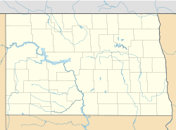
Galchutt is located in the southeastern part of North Dakota. It sits in Richland County. The community is found along the tracks of the Red River Valley and Western Railroad. This railroad was important for moving goods and people in the past.
The elevation of Galchutt is about 951 feet (or 290 meters) above sea level. This means it's not very high up. It's part of the flat landscape of the Red River Valley, which is known for its rich farming soil.
 | Misty Copeland |
 | Raven Wilkinson |
 | Debra Austin |
 | Aesha Ash |


