Gandy, Utah facts for kids
Quick facts for kids
Gandy, Utah
|
|
|---|---|
| Country | United States |
| State | Utah |
| County | Millard |
| Named for | Isaac Gandy |
| Elevation | 4,951 ft (1,509 m) |
| Time zone | UTC-7 (Mountain (MST)) |
| • Summer (DST) | UTC-6 (MDT) |
| ZIP codes |
84728
|
| Area code(s) | 435 |
| GNIS feature ID | 1437769 |
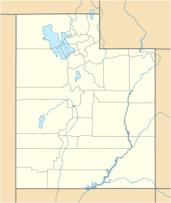
Gandy is a small, quiet place in the state of Utah, United States. It's known as an unincorporated community, which means it doesn't have its own local government like a city or town. Gandy is located in the far northwestern part of Millard County. It sits very close to the border between Utah and Nevada.
Discovering Gandy
Gandy is found in the west-central part of a large area called Snake Valley. This valley is part of the bigger Great Basin region. The area is famous for its natural features.
Gandy Warm Springs
One of the most special things about Gandy is the Gandy Warm Springs. These springs are a large source of water that flows out from the base of Spring Mountain. The water comes out at a steady temperature of about 81–82 degrees Fahrenheit (27–28 Celsius) all year round. This is quite warm and makes the springs unique. The amount of water flowing from the springs is very large, about 15 to 19 cubic feet per second. This is enough water to fill a small swimming pool in just a few minutes!
How Gandy Got Its Name
Gandy was not always called Gandy. It was first known as Smithville. In 1925, the community was renamed Gandy. It was named after Isaac Gandy. He was the first person to own a ranch in this area. Long ago, Gandy was also an important stop along the Pony Express and Overland Route. These were famous routes used for delivering mail and traveling across the country in the 1800s.
Population Over Time
The number of people living in Gandy has changed over many years. Here's a look at the population from 1900 to 1950:
| Historical population | |||
|---|---|---|---|
| Census | Pop. | %± | |
| 1900 | 89 | — | |
| 1910 | 69 | −22.5% | |
| 1920 | 79 | 14.5% | |
| 1930 | 65 | −17.7% | |
| 1940 | 39 | −40.0% | |
| 1950 | 48 | 23.1% | |
| Source: U.S. Census Bureau | |||
As you can see, the population was highest in 1900 with 89 people. By 1950, it had become a much smaller community.
 | Kyle Baker |
 | Joseph Yoakum |
 | Laura Wheeler Waring |
 | Henry Ossawa Tanner |


