
Gard Island facts for kids

Gard Island
Location in Michigan

Gard Island
Location in the United States
|
|
| Geography | |
|---|---|
| Location | Michigan |
| Coordinates | 41°44′55″N 83°26′37″W / 41.74861°N 83.44361°W |
| Adjacent bodies of water | Maumee Bay |
| Highest elevation | 568 ft (173.1 m) |
| Administration | |
|
United States
|
|
| State | |
| County | Monroe |
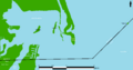
Gard Island is a small island located in Maumee Bay. This bay is part of Lake Erie, one of the Great Lakes in North America. Gard Island is found within Monroe County, in the state of Michigan, United States.
Contents
Gard Island's Location and Features
Gard Island sits at specific geographic coordinates: 41°44′55″N 83°26′37″W / 41.74861°N 83.44361°W. This helps scientists and mapmakers pinpoint its exact spot on Earth.
Elevation of Gard Island
In 1980, the United States Geological Survey (USGS) measured the island's elevation. They found that Gard Island is about 568 ft (173 m) above sea level. This measurement helps us understand how high the island is compared to the surrounding water.
Part of Maumee Bay
Maumee Bay is a large, shallow bay at the western end of Lake Erie. It's an important area for wildlife and is known for its wetlands. Islands like Gard Island are natural parts of this unique environment.
Images for kids
-
Indian Island and Gard Island in North Maumee Bay

