Garzas, Adjuntas, Puerto Rico facts for kids
Quick facts for kids
Garzas
|
|
|---|---|
|
Barrio
|
|

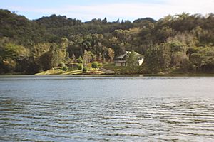
Garzas Lake
|
|

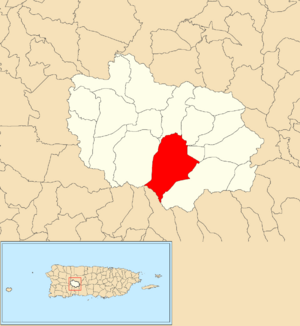
Location of Garzas barrio within the municipality of Adjuntas shown in red
|
|
| Commonwealth | |
| Municipality | |
| Area | |
| • Total | 6.37 sq mi (16.5 km2) |
| • Land | 6.28 sq mi (16.3 km2) |
| • Water | 0.09 sq mi (0.2 km2) |
| Elevation | 2,211 ft (674 m) |
| Population
(2010)
|
|
| • Total | 1,337 |
| • Density | 212.9/sq mi (82.2/km2) |
| Source: 2010 Census | |
| Time zone | UTC−4 (AST) |
| ZIP Codes |
00601, 00631
|
| Area code(s) | 787/939 |
Garzas is a small, countryside area, also called a barrio, located in the town of Adjuntas, Puerto Rico. In 2010, about 1,337 people lived there.
Exploring Garzas
Garzas is known for its beautiful natural spots. Near the Garzas River, you can find a special waterfall called Salto Ataúd. This waterfall has different levels, like steps, and is located on the Río Las Vacas. You can reach it from a road called PR-522.
A Look at History
Puerto Rico became a territory of the United States after the Spanish–American War. This happened because of an agreement called the Treaty of Paris of 1898.
In 1899, the United States government counted everyone living in Puerto Rico. This count, called a census, showed that 1,425 people lived in Garzas barrio at that time. The population has changed over the years, as you can see in the chart below.
| Historical population | |||
|---|---|---|---|
| Census | Pop. | %± | |
| 1900 | 1,425 | — | |
| 1910 | 1,204 | −15.5% | |
| 1920 | 1,206 | 0.2% | |
| 1930 | 904 | −25.0% | |
| 1940 | 1,173 | 29.8% | |
| 1950 | 1,632 | 39.1% | |
| 1960 | 1,298 | −20.5% | |
| 1980 | 1,357 | — | |
| 1990 | 1,317 | −2.9% | |
| 2000 | 973 | −26.1% | |
| 2010 | 1,337 | 37.4% | |
| U.S. Decennial Census 1899 (shown as 1900) 1910-1930 1930-1950 1960 1980-2000 2010 |
|||
See also
 In Spanish: Garzas para niños
- List of communities in Puerto Rico
 | Precious Adams |
 | Lauren Anderson |
 | Janet Collins |


