General José de San Martín, Chaco facts for kids
Quick facts for kids
General José de San Martín
|
|
|---|---|

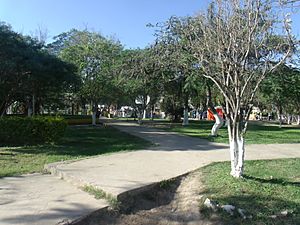
Plaza Principal
|
|
| Lua error in Module:Location_map at line 416: Malformed coordinates value. | |
| Country | |
| Province | |
| Department | Libertador Gen. S. Martín |
| Area | |
| • Total | 79.89 km2 (30.85 sq mi) |
| Elevation | 74 m (243 ft) |
| Population | |
| • Total | 31,758 |
| • Density | 397.522/km2 (1,029.58/sq mi) |
| Time zone | UTC−3 (ART) |
| Climate | Cfa |
General José de San Martín is a city located in the northeast part of the Chaco Province in Argentina. This city is named after José de San Martín, a very important Argentine general. He helped lead South America to freedom from Spain during the Argentine War of Independence.
Contents
History of the City
Early Days as El Zapallar
The city you know today as General José de San Martín started with a different name: El Zapallar. It was founded on April 25, 1907. However, the official land measurements and divisions were not fully completed until July 2, 1913.
In its early years, the town grew slowly. This was mainly because it was hard to travel to and from the area. Things started to improve in 1917 when a person named Juan Godoy began a simple bus service. This bus connected El Zapallar with Resistencia, the capital city of the province, which was about 120 kilometers (75 miles) away.
Growth and Development
By 1924, El Zapallar had grown quite a bit, with about 5,000 people living there. It became the main town for the Toba Department. The town had important services like a police station, a court, and mail and telegraph services. There was also a social club for people to gather.
In the same year, the El Zapallar Agricultural Cattleman Association was created. This group helped farmers and ranchers in the area. The arrival of the Quijano railroad line also helped the town grow even more. It connected El Zapallar to a nearby town called Lapachito.
Becoming General José de San Martín
In 1928, a special group called a Development Commission was set up by a government order from Hipólito Yrigoyen, who was the president at the time. This commission helped plan for the town's future.
Later, in 1934, El Zapallar officially became a municipality. This meant it had its own local government. Then, in 1955, the municipality was renamed General José de San Martín. This new name honored the famous general who fought for Argentina's independence.
How to Get Around
Roads and Transportation
The area around General José de San Martín is connected by several important roads. National Route 90, which is paved with asphalt, runs from the southwest to the northwest. This route links the city directly to Resistencia, the provincial capital.
There are also Provincial Routes 3 and 7. Route 3 crosses the area from east to west, and Route 7 goes from east to southwest. These roads help people travel to and from the city and connect it to other places in the province.
Air Travel
The city also has a small airstrip. This airstrip can handle a limited number of planes, making it another way for people to travel to General José de San Martín.
See also
 In Spanish: San Martín (Chaco) para niños
 | Jackie Robinson |
 | Jack Johnson |
 | Althea Gibson |
 | Arthur Ashe |
 | Muhammad Ali |

