Geology of West Virginia facts for kids
West Virginia has an amazing geologic history that goes back over a billion years! It's a story of huge changes, like when massive mountains formed and then slowly wore away. Long, long ago, much of West Virginia was covered by swamps, marshlands, and shallow seas. This is why we find so many different kinds of rocks here, and why the state has lots of coal and natural gas. West Virginia hasn't had active volcanoes for a very long time, and it doesn't get big earthquakes. Sometimes, smaller tremors happen near a deep crack in the Earth called the Rome Trough, which runs through the western part of the state.
Contents
How West Virginia's Rocks Began
The very oldest rocks deep under West Virginia were made during an event called the Grenville orogeny. This happened about 1.1 billion to 980 million years ago. Imagine two huge landmasses, like giant puzzle pieces, crashing into each other! One of these was Laurentia, which is the ancient core of North America. This collision created a "supercontinent" called Rodinia.
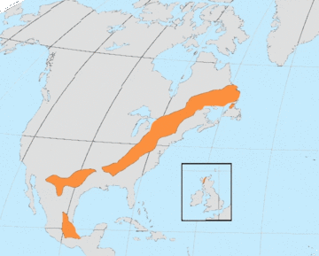
The immense heat and pressure from this crash melted existing rocks. Some rock was pushed deep into the Earth, while a giant chain of mountains formed on the surface. As these mountains slowly eroded away, the underlying layers of hard rocks like granite were pushed up and became visible. These ancient rocks are found under almost all of the Appalachian Mountains, from the Ohio Valley all the way to the Atlantic Ocean.
Today, these old, hard rocks form the core of the Blue Ridge Mountains. In West Virginia, you can only see these ancient rocks in the very eastern part of the state. Most of the rocks you see on the surface in West Virginia are much younger and were formed from sediments.
Ancient Seas and Swamps (Paleozoic Era)
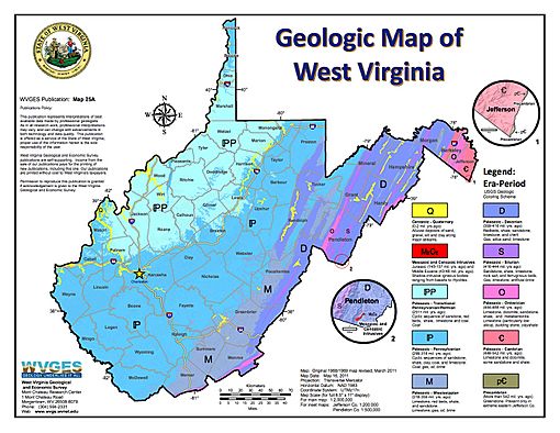
Around 541 to 485 million years ago, during the Cambrian Period, a shallow sea spread across most of what is now West Virginia. For about 370 million years, layers of sediment were laid down in this sea. These sediments eventually turned into the rocks we see today in places like Jefferson and Berkeley counties.
Near the end of the Ordovician Period, a mountain-building event called the Taconic orogeny created tall mountains east of West Virginia. These mountains provided lots of sediment that washed into the seas covering West Virginia.
Later, around 330 million years ago, during the Mississippian Period, the sea returned one last time. This led to the formation of the Greenbrier Formation, which is mostly limestone.
About 310 million years ago, West Virginia was no longer under the sea. Instead, it became covered by huge, vast swamps. These swampy conditions lasted for more than 50 million years! During this time, thousands of feet of non-marine sandstone and shale were deposited. This is also when the many important coal seams we use today were formed from ancient plant material.
The Rise of the Appalachians
The Appalachian Orogeny began roughly 270 to 225 million years ago. This was another major mountain-building event that created the Appalachian Mountains we see today. Most of West Virginia was pushed upwards, and the process of erosion (wearing away of rocks) began. The sea has never covered West Virginia again since this time.
Later Eras and Ice Ages
There are almost no sedimentary rocks from the Mesozoic Era (225 to 66 million years ago) in West Virginia. This is the time when dinosaurs lived! While dinosaur fossils are found in other parts of the world from this period, they are almost never found in West Virginia.
In the Cenozoic Era, which started 66 million years ago and continues to today, there was some volcanic activity in the eastern part of West Virginia. About 45 million years ago, molten rock pushed into the older sedimentary rocks, forming unique igneous rocks.
Much later, less than 100,000 years ago, huge glaciers covered the northern parts of North America. These ice sheets came very close to West Virginia's northern border but didn't actually enter the state. The glaciers changed how rivers flowed. For example, the Monongahela River used to flow north, but the ice sheets blocked it, creating a large lake. This led to deposits of clay in the Monongahela River basin. The river's path was then diverted westward into the Ohio River system.
Ancient Life in West Virginia
The oldest signs of life found in West Virginia are in rocks about 600 million years old, in the Antietam Formation. These fossils show that life had already developed quite a bit by then. In other parts of the world, signs of life have been found in rocks that are at least 3 billion years old! As you look at younger rocks in West Virginia, you find more and more fossils, showing how life has changed and evolved over millions of years.


