Georges River National Park facts for kids
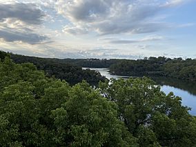
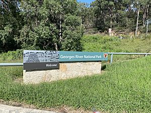
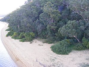
Georges River National Park is a special protected area in Australia. It is managed by the NSW National Parks and Wildlife Service. The park is located in Sydney, about 25 kilometres south-west of the city centre. It is surrounded by suburbs like Lugarno and Picnic Point.
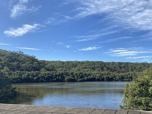
This park is a great place for outdoor fun. People come here for bushwalking, picnics, barbecues, boating, fishing, and even jet skiing. The park is split into 15 sections along the Georges River. It covers 514 hectares (about 1,270 acres). It is home to many native Australian plants and animals. The traditional owners of this land are the Dharug people on the north side of the river and the Dharawal people on the south side.
The park is protected by law under the National Parks and Wildlife Act 1974. This law helps keep nature safe and healthy. It also encourages people to visit the park in a fun, safe, and sustainable way.
Contents
Fun Things to Do and See
The main way to enter the park is from Henry Lawson Drive at Revesby Heights. You can turn onto Burrawang Reach Road.
- Revesby Beach
This beach is on the Georges River. It is a very popular spot for visitors to swim. However, it is important to be careful. Bull sharks are sometimes found in the deeper waters.
- East Hills District Men's Shed Association
The Men's Shed Association (AMSA) is a group that helps local men. They do activities like making furniture, fixing motors, and restoring bikes. The East Hills District Men's Shed is inside Georges River National Park. They work on engineering, woodwork, and leather. They also help with community projects and park maintenance.
- Ridge Walking Track
This walking track is 3.2 kilometres long (1.6 km each way). It usually takes about 30 minutes to an hour to walk the whole loop.
- Yeramba Lagoon Loop Walking Track
This trail is 1.8 kilometres long. It is very popular for birdwatching. Over 100 different types of birds have been seen here. You can often spot 15 different bird species at one time. This area has many birds because of its freshwater wetlands and lakes. The trail takes about 30 minutes to an hour to finish.
- Burrawang Reach Picnic Area
This spot is next to Little Salt Pan Creek and Morgan's Creek. It is a favourite place for barbecues and picnics. There are also places nearby to temporarily park boats near the shore.
- Morgan Creeks Picnic Area
This is a top spot for water activities. You can go fishing, jet skiing, and boating here. There is a wide boat ramp for visitors to use. It is also the closest picnic area to the car park.
Nature: Land, Plants, and Animals
- The Land
Georges River National Park sits on thick Hawkesbury sandstone. In some parts, like Sandy Point, you will find Mittagong sandstone. This type of sandstone is younger and has finer grains. The Georges River is 96 kilometres long and flows through the park. It is a saltwater river named after King George the III. The highest point in the park is Mill Creek, which is 100 metres above sea level. The park gets about 850-900 millimetres of rain each year. This is less than Sydney's average rainfall.
- Plants
Along the river, you will mostly see mangrove swamps and salt marshes. Mangroves cover 24 hectares, and salt marshes cover 11 hectares. Sadly, some of these areas have shrunk over the years due to vehicles like BMX bikes. The most common plants in the park are eucalyptus trees, which are 10–25 metres tall. There are also small, tough shrubs. Other plant areas include rainforests, coastal heaths, and wetlands.
Some important tree species are at risk in the park. These include swamp mahogany and red gum. These trees have flowers that feed animals like the grey-headed flying fox and little lorikeets. They are at risk because of human activity. Also, there are fewer hollow trees in the park. These hollows are important homes for birds like the Sittella.
- Animals
About 248 different native animals live in Georges River National Park. These include amphibians, reptiles, birds, and mammals. Some of these animals are at risk and need special protection. For example, the Green and Golden Bell frog and the blue billed duck are protected by law.
The park has sixteen types of frogs. The most common ones are the eastern dwarf tree frog and Tylers tree frog. You can also find thirty-two types of reptiles. These include one freshwater turtle, twenty-two kinds of lizards, and nine types of snakes. The dark-flecked garden sunskink is the most common reptile.
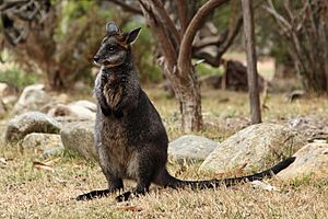
There are 180 native bird species, with 59 being waterbirds. Twenty types of native mammals live here. The common ringtail and brushtail possums, the swamp wallaby, and the grey-headed flying-fox are often seen. A group of Koalas also lives in the park, but they are at risk. Many mammals in the park are nocturnal microbats, like the little forest bat.
Sadly, eighteen invasive animal species threaten the native animals. The common fox is the biggest problem. It harms animals like the long-nosed bandicoot and the swamp wallaby.
How the Park is Managed
- Park Management
The NSW National Parks and Wildlife Act of 1974 says that all 870 National Parks in NSW must have a plan. This plan helps protect the parks' nature for the future. The Georges River National Park plan aims to protect the park's beauty, wildlife, and Aboriginal sites. It also encourages fun and safe activities for visitors.
To reach these goals, the park works to control erosion and weeds. They also fix disturbed areas and study the park more. They try to remove introduced plants and animals and bring back native ones.
Swimming was once popular in the park. But due to shark attacks and pollution, swimming was stopped in the 1960s. The park management does not allow swimming yet because the water is still too polluted. About 90% of the pollution comes from stormwater runoff. The Georges River Keeper program is working to clean the river. They collect about 100 tonnes of rubbish each year. This includes 68,000 plastic bottles! Since this program started, pollution has gone down. The NSW National Parks Wildlife Service hopes to reopen swimming areas once the river is much cleaner.
- Fire Management
The National Parks and Wildlife Act also requires a plan for natural disasters like bushfires. In 1985, a wildfire burned 80% of Georges River National Park. Because of this, the park is now considered a threatened fire area. Strict fire management plans are in place. The Georges River Park Fire Management Strategy from 2018 is a legal document. It explains how to manage planned burns and wildfires.
The plan lists ways to fight wildfires. These include using water from the air, controlled burning, and fire breaks. It also covers how to manage visitors during a fire and how to fix burnt areas. The plan maps out the park's vegetation. It shows areas that are vulnerable, often burned, or not burned for a long time. The plan also highlights animals at risk from fire. These include the little eagle and the powerful owl. It also notes their habitats, like hollow trees.
Park History
- Recent History
After WW2, the Georges River area became very industrial. By 1971, the Georges River was one of the most polluted waterways in Sydney. This pollution made local people want to protect the river's natural areas. So, between 1961 and 1967, Georges River National Park was created. A group was formed to manage and protect the park.
Later, in 1967, the park was changed to a 'nature reserve'. This was because it was not big enough to be a full National Park. But in 1992, the park was declared a National Park again. It also grew in size from 173 hectares in 1961 to 514 hectares by 2020.
- Indigenous History
The Georges River is known as the Tucoerah River to Indigenous people. You can still find signs of past Indigenous life in the park. These include shelters, rock engravings, and axe grinding sites. When Europeans settled in Sydney, the Dharug and Dharawal people were pushed upstream. Many ended up in what is now Georges River National Park.
However, fast industrial growth from 1900–1930 led to many native families being forced off their land. In 1930, an Indigenous activist named Joe Anderson asked for Salt Pan Creek to become a safe place for Indigenous people. Salt Pan Creek, near Padstow in the park, became a refuge for many Indigenous leaders. These included Jack Patten, Bert Grovers, and Bill Onus.
Salt Pan Creek was also a place where many Aboriginal families found shelter from the Australian Government. This was especially true between 1910–1970, during the Stolen Generations. The park and its waterways helped Aboriginal people hunt, gather food, and practice their traditions. It also helped them stay connected to their culture and the land.
See also
 In Spanish: Parque nacional Río Georges para niños
 | Selma Burke |
 | Pauline Powell Burns |
 | Frederick J. Brown |
 | Robert Blackburn |


