Germein Bay facts for kids
Quick facts for kids Germein Bay |
|
|---|---|
| Location | Spencer Gulf, South Australia |
| Coordinates | 33°05′31″S 137°58′37″E / 33.092°S 137.977°E |
| Type | Bay |
| Etymology | John Germein |
| Part of | Spencer Gulf |
| Primary inflows | Port Pirie River |
| Basin countries | Australia |
| Designation | Marine park: Upper Spencer Gulf (part only) |
| Max. length | about 17 km (11 mi) (east-west) |
| Max. width | about 17 km (11 mi) ( north-south) |
| Max. depth | 15 m (49 ft) |
| Islands | Weeroona |
| Settlements | Port Pirie Weeroona Island Port Germein (settlements listed from south to north) |
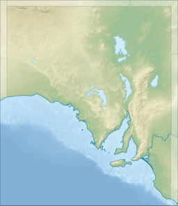
Germein Bay is a large bay in South Australia. It's located at the very top end of Spencer Gulf, on the gulf's east coast. You'll find it just north of the city of Port Pirie. This bay is important because it includes the busy 'Port Pirie' shipping area and the historic 'Port Germein'. Since 2012, most of Germein Bay has been part of a special protected area called the Upper Spencer Gulf Marine Park. This park helps protect the bay's natural environment and marine life.
Contents
What is Germein Bay Like?
Germein Bay is in South Australia, at the northern end of Spencer Gulf. It sits on the gulf's east coast, just north of Port Pirie. The bay stretches between two main points: Point Jarrold in the south and Ward Spit in the north. Ward Spit is a shoal (a shallow area) that can be seen when the tide is low.
The southern part of the bay's coastline has thick mangrove forests. Behind these mangroves, the land often gets flooded. The coast here is also lined with sand and mud flats that can dry out for about 1.85 kilometers (1 nautical mile). These mangroves continue along the eastern side of the bay, reaching up to Weeroona Island, which is also known as Mount Ferguson.
The western side of Weeroona Island and the rest of the bay's coastline (not including Ward Spit) are different. They don't have mangroves. Instead, they have calm beaches with wide sand flats in front of them.
Several towns and settlements are located along the bay's coast. These include:
- Port Pirie: This city is on the west and south sides of the Port Pirie River estuary.
- Weeroona Island: This settlement is on Weeroona Island, in the bay's south-east corner.
- Port Germein: This town is in the north-east corner of the bay.
The bay itself has many shallow areas, sandbanks, and shoals. A large shoal called Cockle Spit is in the middle of the bay and is visible at low tide. Most of the bay is less than 5 meters deep. However, in the northern part, between Cockle Spit and Ward Spit, the water is deeper, sometimes more than 10 meters. The deepest spot recorded is about 15.2 meters.
History of the Bay's Name
Germein Bay was named after John Germein. He was a pilot (someone who guides ships) for the South Australian government in the 1800s. He was also the brother of Benjamin Germein, another notable figure.
Port Facilities and Shipping
A part of Germein Bay, along with some waters to its west, is officially called the 'Harbor of Port Pirie' and 'Port Pirie'. This area is important for shipping.
How Ships Reach Port Pirie
Ships that want to reach the port facilities at Port Pirie must travel through Germein Bay. They enter the bay from its northern side, where the water is deepest. This path is known as the 'northern channel'.
Once inside the bay, between Cockle Spit and the Port Germein jetty, ships need to enter a special dug-out path. This path is called the 'Port Pirie shipping channel'. It leads south to the Port Pirie River estuary, where the ship berths (places where ships can dock) are located.
What's at the Port?
The port facilities in the Port Pirie River have eight berths. These can handle ships up to 183 meters long. They are used for loading large amounts of materials like acid, grain, and ores such as lead and coal. The company Flinders Ports manages these facilities.
To help ships navigate safely, there are many navigation aids in the bay. These include:
- Lit beacons along the northern channel and the Port Pirie shipping channel.
- Flashing lights on the Port Germein jetty and on the south side of Weeroona Island.
- Many buoys and other markers in the southern part of the bay. These markers help identify dangerous areas for ships.
There's also a long jetty at Port Germein. It was built in 1881 to load ships. Today, it's a popular spot for fun activities like fishing.
You can also find several boat ramps around the bay for smaller boats. These are located in the Port Pirie River (in the suburbs of Solomontown and Port Pirie), on Weeroona Island, and at Port Germein.
Protected Status
The parts of Germein Bay that are not officially declared as a port have been part of the Upper Spencer Gulf Marine Park since 2012. This means these areas are protected to help preserve their marine life and natural beauty.
 | Victor J. Glover |
 | Yvonne Cagle |
 | Jeanette Epps |
 | Bernard A. Harris Jr. |


