Gibbonsville, Idaho facts for kids
Quick facts for kids
Gibbonsville, Idaho
|
|
|---|---|
| Country | United States |
| State | Idaho |
| County | Lemhi |
| Elevation | 4,570 ft (1,390 m) |
| Time zone | UTC-7 (Mountain (MST)) |
| • Summer (DST) | UTC-6 (MDT) |
| ZIP code |
83463
|
| Area code(s) | 208, 986 |
| GNIS feature ID | 396546 |
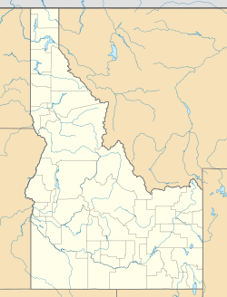
Gibbonsville is a small community in Lemhi County, Idaho, in the United States. It's called an "unincorporated community" because it doesn't have its own local government like a city or town. Instead, it's managed by the county. Gibbonsville is about 26 miles (42 km) north of a larger town called Salmon. It even has its own post office!
Contents
A Look Back in Time
How Gibbonsville Got Its Name
Gibbonsville was named after a person named John Gibbon. We don't have many details about him here, but his name lives on in this community.
Population Changes Over the Years
In 1909, Gibbonsville was a much bigger place, with 735 people living there. By 1960, the population had become smaller, with only 125 residents. This shows how communities can change over time!
Weather and Climate
Living in the Bitterroot Mountains
Gibbonsville is located in the beautiful Bitterroot Mountains. The weather here is typical for this mountain region. It's usually warmer than places higher up in the mountains.
Understanding the Climate Type
The climate in Gibbonsville is known as a Warm Summer Humid Continental type. This means it has warm summers and cold, snowy winters. It's similar to other mountain areas in Wyoming and Montana.
Daily Temperature Swings
One interesting thing about Gibbonsville's climate is the big difference between daytime and nighttime temperatures. For example, in July, the temperature can change by almost 40 degrees Fahrenheit (22.2 °C) in one day! Even on warm summer afternoons, the nights stay cool, usually between 40°F (4°C) and 45°F (7°C).
Precipitation and Snowfall
Gibbonsville gets more rain and snow in winter than in summer. On average, it snows about 80 inches (203 cm) each year. Most of this snow falls between November and April, with January being the snowiest month.
| Climate data for Gibbonsville, Idaho, 1991–2020 normals, extremes 1895–present | |||||||||||||
|---|---|---|---|---|---|---|---|---|---|---|---|---|---|
| Month | Jan | Feb | Mar | Apr | May | Jun | Jul | Aug | Sep | Oct | Nov | Dec | Year |
| Record high °F (°C) | 48 (9) |
55 (13) |
73 (23) |
85 (29) |
94 (34) |
100 (38) |
100 (38) |
100 (38) |
98 (37) |
85 (29) |
67 (19) |
54 (12) |
100 (38) |
| Mean daily maximum °F (°C) | 29.3 (−1.5) |
35.6 (2.0) |
47.0 (8.3) |
55.8 (13.2) |
64.6 (18.1) |
71.6 (22.0) |
83.0 (28.3) |
82.5 (28.1) |
72.9 (22.7) |
58.0 (14.4) |
40.4 (4.7) |
30.0 (−1.1) |
55.9 (13.3) |
| Daily mean °F (°C) | 20.0 (−6.7) |
24.3 (−4.3) |
34.0 (1.1) |
42.3 (5.7) |
50.3 (10.2) |
56.8 (13.8) |
64.6 (18.1) |
63.5 (17.5) |
55.4 (13.0) |
43.9 (6.6) |
30.4 (−0.9) |
20.8 (−6.2) |
42.2 (5.7) |
| Mean daily minimum °F (°C) | 10.6 (−11.9) |
12.9 (−10.6) |
21.0 (−6.1) |
28.8 (−1.8) |
35.9 (2.2) |
41.9 (5.5) |
46.2 (7.9) |
44.4 (6.9) |
37.9 (3.3) |
29.8 (−1.2) |
20.3 (−6.5) |
11.5 (−11.4) |
28.4 (−2.0) |
| Record low °F (°C) | −36 (−38) |
−26 (−32) |
−15 (−26) |
8 (−13) |
16 (−9) |
25 (−4) |
29 (−2) |
21 (−6) |
14 (−10) |
0 (−18) |
−20 (−29) |
−36 (−38) |
−36 (−38) |
| Average precipitation inches (mm) | 1.96 (50) |
1.31 (33) |
1.24 (31) |
1.37 (35) |
1.76 (45) |
1.93 (49) |
1.04 (26) |
1.02 (26) |
1.02 (26) |
1.02 (26) |
1.73 (44) |
2.03 (52) |
17.43 (443) |
| Average snowfall inches (cm) | 23.1 (59) |
12.9 (33) |
6.9 (18) |
1.6 (4.1) |
0.3 (0.76) |
trace | 0.0 (0.0) |
0.0 (0.0) |
0.1 (0.25) |
0.5 (1.3) |
13.3 (34) |
24.2 (61) |
82.9 (211.41) |
| Average precipitation days (≥ 0.01 in) | 12.3 | 8.5 | 9.4 | 9.8 | 11.5 | 10.6 | 6.3 | 6.3 | 6.0 | 6.9 | 10.8 | 10.9 | 109.3 |
| Average snowy days (≥ 0.1 in) | 11.4 | 6.9 | 4.7 | 1.8 | 0.1 | 0.0 | 0.0 | 0.0 | 0.0 | 0.5 | 7.0 | 10.0 | 42.4 |
| Source 1: NOAA (precip/precip days, snow/snow days 1981–2010) | |||||||||||||
| Source 2: National Weather Service | |||||||||||||
 | Stephanie Wilson |
 | Charles Bolden |
 | Ronald McNair |
 | Frederick D. Gregory |


