Glen of Aherlow facts for kids
Quick facts for kids Glen of Aherlow |
|
|---|---|
| Length | 13 km (8.1 mi) east-west |
| Width | 3 km (1.9 mi) north-south |
| Area | about 40 square kilometres (9,900 acres) |
| Naming | |
| Native name | Gleann Eatharlaí (Irish) |
| English translation | From Irish eatharlach, "land between elevations" |
| Geography | |
| Country | Republic of Ireland |
| State | County Tipperary |
| Region | Munster |
| Borders on | Slievenamuck (north); Galtee Mountains (south) |
| River | River Aherlow |
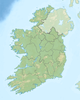
The Glen of Aherlow is a beautiful valley in the western part of County Tipperary in Ireland. Its name in Irish is Gleann Eatharlaí. This means "land between elevations," which perfectly describes the valley's location. It sits right between two mountain ranges: Slievenamuck to the north and the Galtee Mountains to the south.
The main village you'll find in the Glen is Lisvarrinane. Sometimes people spell it Lisvernane. There's also a smaller place called Rossadrehid. Long ago, there was a creamery there, but it closed down. Other villages nearby include Galbally on the west side, Kilross to the northwest, and Bansha on the east. Just across Slievenamuck to the north is Tipperary Town.
A Famous Visitor: Geoffrey Keating
The Glen of Aherlow has a special connection to a famous Irish historian named Geoffrey Keating. He lived in the 1600s. It's said that Keating found a safe place to stay in the Glen. He even preached sermons there.
Local stories say that he lived in a cave for a long time. This was while he was trying to avoid capture. During this period, he worked on his most important book, Foras Feasa Ar Éirinn. This big history book was finished around 1634.
The Christ the King Statue
A large statue called 'Christ the King' stands high above the Glen of Aherlow. It was built in 1950. You can find it on Slievenamuck, along the road that leads to Tipperary Town.
The area around the statue has a car park. In the summer, many people visit this spot. On a clear day, it offers amazing views of the entire Glen and the surrounding valley. It's a great place to see how wide and beautiful the area is.
 | Ernest Everett Just |
 | Mary Jackson |
 | Emmett Chappelle |
 | Marie Maynard Daly |


