Glen of Imaal facts for kids
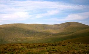
The Glen of Imaal (which means Gleann Uí Mháil in Irish) is a quiet valley in the western Wicklow Mountains in Ireland. Tall mountains like Lugnaquilla and Table Mountain surround it. A large part of the glen is used by the Irish Army for shooting practice. If you visit, always check when they are training. Also, never pick up strange objects you might find.
The Glen of Imaal is famous for an Irish folk song named after it. It is also the home of a special dog breed, the Glen of Imaal Terrier.
Contents
History of the Glen
Early Times in the Glen
The Glen of Imaal gets its name from the Uí Máil people. They were powerful rulers of Leinster in the 600s. Later, another group, the Uí Dúnlainge, took over. They moved into the western Wicklow mountains. The valley seems to have been an important place for them. By the 1300s, the O'Toole family ruled the Uí Máil area.
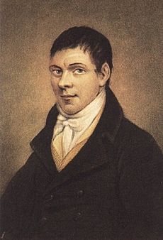
A small house in Derrynamuck in the Glen of Imaal remembers Michael Dwyer. He was a famous leader during the 1798 rebellion in Ireland. This house is now called the Dwyer-McAllister cottage. Michael Dwyer and other Irish rebels were hiding there. British soldiers surrounded them. A rebel named Samuel McAllister bravely drew enemy fire. This allowed Michael Dwyer to escape safely.
Military Use of the Glen
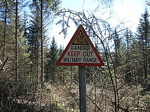
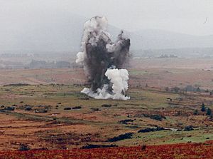
Since 1900, a large part of the Glen of Imaal has been used by the army. It is an artillery range, which means they practice shooting big guns there. Because of this, you should be careful when you are near the army range. Signs are put up to tell people when the army is doing exercises.
The 1941 Disaster
On September 16, 1941, a sad event happened in the Glen of Imaal. It was the worst accident for the Irish Defence Forces in their history. This event is called the Glen of Imaal Disaster. It happened during a training exercise. Twenty-seven soldiers were involved. Sixteen soldiers died when an anti-tank mine exploded by accident. In 1986, a memorial was built near Seskin Bridge to remember them.
The Army Firing Range
The Glen of Imaal firing range is used all year by the Irish Army. It is their main training area. It is the only place in Ireland big enough for large artillery guns. These include guns like the 105mm Light Gun. Soldiers also practice firing anti-tank weapons and heavy machine guns here. Vehicles like MOWAG Armoured Personnel Carriers also train in the glen.
The army also practices for peacekeeping missions in the Glen. Sometimes, Irish Air Corps helicopters join these exercises. You should drive carefully on local roads. This is because there can be heavy military vehicles.
Soldiers using the Glen often stay at Coolmoney Camp nearby. The Glen of Imaal is easy to reach from the Curragh Camp in County Kildare.
Mountain Climbing Adventures
Lugnaquilla is the highest mountain in Wicklow. It is also one of the tallest mountains in Ireland. It is located at the southeastern end of the Glen. Fenton's Pub is a common place for climbers to start their journey. The Glen of Imaal Red Cross Mountain Rescue Team started in 1983. They help people in the area. They work with the Dublin-Wicklow Mountain Rescue Team.
 | Valerie Thomas |
 | Frederick McKinley Jones |
 | George Edward Alcorn Jr. |
 | Thomas Mensah |


