Lugnaquilla facts for kids
Quick facts for kids Lugnaquilla |
|
|---|---|
| Log na Coille | |

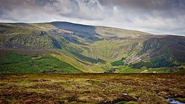
Looking into the Fraughan Rock Glen (river) and the summit of Lugnaquilla (back, centre)
|
|
| Highest point | |
| Elevation | 925 m (3,035 ft) |
| Prominence | 905 m (2,969 ft) |
| Listing | County top (Wicklow), P600, Marilyn, Furth, 100 Highest Irish Mountains, Hewitt, Arderin, Simm, Vandeleur-Lynam |
| Naming | |
| English translation | hollow of the wood |
| Language of name | Irish |
| Geography | |
| Location | County Wicklow, Ireland |
| Parent range | Wicklow Mountains |
| OSI/OSNI grid | T032917 |
| Topo map | OSI Discovery 56 |
| Geology | |
| Mountain type | Aphyric granodiorite, (Percys Table Granodiorite) |
| Climbing | |
| Easiest route | Glen of Imaal Route |
Lugnaquilla is a very tall mountain in Ireland. It stands at 925 metres (3,035 ft) high. This makes it the highest mountain in County Wicklow and in the whole province of Leinster.
Lugnaquilla is part of the Wicklow Mountains range. It is also the tallest mountain in Ireland outside of County Kerry. From its top, you can look down on the Glen of Imaal to the west and Glenmalure to the east.
Contents
What's in a Name?
The Meaning of Lugnaquilla
The name Lugnaquilla comes from the Irish words Log na Coille. This means "hollow of the wood". It describes a part of the mountain's shape.
Some people shorten the name to "Lug". You might also see it spelled "Lugnaquillia" on some maps. However, "Lugnaquilla" is the correct way to spell it.
Percy's Table
The flat top of Lugnaquilla is known as Percy's Table. This name comes from an old landowner named Colonel Percy. He lived in the area in the 1700s.
How Lugnaquilla Was Formed
Rocks and Ice
Scientists from the Geological Survey of Ireland say Lugnaquilla is a "slate capped, granite rooted" mountain. This means it has a top layer of dark-grey rock called schist (which is a type of slate). Underneath, it has a core of lighter grey rock called granite.
These rocks tell a story about how the mountain was made. The granite formed deep underground from hot, melted rock (magma). The schist layer on top is what's left of the "roof" of this magma chamber.
An Ice Age Survivor
During the last Ice Age, most of Ireland was covered in thick ice. But Lugnaquilla's very top was so high that it poked out of the ice. Places like this are called nunataks. This means the top of Lugnaquilla was never covered by the ice.
Exploring Lugnaquilla's Shape
A Big, Flat-Topped Mountain
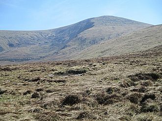
Lugnaquilla is known as a "bulky mountain." It has a large, flat, grassy top, which is Percy's Table. This flat top is surrounded by steep, bowl-shaped valleys called "corries."
On one side, there's the "North Prison." It looks down into the Glen of Imaal. On the other side, there's the "South Prison." This one looks into the valley of the River Ow.
Valleys and Rivers
To the east of Lugnaquilla, you'll find the Fraughan Rock Glen. This is a valley with cliffs that drops into the U-shaped valley of Glenmalure. The mountain is also the starting point for the River Slaney.
Lugnaquilla doesn't have sharp, rocky peaks. Instead, it's a wide area of "sprawling mountain moorland." This big area, called a "massif," includes several other smaller mountains and lakes. They often form a horseshoe shape around deep valleys.
Special Mountain Lists
Lugnaquilla is on many important lists of mountains. It's a P600 mountain, which means it's one of the "Majors" in Britain and Ireland. It's also a Marilyn.
The Scottish Mountaineering Club (SMC) calls Lugnaquilla a "Furth." This means it's a mountain over 3,000 ft (914 m) that meets certain rules, but it's outside of Scotland. Lugnaquilla is one of 13 such "Irish Munros."
Hiking Up Lugnaquilla
The Glen of Imaal Route

The quickest way to reach the top of Lugnaquilla is the Glen of Imaal Route. This path is sometimes called the "Tourist Route." It's about 13 kilometers long and takes 4 to 5 hours to walk.
You start at Fenton's Pub in the Glen of Imaal. The path follows a military road and then goes up a grassy hill to Camarahill. From there, you continue to the summit. Remember, part of this route goes through a military training area, so always check if it's open before you go!
The Glenmalure Loop
Many people say the 15-kilometer Glenmalure Loop is the most beautiful way to hike Lugnaquilla. This walk takes about 5 to 6 hours.
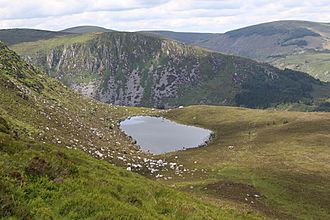
It begins at the Baravore car park in the Glenmalure valley. You hike up through the stunning Fraughan Rock Glen, which has cliffs on its sides. On your way back, you can go past Cloghernagh and then down to the lovely Arts Lough. This lake is known as one of the most beautiful sights in the area.
The Aghavannagh Route
The Aghavannagh Route is less busy. It's a 16-kilometer walk that takes about 6 hours. You start at the Aghavannagh Bridge.
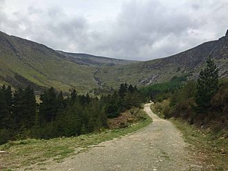
This route follows long forest paths along the River Ow. It leads to the dramatic "South Prison" of Lugnaquilla. You can climb out of the "South Prison" using a grassy slope called Green Street. You can also cycle the 12 kilometers of forest trails on this route.
See also
 In Spanish: Log na Coille para niños
 | Valerie Thomas |
 | Frederick McKinley Jones |
 | George Edward Alcorn Jr. |
 | Thomas Mensah |


