County Wicklow facts for kids
Quick facts for kids
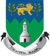
County Wicklow
Contae Chill Mhantáin
|
||
|---|---|---|
|
||
| Nickname(s):
The Garden of Ireland
|
||
| Motto(s): | ||
 |
||
| Country | Ireland | |
| Province | Leinster | |
| Region | Eastern and Midland | |
| Established | 1606 | |
| County town | Wicklow | |
| Largest settlement | Bray | |
| Area | ||
| • Total | 2,027 km2 (783 sq mi) | |
| Area rank | 17th | |
| Highest elevation | 925 m (3,035 ft) | |
| Population
(2022)
|
||
| • Total | 155,851 | |
| • Rank | 16th | |
| • Density | 76.888/km2 (199.14/sq mi) | |
| Time zone | UTC±0 (WET) | |
| • Summer (DST) | UTC+1 (IST) | |
| Eircode routing keys |
A63, A67, A98 (primarily)
|
|
| Telephone area codes | 01, 0402, 0404 (primarily) | |
| Vehicle index mark code |
WW | |
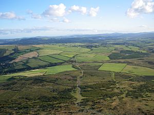
County Wicklow is a beautiful county in Ireland. It's often called the "Garden of Ireland" because of its amazing scenery. You can find thick forests, lovely nature trails, sunny beaches, and old ruins here. It's a great place for walking, hiking, and climbing!
Wicklow is named after its main town, Wicklow. The name comes from an old Norse (Viking) word meaning "Vikings' Meadow." It was the very last of Ireland's 32 traditional counties to be officially formed, back in 1606. Today, about 155,258 people live here.
Contents
A Look at Wicklow's Past
Early Churches and Monasteries
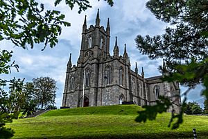
Around the year 431 AD, a bishop named Saint Palladius arrived in Wicklow. He came from Britain or Gaul to help Irish people who believed in Christ. Palladius started three old churches in the area. Even though some local tribes were not friendly, he managed to build these churches.
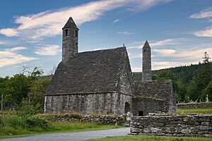
Many other early Irish saints, both men and women, also founded churches and monasteries in Wicklow. One of the most famous places is the ancient monastery of Glendalough. It was founded by Saint Kevin and is still a very special place to visit today.
Wicklow from the 1600s Onwards
County Wicklow was officially created in 1606. This was done to help control local groups in the area. A special road, called the Military Road, was built through the Wicklow Mountains. This road helped government forces reach areas where rebels were hiding after the Irish Rebellion of 1798. Barracks were built along the road for soldiers. Today, one of these old barracks is home to the Glencree Centre for Peace and Reconciliation.
During the Cromwellian conquest of Ireland, local leaders in Wicklow gave up without a fight. Later, during the 1798 rebellion, some rebels hid in the Wicklow Mountains. There were battles between British forces and the rebels. In 1957, some land from County Dublin was added to County Wicklow, making it a bit bigger.
Exploring Wicklow's Nature
Where is County Wicklow?
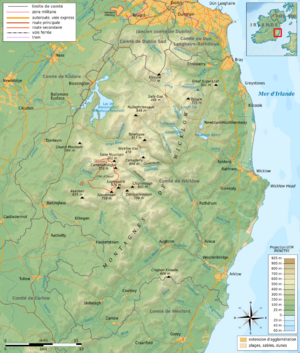
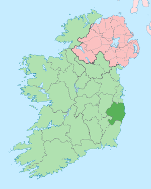
Wicklow is in the Leinster province of Ireland. It shares borders with four other counties: Dublin to the north, Kildare and Carlow to the west, and Wexford to the south. To the east, it meets the Irish Sea.
Wicklow is the 17th largest county in Ireland by land area. It's also the 16th most populated. The main town, Wicklow, is about 50 kilometers (31 miles) south of Dublin, Ireland's capital city.
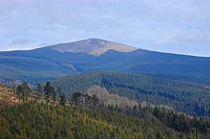
The Wicklow Mountains are Ireland's biggest continuous mountain range. They cover a large part of central Wicklow and even stretch into Dublin and Wexford. Lugnaquilla is the tallest peak in these mountains, standing at 925 meters (3,035 feet) high. It's the highest mountain in Ireland outside of County Kerry.
A big part of the mountains is protected as the Wicklow Mountains National Park. This park covers 205 square kilometers (79 square miles) and is the largest national park in Ireland. The Wicklow Way is a famous walking trail that goes through the mountains for 131 kilometers (81 miles).
How Wicklow's Landscape Was Formed
The Wicklow Mountains are mostly made of granite rock. This rock was formed deep underground a very long time ago. The oldest rocks in the county are found at Bray Head and the Little Sugar Loaf and Great Sugar Loaf mountains. These rocks are over 500 million years old!
Like much of Ireland, Wicklow's landscape was shaped by huge sheets of ice during the quaternary ice ages. These glaciers carved out long valleys, which are called "glens" in Ireland. Famous glens include Glenmacnass, Glenmalure, and Glendalough.
Rivers and Lakes of Wicklow

Wicklow has several important rivers. The River Liffey, which flows through Dublin City, starts near Tonduff mountain in Wicklow. It's Ireland's 8th longest river. The River Slaney also begins in Wicklow, at Lugnaquilla mountain. The Avonmore and Avonbeg rivers meet to form the Avoca River at a spot called the Meeting of the Waters.
Most of Wicklow's lakes are "ribbon lakes" or "corrie lakes." These were formed by glaciers and are found in beautiful valleys surrounded by mountains. They are very popular with tourists. Some well-known lakes include Glendalough Upper Lake, Lough Tay (also known as 'The Guinness Lake'), and Lough Dan.
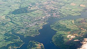
The largest lake in Wicklow is Poulaphouca Reservoir. It's an artificial lake, meaning it was created by people. It was formed in 1940 when the River Liffey was dammed. An entire village, Ballinahown, was covered by the water, and its 70 families had to move. Sometimes, when the water level is low, you can still see parts of the old village!
Wicklow's Coastline
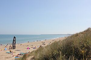
Wicklow has a coastline that is about 64 kilometers (40 miles) long. It's mostly straight, with not many large bays or islands. Wicklow Head is the most famous point on the coast and is the most easterly mainland spot in the Republic of Ireland.
Wicklow's east coast is a favorite place for summer holidays. There are many lovely beaches, like Brittas Bay, Clogga Beach, and Greystones North and South Beaches.
Forests and Woodlands
Wicklow is famous for its forests. About 18.5% of the county is covered in trees, which is one of the highest percentages in Ireland. This is why it's called the "Garden of Ireland." Most of Wicklow's forests are conifer trees, which are grown for wood.
Wicklow's Climate
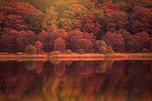
Wicklow has a mild and wet climate. Summers are cool and humid, while winters are mild and wet. The areas near the Irish sea have slightly milder winters and cooler summers. The mountains, however, are colder and get more rain all year round.
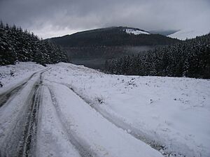
Snow usually falls from December to March. Low-lying areas might only see a few days of snow, but the Wicklow Mountains get a lot more, sometimes over 50 days of snow each year!
Wicklow can sometimes be affected by strong storms, especially during winter. In 1986, during Hurricane Charley, a huge amount of rain fell near the Wicklow-Dublin border. This caused severe flooding, and many homes had to be evacuated.
People and Towns of Wicklow
Who Lives in Wicklow?
As of the 2016 census, about 142,425 people lived in Wicklow. The county's population is growing quite fast. Many people have moved here, especially from nearby Dublin, because of better transport links.
Most of Wicklow's population lives along the east coast, especially near the Dublin border. Towns like Bray, Greystones, and Newtownmountkennedy are very populated. The middle of the county, in the mountains, is much less populated, with only a few small villages.
Main Towns and Villages
The county town of Wicklow is Wicklow. Here are the 10 largest towns in the county by population:
| Rank | City | Population (2016) |
|---|---|---|
| 1 | Bray | 32,600 |
| 2 | Greystones | 18,140 |
| 3 | Arklow | 13,163 |
| 4 | Wicklow | 10,584 |
| 5 | Blessington | 5,520 |
| 6 | Kilcoole | 4,239 |
| 7 | Rathnew | 3,370 |
| 8 | Newtownmountkennedy | 2,835 |
| 9 | Enniskerry | 1,889 |
| 10 | Rathdrum | 1,663 |
People from Other Countries
Most people in Wicklow were born in Ireland. The largest group of people born outside of Ireland come from the United Kingdom. The second largest group are from Poland. Other groups include people from Romania, India, and the Philippines.
Religion in Wicklow
In 2016, most people in Wicklow (73%) were Catholic. About 13.3% said they had no religion. Other Christian groups made up 8.8% of the population. Wicklow has the highest percentage of people belonging to the Church of Ireland compared to other counties in the Republic of Ireland.
Things to Do and See
Fun and Tourism
Wicklow is a very popular place for tourists. People love its beautiful scenery, beaches, and many options for walking, hiking, and climbing. Some top attractions include:
- The ruins of the old monastic city of Glendalough.
- Wicklow Gaol, an old prison you can visit.
- Water activities on the reservoirs and along the coast.
The Wicklow Way is Ireland's oldest long-distance walking trail, perfect for adventurers. Every year since 1982, a big bike ride called Wicklow 200 takes place in the county.
Wicklow on Screen
Wicklow is a popular place for making films and TV shows. Bray is home to Ardmore Studios, where many famous Irish movies have been filmed, like Excalibur and In the Name of the Father. The BBC series Ballykissangel was also filmed here.
More recently, parts of the TV series Vikings were filmed at Ashford Studios in Wicklow. Some outdoor scenes for Vikings were shot at places like Powerscourt Waterfall and Lough Tay. The new Netflix series Vikings: Valhalla is also based at Ashford Studios.
Other shows and movies filmed in Wicklow include:
- Into the Badlands (TV series) (2016-2018)
- Fate: The Winx Saga (Netflix)
- The Disney film Disenchanted, which even decorated Enniskerry village for filming!
Getting Around Wicklow
Roads and Routes
Wicklow has a good network of roads. These roads help people travel across the Wicklow Mountains from east to west. There are also roads that go north to south through the mountains, giving access to beautiful areas.
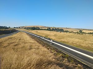
The main roads include the N11/M11 along the east coast, which connects Wicklow to Dublin and Wexford. In western Wicklow, the N81 runs from Dublin through towns like Blessington and Baltinglass.
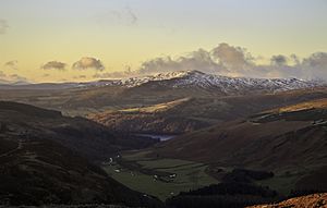
Some important routes are:

 N11/M11 – This road runs near the east coast and links Dublin and Wexford.
 N81 – A national road that goes through western Wicklow, connecting Dublin to Tullow.
 R115 – This is Ireland's highest paved mountain pass. It follows the old Military Road.
 R756 – This road goes through the Wicklow Gap and is known as the Wicklow Gap Road.
 R759 – This road goes through the Sally Gap. It can be dangerous in winter due to snow and ice.
Wicklow Culture and Media
Arts and Festivals
The Mermaid, County Wicklow Arts Centre in Bray is a hub for art. It offers visual arts, theatre, dance, movies, comedy, and music. Arklow hosts two popular festivals: the Arklow Music Festival and the Arklow Seabreeze Festival.
Local News and Radio
For local news, you can read newspapers like The Bray People, Wicklow Times, and Wicklow People. WicklowNews.net is also a popular online news source.
The local radio station is East Coast FM. In North Wicklow, you can also listen to Radio Nova.
Places to Visit
- Avondale Forest
- Bray Head
- Brittas Bay
- Glen of the Downs
- Glendalough
- Poulaphouca Reservoir
- Powerscourt Estate
- Powerscourt Waterfall
- Wicklow Gaol
- Wicklow Mountains National Park
Wicklow's Sister Cities
County Wicklow has special connections with other places around the world. It is twinned with Würzburg, Germany, and Seminole County, Florida, USA.
See also
 In Spanish: Condado de Wicklow para niños
 | Audre Lorde |
 | John Berry Meachum |
 | Ferdinand Lee Barnett |


