Wicklow Gap facts for kids
Quick facts for kids Wicklow Gap |
|
|---|---|
| Bearna Chill Mhantáin | |

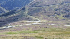
The pass from Tonelagee slopes
|
|
| Elevation | 475 m (1,558 ft) |
| Traversed by | Road |
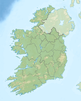
| Location | County Wicklow, Ireland |
| Range | Wicklow Mountains |
| Coordinates | 53°2′30.2″N 6°23′47.3″W / 53.041722°N 6.396472°W |
The Wicklow Gap (also called Bearna Chill Mhantáin in Irish) is a high mountain pass in County Wicklow, Ireland. It is one of the highest mountain passes in Ireland that has a paved road. A mountain pass is like a low point between mountains that makes it easier to travel from one side to another.
Where is Wicklow Gap?
This mountain pass is about 475 meters (1,558 feet) high. It sits between two mountains: Tonelagee to the northeast and Turlough Hill or Camaderry to the south. The Wicklow Gap connects the towns of Dunlavin in the west with Glendalough.
It is one of only two main roads that cross the beautiful Wicklow Mountains. The other road is the Sally Gap. On a clear day, you can see far across the Irish Sea from the pass. You might even spot the mountains of Snowdonia in Wales!
Getting There
You can reach the Wicklow Gap by driving on the scenic R756 road. This road is known for its amazing views. Many people enjoy cycling up to the pass. It is a popular challenge for bike riders. The famous Tour de France cycling race even considers it a "Cat. 3" climb. This means it's a tough but not super-hard uphill section.
From the pass, a smaller road leads to Turlough Hill. Here, you will find a special power plant. It is a hydro-plant that stores electricity using water.
Fun Things to Do
The Wicklow Gap is a great place for hikers. It is part of the St Kevin's Way, which is a long walking trail. This trail is clearly marked with signs and leads from Hollywood all the way to Glendalough.
If you like walking, you can start right from the pass. From here, you can hike up to both Turlough Hill and Tonelagee mountains. It's a perfect spot to explore the stunning Wicklow Mountains on foot.
 | Jewel Prestage |
 | Ella Baker |
 | Fannie Lou Hamer |


