
Camaderry facts for kids
Quick facts for kids Camaderry |
|
|---|---|
| Sliabh Céim an Doire | |

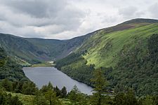
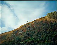
Camaderry (right) at Glendalough Upper Lake
|
|
| Highest point | |
| Elevation | 699 m (2,293 ft) |
| Prominence | 71 m (233 ft) |
| Listing | Hewitt, Arderin, Simm, Vandeleur-Lynam |
| Naming | |
| English translation | step/pass of the oak-wood |
| Language of name | Irish |
| Geography | |

Camaderry
Location in island of Ireland
|
|
| Location | Wicklow, Republic of Ireland |
| Parent range | Wicklow Mountains |
| OSI/OSNI grid | T081980 |
| Topo map | OSi Discovery 56 |
| Geology | |
| Mountain type | Adamellite with microcline phenocrysts |
Camaderry is a mountain in Ireland. Its name, Sliabh Céim an Doire, means "step or pass of the oak-wood" in Irish. This mountain stands at 699 metres (2,293 ft) tall. It is one of the highest peaks in Ireland.
Camaderry is located in the southern part of the Wicklow Mountains. It forms a wide horseshoe shape around the beautiful Glendalough valley. Other mountains nearby include Turlough Hill (681 metres (2,234 ft)), Conavalla (734 metres (2,408 ft)), and Lugduff (652 metres (2,139 ft)). Camaderry also has a smaller peak called Camaderry South East Top, which is 677 metres (2,221 ft) high. These peaks are separated from Tonelagee (817 metres (2,680 ft)) by the deep Wicklow Gap.
Discovering Lough Nahanagan
Between Camaderry's north side and Turlough Hill's east side, you will find Lough Nahanagan. This lake's name means "Lake of the Water Monster" in Irish. It is a very deep corrie lake. This means it was carved out by a glacier during the last ice age.
The steep cliffs around Lough Nahanagan are popular for rock climbing. Climbers can find different routes here. Many interesting Irish folk stories are also connected to this lake.
The History of Mining on Camaderry
Camaderry mountain holds a special secret: the Luganure mineral vein. This vein was a source of lead. The lead was found in a mineral called galena (PbS). This mineral also contained small amounts of silver.
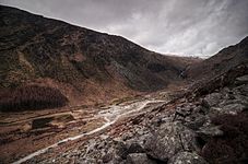
In 1859, the Glendasan and Glendalough mines were connected. Miners dug tunnels, called adits, through the mountain to link them. Most of these tunnels are now filled with water. Mining on Camaderry stopped in 1957 after several attempts to restart it. However, you can still see the remains of the old Miner's Village in Glendalough. It shows what life was like for the miners.
Gallery
-
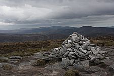
Summit cairn
-
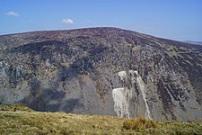
South face from Luggala
-
Camaderry (right)
-
Miner's Village
-
Slopes of SE Top


