Wicklow Mountains facts for kids
Quick facts for kids Wicklow Mountains |
|
|---|---|
| Cuala Dublin Mountains |
|
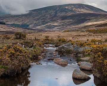
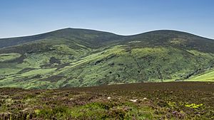
Tonelagee mountain seen from the Glendasan valley, Wicklow Mountains
|
|
| Highest point | |
| Peak | Lugnaquilla |
| Elevation | 925 m (3,035 ft) |
| Naming | |
| Native name | Error {{native name}}: an IETF language tag as parameter {{{1}}} is required (help) |
| Geography | |
| Country | Ireland |
| Range coordinates | 53°04′52″N 6°23′24″W / 53.08111°N 6.39000°W |
| Parent range | Leinster Chain |
| Geology | |
| Orogeny | Caledonian |
| Age of rock | Cambrian to Devonian, Pleistocene |
| Type of rock | Granite, mica, schist and quartzite |
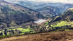
The Wicklow Mountains are the largest area of high ground in Ireland. They cover most of County Wicklow and reach into Dublin, Wexford, and Carlow. In Dublin, people often call them the Dublin Mountains. The tallest peak is Lugnaquilla, standing at 925 meters (3,035 feet) high.
These mountains are mostly made of granite rock. They are surrounded by older rocks like mica-schist and quartzite. The mountains were formed millions of years ago during a huge event called the Caledonian orogeny. The last ice age also shaped them, creating deep valleys and beautiful lakes.
Many important rivers start in the Wicklow Mountains, including the Liffey and Slaney. Powerscourt Waterfall is Ireland's tallest waterfall. Some rivers are used to fill reservoirs, which provide drinking water for Dublin.
The Wicklow Mountains have a mild, wet climate. The main habitats are blanket bogs, heathlands, and grasslands. You can find birds like merlins and peregrine falcons here. The valleys have both conifer and deciduous trees.
People have lived in these mountains since the Neolithic Age. Ancient tombs and the famous monastery at Glendalough show this history. For centuries, the mountains were a hiding place for Irish clans fighting English rule. Today, they are a popular spot for tourists and outdoor activities. The area is protected as the Wicklow Mountains National Park.
Contents
- Exploring the Name of the Wicklow Mountains
- Understanding the Mountain Landscape
- How the Mountains Were Formed: Geology
- Rivers and Water Supply: Hydrology
- Climate and Weather in the Mountains
- Plants and Animals: Habitat and Life Cycle
- A Look Back: History of the Wicklow Mountains
- The Wicklow Mountains Today
- See also
Exploring the Name of the Wicklow Mountains
The Wicklow Mountains get their name from County Wicklow. The county itself is named after Wicklow town. The name "Wicklow" comes from an old Norse word, Wykynglo. This means "Viking's meadow."
The Irish name for Wicklow town is Cill Mhantáin. This means "Church of Mantan," named after a follower of Saint Patrick. Wicklow became a county in 1606. Before that, it was part of County Dublin. In medieval times, the English called this area the Leinster Mountains.
An older name for the entire Wicklow Mountains was Cualu. This later became Cuala. For example, the Irish name for Great Sugar Loaf mountain means "lump of Cuala." Different parts of the mountains also had historical names linked to local families.
The mountains were also once known as Sliabh Ruadh. This means the Red Mountains.
Understanding the Mountain Landscape
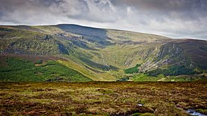
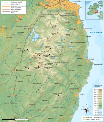
The Wicklow Mountains form Ireland's largest area of continuous high ground. They cover over 500 square kilometers (193 square miles) above 300 meters (984 feet). The mountains stretch from north-east to south-west. They are divided into several groups. These include Kippure in the north and Lugnaquilla in the center.
Lugnaquilla is the highest peak in the Wicklow Mountains. It stands at 925 meters (3,035 feet). It is also the tallest mountain in the province of Leinster. There are 39 peaks over 600 meters (1,969 feet) in the Wicklow Mountains.
There are only three main roads that cross the mountains below 600 meters. The Sally Gap and the Wicklow Gap are the highest road passes in Ireland.
How the Mountains Were Formed: Geology
The Wicklow Mountains are mainly made of granite. This granite is surrounded by a layer of mica-schist and even older rocks like quartzite. The oldest rocks are found in places like Bray Head and the Little Sugar Loaf and Great Sugar Loaf mountains. These rocks formed from sand in an ancient ocean over 542 million years ago.
The ancient ocean closed up about 415 million years ago. This caused a huge collision between continents. This collision pushed up the Wicklow Mountains. It also created a large mass of granite called the Leinster Chain. This is the biggest continuous area of granite in Ireland and Britain.
The heat from this collision changed the surrounding rocks into schists. Over time, erosion wore away much of the schist, showing the granite underneath. Some schist still remains on mountain tops like Lugnaquilla. Granite peaks are often round, while schist peaks are sharper. For example, War Hill (granite) is round, but Djouce (schist) is pointed.
The last major event that shaped the mountains was the last ice age. This happened between 2.6 million and 11,700 years ago. The ice carved out the valleys into a "U" shape, like in Glendalough. As the ice melted, it left behind small glaciers in bowl-shaped hollows called corries. These corries now hold lakes like Lough Bray.
Mining and Quarrying in the Mountains
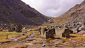
The formation of the Wicklow Mountains also created areas rich in metals. Important mining sites were at Avoca and Glendalough. People have mined at Avoca since the Bronze Age, around 2,500 BCE. They mined iron, then lead, and mainly copper until 1982.
Lead mining was the main activity in the Glendalough valley. Lead was found there in the early 1800s. The last mine closed in 1957.
In 1795, a teacher found gold in a river near Croghan Kinsella. This led to a gold rush. About 80 kilograms (176 pounds) of gold were found. This included a single piece weighing 682 grams (24 ounces), the largest ever found in Ireland and Britain. The British government took over and found even more gold.
Granite from the Wicklow Mountains has been used to build many structures. Quarries at Ballyknockan supplied stone for buildings like the Bank of Ireland in Dublin. Quarries at Glencullen provided stone for the G. P. O. in Dublin. Dalkey quarry supplied granite for Dún Laoghaire Harbour.
Rivers and Water Supply: Hydrology
Many major rivers start in the Wicklow Mountains. Because the blanket bogs don't hold much water, these rivers can fill up quickly after heavy rain.
The River Liffey begins between the mountains of Kippure and Tonduff. The River Dodder, a main branch of the Liffey, also starts nearby on Kippure. The King's River begins on Mullaghcleevaun.
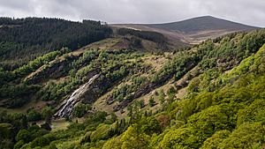
The River Vartry starts on Djouce mountain. The River Dargle begins nearby and forms Powerscourt Waterfall. This is Ireland's tallest waterfall, dropping 121 meters (397 feet). Other waterfalls, like those in Glendalough and Glenmacnass, are also found where different rock types meet.
The River Slaney starts on Lugnaquilla mountain. It flows through the Glen of Imaal.
The main parts of the River Avoca are the Avonmore, Avonbeg, and Aughrim rivers. Many smaller streams that form these rivers begin in the Wicklow Mountains. The Avonmore and Avonbeg rivers meet at the "Meeting of the Waters" in the Vale of Avoca. This place is famous in a song by Thomas Moore.
Water Reservoirs for Dublin
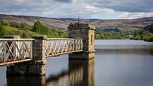
Several rivers in the Wicklow Mountains have been dammed. This creates reservoirs that provide drinking water for Dublin. The first was the Vartry Reservoir near Roundwood, built in the 1860s.
The River Dodder feeds the two Bohernabreena reservoirs. These were built between 1883 and 1887. The Poulaphouca Reservoir on the River Liffey was built between 1938 and 1940. There are also two hydroelectricity plants at Poulaphouca.
A pumped storage hydroelectricity plant was built at Turlough Hill between 1968 and 1974. Water is pumped from Lough Nanahangan to a higher reservoir. It is then released to generate electricity when needed.
Climate and Weather in the Mountains
Like the rest of Ireland, the Wicklow Mountains have a mild, wet oceanic climate. Summers are mild and damp, while winters are cool and wet. The highest mountains receive about 2,000 millimeters (79 inches) of rain each year. The western peaks get the most rain.
June and July are usually the driest months. On average, there are four hours of sunshine per day throughout the year. Snow can cover the highest peaks for about 50 days a year. Strong winds also cause the peat on the mountain tops to wear away.
Plants and Animals: Habitat and Life Cycle
The main habitat in the uplands is heathland and bog. The mountain blanket bogs formed about 4,000 years ago. This happened because of changes in climate and human activity. Before this, the mountains were covered in pine forest. Wetter weather made the ground waterlogged, leading to peat formation.
Blanket bogs are found above 200 meters (656 feet) where it rains more than 175 days a year. Sphagnum mosses are important for building peat. Carnivorous plants like sundews and butterworts live in bogs. Dragonflies and damselflies also reproduce in bog water.
Many bogs in Wicklow have dried out due to human activity. This means Sphagnum mosses can no longer grow well. Instead, moorland and heath plants have taken over. Common plants include heather and bilberry. Birds like red grouse and skylark live on the moorland. Birds of prey such as kestrels and peregrine falcons are also found here.
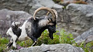
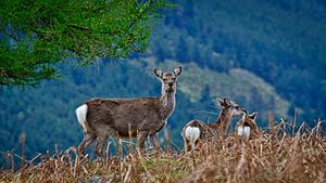
Red deer, which once lived in Wicklow, were brought back in the 1700s. Japanese sika deer were also brought in and have bred with the red deer. All deer in the Wicklow Mountains today are either sika deer or a mix of red and sika deer. Other mammals include feral goats, mountain hares, badgers, and otters.
Wolves used to live in the mountains but were hunted until they disappeared. The last wolf in Wicklow was killed in Glendalough in 1710.
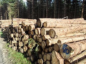
Forests were cleared for a long time, but new trees were planted starting in the 1920s. Most of these new forests are conifer trees, especially Sitka spruce. These are not native trees, so they have less variety of life.
The young rivers in the glens are places where salmon and brown trout lay their eggs. Arctic char, a type of fish, used to live in Lough Dan and the Glendalough lakes. They are now thought to be gone, but there is a plan to bring them back to the Upper Lake at Glendalough.
A Look Back: History of the Wicklow Mountains
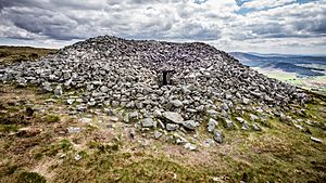
The earliest signs of people in Wicklow date back to about 4,300 BCE. Large stone tombs called passage tombs from the Neolithic period are found on many western and northern mountain tops. These tombs might have marked territories. Other ancient sites include stone circles and rock art.
One famous person from the early tribes was Saint Kevin. He founded the monastery at Glendalough in the late 500s. By the 700s, Glendalough was a large settlement and an important center for learning. It was often attacked, especially by Norse invaders. The monastery became less important after the Normans arrived in the 1100s.
In 1170, during the Norman invasion of Ireland, Strongbow and Dermot MacMurrough took Dublin by using a high route through the Wicklow Mountains. This avoided the usual defenses. The Norman invasion forced two Irish families, the O'Byrnes and the O'Tooles, to move into the Wicklow Mountains.
From their mountain strongholds, these families often attacked the invaders. The Wicklow Mountains became known as the "land of war." The valley of Glenmalure was a safe haven for the clans. English forces suffered big defeats there in 1274 and 1580. The O'Byrnes and O'Tooles finally lost their power in 1652 when their land was taken by the English.
A long period of peace followed until the 1798 Rising. Irish rebels again used the mountains as a hiding place. Michael Dwyer and General Joseph Holt were among them. Both eventually surrendered and were sent to Australia.
To stop future rebellions, the British government built a military road. The Wicklow Military Road was built between 1800 and 1809. It runs from Rathfarnham in Dublin to Aghavannagh in Wicklow. Army barracks were built along the road, but they were not used much. The mountains soon stopped being a center for rebel activity.
The population in the Wicklow uplands dropped greatly after the Great Famine in the mid-1800s. People left the difficult mountain lands.
The building of railways in the 1800s led to more tourism in the Wicklow Mountains. Visitors traveled from Rathdrum by horse-drawn transport. Glendalough quickly became the most popular place to visit.
The Wicklow Mountains Today
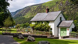
Today, the main farming activity in the uplands is sheep grazing. Land is also used for forestry and cutting turf (peat). Tourism and recreation are also very important. Glendalough still attracts about one million visitors each year.
People enjoy walking, rock climbing, fishing, and cycling in the mountains. Hillwalking became popular thanks to J. B. Malone. He helped create the Wicklow Way, Ireland's first long-distance walking trail. It opened in 1980 and crosses the Wicklow Mountains. Other trails like the Dublin Mountains Way and Saint Kevin's Way also cross parts of the mountains.
To protect the environment, the Wicklow Mountains National Park was created in 1991. It covers over 20,000 hectares (77 square miles). The Wicklow Mountains are also a Special Area of Conservation and a Special Protection Area under European Union law.
The Dublin Mountains Partnership helps manage the Dublin foothills of the Wicklow Mountains. This group works to improve the experience for people using the mountains for fun. They have fixed paths and created new walking and mountain biking trails.
See also
 In Spanish: Montes Wicklow para niños
 | Kyle Baker |
 | Joseph Yoakum |
 | Laura Wheeler Waring |
 | Henry Ossawa Tanner |


