Dublin Mountains Way facts for kids
Quick facts for kids Dublin Mountains Way(Slí Shléibhte Bhaile Átha Cliath) |
|
|---|---|
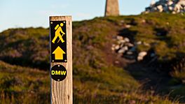
Waymarker on the Dublin Mountains Way at Fairy Castle with yellow man symbol and "DMW" sign
|
|
| Length | 42 km (26 mi) |
| Location | South Dublin; Dún Laoghaire–Rathdown, Ireland |
| Designation | National Waymarked Way |
| Trailheads | Shankill, Dún Laoghaire–Rathdown Tallaght, South Dublin |
| Use | Hiking |
| Elevation change | 1,140 m (3,740 ft) |
| Highest point | Fairy Castle, 536 m (1,759 ft) |
| Lowest point | Shankill, 20 m (66 ft) |
| Difficulty | Strenuous |
| Season | Any |
| Sights | Dublin Mountains Carrickgollogan The Scalp Glencullen Three Rock Two Rock Tibradden Mountain Featherbed Forest Bohernabreena waterworks |
| Hazards | Some sections on busy roads |
| Surface | Road and forest and mountain tracks and trails |
| Website | dublinmountains.ie |
The Dublin Mountains Way (Irish: Slí Shléibhte Bhaile Átha Cliath) is a special long-distance walking trail in the Dublin Mountains of Ireland. It's about 42 kilometers (26 miles) long. The trail stretches from Shankill in the east to Tallaght in the west.
This amazing path was created by the Dublin Mountains Partnership. This group brings together different organizations and people who love to use the mountains for fun. Their goal is to make the Dublin Mountains even better for everyone to enjoy.
Work on the trail started in 2008. The first part opened in June 2009. Many volunteers helped build and improve the paths. They also put up signs to guide walkers. The full trail officially opened in October 2010.
As you walk the Dublin Mountains Way from east to west, you'll see many interesting places. These include old historical sites and special natural areas. The path goes through different types of land, from city parks to thick forests and open mountains. You'll walk on roads, forest tracks, and mountain trails.
Contents
- Building the Trail: A History
- Exploring the Trail: What You'll See
- Shankill and Rathmichael: The Start of Your Journey
- Carrickgollogan and Barnaslingan: Forests and Glaciers
- Kilternan and Glencullen: Villages and Stone
- Three Rock and Two Rock Mountains: Ancient Sites and High Views
- Tibradden Mountain and Cruagh Wood: More History and Nature
- Glenasmole and Tallaght: Valleys and Waterworks
- Other Paths You Might Find
- Getting There: Public Transport
Building the Trail: A History
The Dublin Mountains Way was created by the Dublin Mountains Partnership (DMP). This group started in May 2008. Their main aim was to make the Dublin Mountains a better place for people to enjoy outdoor activities.
The DMP includes members from different groups. These are Coillte (Ireland's state forestry company), South Dublin County Council, Dún Laoghaire–Rathdown County Council, and the National Parks and Wildlife Service. There's also the Dublin Mountains Initiative, which is a group of people who love using the mountains.
Local councils wanted to build this trail since the 1980s. But it was hard to get permission for the path to go through state forests. When the DMP was formed in 2008, the dream of the trail finally started to come true.
Work on the trail began in September 2008. The first big job was to improve the path at Tibradden Mountain. They built a special wooden bridge over boggy ground to protect the plants. They also added stone steps and ways to manage water on the trail. This first section opened on June 19, 2009.
Many parts of the trail were finished with help from over 300 volunteers! These volunteers worked hard to build paths and put up signs. Their efforts even won an award for protecting the environment and making outdoor fun sustainable. The whole trail officially opened on October 31, 2010. In 2011, the Dublin Mountains Way won another award for being a great local project.
Some changes were made to the route in 2012 and 2013. For example, a part of the trail that used to go through a graveyard now follows a road. Also, a section that went in a loop was removed. This was done to make sure the trail follows international rules for walking paths, which say trails should be continuous.
Exploring the Trail: What You'll See
Shankill and Rathmichael: The Start of Your Journey
The Dublin Mountains Way starts in the village of Shankill. You'll find a mapboard there to guide you. The trail is marked with a yellow "walking man" symbol. This is the standard sign for long-distance trails in Ireland.
The path takes you through small lanes and crosses the M11 motorway on a bridge. You'll follow an old path to Rathmichael. Then, you'll walk on roads and a lane that leads into Rathmichael Wood.
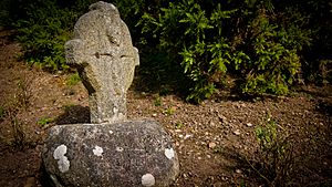
Along this lane, you'll see a very old cross from the 12th century. It's called the Fassaroe Cross. This cross is special because it has a picture of the crucifixion on both sides. People aren't sure why it was placed there. Some think it marked a path between old churches. Others believe it marked the spot of another church that's now gone. There's even a local story about bad luck happening to people who tried to move the cross! The trail then goes through Rathmichael Wood.
Carrickgollogan and Barnaslingan: Forests and Glaciers
From Puck's Castle Lane, you'll enter Carrickgollogan Wood. These woods have many different types of trees, like pine, larch, and beech. As you climb, you might see the tall, ruined chimney of the old Ballycorus Leadmines. It has a cool spiral staircase on the outside! The trail goes near Carrickgollogan Hill but doesn't go to the very top.
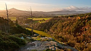
Next, the trail enters Barnaslingan Wood. You'll walk through thick pine trees as you climb Barnaslingan Hill. From the top, you can look down at The Scalp. This is a narrow valley that was carved out by melting ice during the last Ice Age. It's an important example of how glaciers shaped the land. You can see big granite rocks scattered around, showing its icy past. The trail then goes down through the woods and onto the R117 (Enniskerry) Road.
Kilternan and Glencullen: Villages and Stone
The trail follows the R117 road to the village of Kilternan. You'll pass a partially built golf club and a old house called Springfield. This house was once home to a poet and mathematician named George Darley. In Kilternan, you'll turn onto the R116 road at a unique wooden church built in 1929.
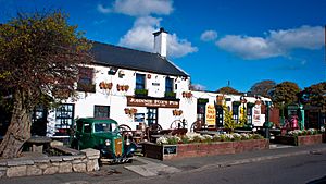
From Kilternan, the Way follows the R116 road to Glencullen. This village is built where two roads meet. Glencullen has a long history of quarrying for granite stone. Stone from here was used in famous Dublin buildings like the GPO. As you walk through the village, you'll see the ruins of an old church from 1824, a library built in 1907, and a newer church from 1909. A famous spot in the village is Johnnie Fox's pub, which opened way back in 1798!
Three Rock and Two Rock Mountains: Ancient Sites and High Views
Leaving Glencullen, the Way enters the forests at Ballyedmonduff. You'll pass an ancient burial site called the Ballyedmonduff wedge tomb. This tomb is from the Bronze Age. When it was explored in 1945, they found pieces of pottery and tools inside.
The trail then climbs through the forests of Ticknock to reach the top of Three Rock. This area has many tall radio and television masts. The mountain gets its name from the three groups of rocks you can see from Dublin city. People once thought these rocks were man-made altars. But they are actually natural granite formations shaped by weather over many years. One of the rocks has bowl-shaped holes called bullauns, which were used for grinding in early Christian times.
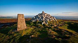
From Three Rock, the trail goes up to the top of Two Rock Mountain. This spot is known as "Fairy Castle" and it's the highest point on the Dublin Mountains Way! At the summit, you'll see a pile of stones (a cairn) and a trig pillar. These are on top of an old mound, which is actually the remains of an ancient burial site called a passage tomb.
Tibradden Mountain and Cruagh Wood: More History and Nature
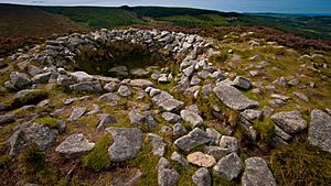
From Fairy Castle, the Way follows a ridge to the top of Tibradden. This mountain is made of granite, and you'll see many granite boulders on its southern slopes. Near the top, there's another ancient site. It was explored in 1849, and a burial urn was found there. It's now in the National Museum of Ireland. Inside the site, there's a stone with a cool spiral pattern.
The trail then goes down from Tibradden through the Pine Forest. This forest has a mix of different trees like Scots pine, larch, and oak. You'll cross the R116 road and the Owendoher River, then enter Cruagh Wood. The path goes along the northern slopes of Cruagh Mountain, but you don't have to climb to its summit. This wood has Sitka spruce and larch trees. As you leave Cruagh Wood, you'll see a stone memorial to a botanist named H. C. Hart. He once won a bet that he could walk from Terenure in Dublin to the top of Lugnaquilla in Wicklow in 24 hours!
Glenasmole and Tallaght: Valleys and Waterworks
After Cruagh Wood, the trail follows the R116 road to a spot called Viewing Point. From there, you'll briefly follow the R115 before entering Featherbed Forest. You'll then come out onto Piperstown Road. The Way follows a few small roads, going down into the Glenasmole Valley. This is a narrow gorge carved out by the River Dodder.
The Glenasmole Valley is a very special area for nature. It has unique habitats and is home to four endangered flower species, including different kinds of orchids.
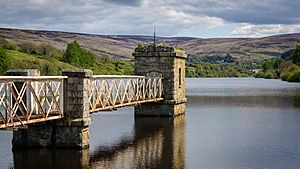
The trail then follows the road to Castlekelly Bridge and enters the Bohernabreena Waterworks. These waterworks were built between 1883 and 1887 to provide drinking water to the town of Rathmines. The Upper Reservoir collects clean water for drinking. It's also a home for birds like whooper swans and moorhens. The Way follows this reservoir, crosses its dam, and then goes along the watercourse of the Dodder to the Lower Reservoir. This lower reservoir helps control flooding on the river.
From the waterworks, the trail follows the Dodder River through Kiltipper Park. After passing some houses, it enters Sean Walsh Park in Tallaght. This is where the Dublin Mountains Way finishes! You'll see a mapboard and a stone marking the opening of this part of the trail.
Other Paths You Might Find
The Dublin Mountains Way shares some of its path with another famous trail called the Wicklow Way. This happens between Fairy Castle and Tibradden. The Way also crosses shorter trails in the forest areas it passes through. These include the Lead Mines Way at Carrickgollogan and the Scalp Lookout Trail at Barnaslingan.
Getting There: Public Transport
You can get to the start of the trail in Shankill using Dublin Bus services or the DART train line. The end of the trail in Tallaght is also served by frequent Dublin Bus services and the Luas light rail red line. There's also a less frequent Dublin Bus route (44B) that goes to Glencullen.
 | John T. Biggers |
 | Thomas Blackshear |
 | Mark Bradford |
 | Beverly Buchanan |


