River Vartry facts for kids
Quick facts for kids River Vartry |
|
|---|---|

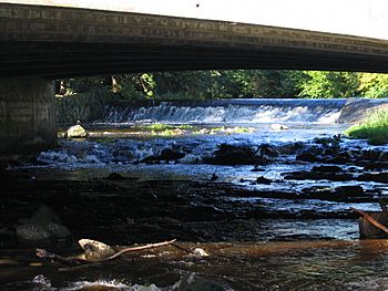
River Vartry through Ashford
|
|
| Native name | Abhainn Fheartraí |
| Physical characteristics | |
| Main source | Calary Bog, County Wicklow |
| River mouth | Irish Sea at Wicklow |
| Length | 33 kilometres (21 mi) |
The River Vartry (Irish: Abhainn Fheartraí) is a river in County Wicklow, Ireland. It is super important because it provides a lot of the drinking water for the big city of Dublin!
Contents
Where Did the Name "Vartry" Come From?
The name of the River Vartry has a long history. It first showed up in old records from the 1100s, spelled as Fertir or Fortir. People think this name comes from an old Irish word that means "fortress." A fortress is like a strong castle or a protected place. Maybe there was an old fort nearby, like a ringfort, which was a circular fort used a long time ago.
The River's Journey: Where Does the Vartry Flow?
The River Vartry starts its journey in a wet, marshy area called Calary Bog. This bog is located under a mountain called the Great Sugar Loaf in the northern part of County Wicklow.
As the river flows, it goes through a special area with reservoirs that hold water for Dublin. Then, it heads east towards a town called Ashford. It passes under Annagolan Bridge and flows through a beautiful, deep valley known as Devil's Glen.
After that, the Vartry goes past Nun's Cross Bridge, which is a very old bridge from the 1700s. It continues through Ashford, goes under the main N11 road, and keeps flowing east.
The Broad Lough and the Sea
The river eventually reaches a narrow lake called Broad Lough. This lake is very close to Wicklow town. Broad Lough and the wet areas around it were formed a long time ago. A natural sand barrier, called a sand spit, grew along the coast. This sand spit, known as The Murrough or Murragh, blocked the river's original path to the sea. Today, the railway line from Dublin to Wicklow runs along this sand spit.
Broad Lough then drains south, flowing right through the center of Wicklow town and into its harbor. From there, the water finally reaches the Irish Sea. The last part of the river, about 1.5 kilometers long, has a few different names. Some people call it the River Leitrim, others the Broad Lough Estuary, and some still call it the River Vartry.
How the Vartry Helps Dublin Get Water
Back in 1861, a special law was passed called the Dublin Waterworks Act. This law led to a big project to build a dam on the River Vartry near Roundwood. This dam created the Vartry Reservoir, a huge lake that holds water.
The dam, along with other water systems and a long tunnel through the Wicklow Mountains, was finished in 1865. This was a really important moment because it gave Dublin its first large supply of clean water! Before this, Dublin got its water from canals, which weren't always as clean.
Today, the Vartry Reservoir and its waterworks are still very important. They provide water to about 200,000 homes and supply about 40% of all the water Dublin needs. So, the River Vartry is not just a beautiful river; it's a vital part of life for many people in Dublin!
 | Shirley Ann Jackson |
 | Garett Morgan |
 | J. Ernest Wilkins Jr. |
 | Elijah McCoy |

