Glenrock Lagoon facts for kids
Quick facts for kids Glenrock Lagoon |
|
|---|---|
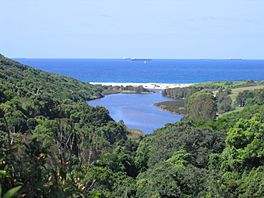
Looking east across Glenrock Lagoon from Leichhardt's Lookout on the Yuelarbah Track
|
|
| Location | Newcastle–Hunter, New South Wales, Australia |
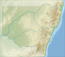
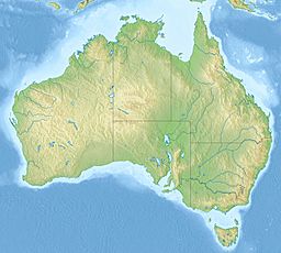
| Coordinates | 32°58′S 151°44′E / 32.967°S 151.733°E |
| Lake type | Intermediate freshwater small coastal creek |
| Primary inflows | Flaggy Creek |
| Primary outflows | Tasman Sea, South Pacific Ocean |
| Catchment area | 7.4 square kilometres (2.9 sq mi) |
| Basin countries | Australia |
| Surface area | 0.1 square kilometres (0.039 sq mi) |
| Average depth | 0.3 metres (1 ft 0 in) |
| Water volume | 15.1 megalitres (530×103 cu ft) |
| Surface elevation | 0 m (0 ft) |
| Settlements | Adamstown, Dudley |
Glenrock Lagoon is a cool freshwater lagoon located near Newcastle, New South Wales, Australia. It's a small body of water that connects to the Tasman Sea. This special place is found close to the suburbs of Adamstown and Dudley. It is about 153 kilometers north of Sydney.
What is Glenrock Lagoon Like?
Glenrock Lagoon gets its water from Flaggy Creek. This creek flows through the Glenrock State Recreation Area. The lagoon is quite shallow, usually about 0.3 meters deep.
The lagoon connects to the Tasman Sea through a channel where tides flow in and out. The area that collects water for the lagoon, called its catchment, is about 7.4 square kilometers. The lagoon itself covers about 0.1 square kilometers.
The lagoon's edge is about 11 kilometers long. It stretches about 4.1 kilometers from east to west. Its width changes from 0.6 kilometers near the coast to 0.35 kilometers in the middle.
There are three smaller areas that feed water into the lagoon. These are Little Flaggy Creek in the north, Flaggy Creek in the center, and a small unnamed creek in the southeast. Flaggy Creek is about 4 kilometers long. Little Flaggy Creek is also known as Glenrock Creek on some maps.
In 1887, an old map showed Little Flaggy Creek as "First Flaggy Creek." Flaggy Creek was called "Second Flaggy Creek." The soil around the lagoon is mostly clay. You can find dry and swampy forests, as well as rainforest plants, in the bush areas.
The Story of Glenrock Lagoon
Glenrock Lagoon formed about 6,000 years ago. This happened after the last ice age, when sea levels became stable. The lagoon is about 900 meters long and 100 meters wide. It covers an area of about 8 hectares. The water level can change a lot, sometimes by as much as 2 meters.
Early European settlers named the area "Glenrock" because of its rugged valleys. However, the local Awabakal people originally called it Pillapay-Kullaitaran. This means "The Valley of the Palms," because Cabbage Palms were common there.
Archaeologists have found evidence of an ancient campsite nearby. It shows that people lived in this area about 7,800 years ago. A site where tools were made marks a place where people gathered near the lagoon.
The first coal in Australia was discovered near Glenrock Lagoon. This happened on March 30, 1791, by early European visitors. They named it Fortunate Creek because they found food and friendly local people there. Later, Lieutenant John Shortland received credit for finding coal in Newcastle in 1797. Even today, you can still see coal in the cliffs at the mouth of Glenrock Lagoon.
In 1842, a famous explorer named Ludwig Leichhardt described walking through the valley. He wrote about the amazing view of the lagoon from a high spot. This spot is now known as "Leichhardt Lookout" and is part of the Great North Walk.
Leichhardt described the valley as a "narrow, rocky gully with steep sides." He said the slopes were covered with "luxurious vegetation." Trees and bushes were connected by climbing plants. He also noted how floods had swept down, creating a wild mix of life and fallen trees.
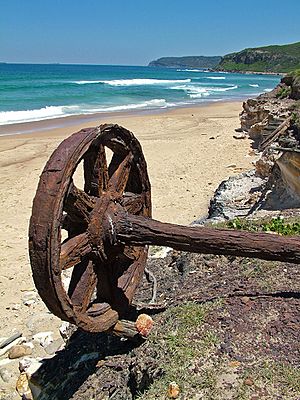
In 1883, the Burwood Coal Mining Company was started. They dug a mine shaft in 1884, which was finished in 1885. This mine was called Burwood Colliery. A private railway line was built from the mine. It went across the lagoon and along Burwood Beach to connect with another railway line.
Flaggy Creek was surveyed in 1828 by Henry Dangar, a landowner. An old map from this survey showed the main road south. It also showed the unnamed Flaggy Creek. Later, local families called this creek Rocky Creek. It was a great place for children to play.
Exploring Glenrock Lagoon Today
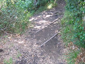
Glenrock Lagoon is a popular spot for outdoor activities. There are major walking trails and a cycleway. The Great North Walk (also called Yuelarbah Track) follows Flaggy Creek. It goes from Charlestown to the top of the lagoon. Then it follows the northern shore to the beach. From there, it heads north to Newcastle.
An old railway path to Belmont has been turned into a cycleway. This project was completed in stages, finishing in 2015.
For over a hundred years, Glenrock Lagoon has been a favorite place for people from Newcastle and Lake Macquarie to relax. In 1986, the Glenrock State Conservation Area was created. This means the area is now protected.
Several suburbs are located within the lagoon's water catchment area. These include Adamstown Heights, Merewether Heights, Highfields, Kahibah, Charlestown, and Whitebridge. Only Kahibah is completely inside the catchment area.
 | Toni Morrison |
 | Barack Obama |
 | Martin Luther King Jr. |
 | Ralph Bunche |


