Gluepot, South Australia facts for kids
Quick facts for kids GluepotSouth Australia |
|||||||||||||||
|---|---|---|---|---|---|---|---|---|---|---|---|---|---|---|---|

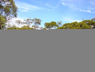
Vegetation at Gluepot Reserve, South Australia
|
|||||||||||||||
| Population | 3 (shared with other localities) (2016 census) | ||||||||||||||
| Established | 2013 | ||||||||||||||
| Postcode(s) | 5417 | ||||||||||||||
| Elevation | 57 m (187 ft) | ||||||||||||||
| Time zone | ACST (UTC+9:30) | ||||||||||||||
| • Summer (DST) | ACST (UTC+10:30) | ||||||||||||||
| Location |
|
||||||||||||||
| LGA(s) | Pastoral Unincorporated Area | ||||||||||||||
| Region | Murray and Mallee | ||||||||||||||
| County | Young | ||||||||||||||
| State electorate(s) | Stuart | ||||||||||||||
| Federal Division(s) | Grey | ||||||||||||||
|
|||||||||||||||
|
|||||||||||||||
| Footnotes | Adjoining localities | ||||||||||||||
Gluepot is a special place in South Australia. It is about 180 kilometers (112 miles) north-east of Adelaide, the state capital. It is also about 40 kilometers (25 miles) north of the town of Waikerie.
This area became an official "locality" on April 26, 2013. A locality is like a small district or area with a known name. Its name comes from a very old "pastoral lease" called Gluepot. A pastoral lease is a large piece of land used for grazing animals like sheep or cattle.
Most of the land in Gluepot is now a special protected area. It is called the Gluepot Reserve. This reserve has been protecting nature since 1997.
In August 2016, a survey called the 2016 Australian census found that Gluepot and its nearby areas had a total population of three people.
Gluepot is part of several larger areas. It is in the federal Division of Grey. It is also in the state electoral district of Stuart. Geographically, it is in the Pastoral Unincorporated Area of South Australia. It is also part of the state’s Murray and Mallee region.
Weather in Gluepot
Gluepot has its own official weather station. This station has been recording weather information since 1999. It helps us understand the climate of the area.
| Climate data for Gluepot, South Australia | |||||||||||||
|---|---|---|---|---|---|---|---|---|---|---|---|---|---|
| Month | Jan | Feb | Mar | Apr | May | Jun | Jul | Aug | Sep | Oct | Nov | Dec | Year |
| Mean daily maximum °C (°F) | 34.1 (93.4) |
32.8 (91.0) |
29.5 (85.1) |
25.1 (77.2) |
20.6 (69.1) |
17.1 (62.8) |
17.1 (62.8) |
18.9 (66.0) |
22.6 (72.7) |
25.9 (78.6) |
29.2 (84.6) |
31.5 (88.7) |
25.4 (77.7) |
| Mean daily minimum °C (°F) | 16.0 (60.8) |
15.4 (59.7) |
12.4 (54.3) |
8.6 (47.5) |
6.2 (43.2) |
4.0 (39.2) |
3.7 (38.7) |
4.3 (39.7) |
6.5 (43.7) |
8.8 (47.8) |
12.0 (53.6) |
13.8 (56.8) |
9.3 (48.7) |
| Average rainfall mm (inches) | 18.7 (0.74) |
22.5 (0.89) |
13.0 (0.51) |
19.5 (0.77) |
19.1 (0.75) |
23.8 (0.94) |
19.4 (0.76) |
19.3 (0.76) |
23.1 (0.91) |
20.7 (0.81) |
29.3 (1.15) |
34.9 (1.37) |
272.5 (10.73) |
| Average rainy days | 2.5 | 1.9 | 1.6 | 2.8 | 4.7 | 4.0 | 4.4 | 5.0 | 3.4 | 3.5 | 3.9 | 3.7 | 41.4 |
 | Victor J. Glover |
 | Yvonne Cagle |
 | Jeanette Epps |
 | Bernard A. Harris Jr. |


