Gogeldrie, New South Wales facts for kids
Quick facts for kids GogeldrieNew South Wales |
|
|---|---|

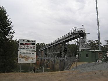
Gogeldrie Weir
|
|
| Population | 65 (2021 census) |
| Postcode(s) | 2705 |
| Elevation | 148 m (486 ft) |
| Location | |
| LGA(s) | Leeton Shire |
| County | Cooper |
| State electorate(s) | Murray |
| Federal Division(s) | Riverina |
Gogeldrie is a small community located in the central part of the Riverina region in New South Wales, Australia. It's about 11 kilometres west of the town of Leeton and 11 kilometres east of Whitton. In 2021, only 65 people lived in Gogeldrie, making it a very quiet place.
About Gogeldrie
Gogeldrie is part of the Leeton Shire, which is a local government area. This means it's managed by the local council in Leeton. The area around Gogeldrie is mostly flat and is known for farming.
Location and Surroundings
Gogeldrie is situated in the Riverina region. The Riverina is a large area in New South Wales that's famous for its agriculture. It gets its name from the many rivers that flow through it, like the Murrumbidgee River. The land here is very fertile, which is great for growing crops.
The town is close to two other towns: Leeton and Whitton. Leeton is a bigger town with more services, while Whitton is also a small community.
Gogeldrie's History
Even though Gogeldrie is a small place now, it once had its own post office. The Gogeldrie Post Office opened its doors on 15 May 1933. It helped people send and receive mail in the community. However, it didn't stay open for very long. The post office closed down in 1945, just 12 years after it first opened. This shows how communities can change over time.
 | Delilah Pierce |
 | Gordon Parks |
 | Augusta Savage |
 | Charles Ethan Porter |


