Goshute Mountains facts for kids
Quick facts for kids Goshute Mountains |
|
|---|---|
| Highest point | |
| Elevation | 2,151 m (7,057 ft) |
| Geography | |
| Country | United States |
| State | Nevada |
| District | Elko County |
| Range coordinates | 40°16′9.758″N 114°16′33.052″W / 40.26937722°N 114.27584778°W |
| Topo map | USGS White Horse Mountain |
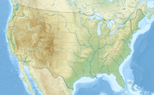
The Goshute Mountains is a mountain range located in the southeastern part of Elko County, Nevada, United States. This mountain range is a natural landmark, standing tall in the landscape of eastern Nevada.
Contents
Exploring the Goshute Mountains
The Goshute Mountains are an important part of the geography of Nevada. They reach an elevation of about 2,151 meters (or 7,057 feet) above sea level. This makes them a noticeable feature in the region.
Where are the Goshute Mountains?
These mountains are found in the eastern part of Nevada, a state known for its vast deserts and many mountain ranges. Specifically, they are in Elko County, which is in the northeastern corner of the state.
Neighboring Mountain Ranges
To the north, the Goshute Mountains are separated from another mountain range called the Toano Range. The natural break between these two ranges is known as Morgan Pass. A "pass" is a lower area or gap in a mountain range, often used as a route for travel.
How the Goshute Mountains Got Their Name
The Goshute Mountains were named after the Goshute people, a Native American tribe. The Goshute are an indigenous group who have lived in parts of Nevada, Utah, and Idaho for thousands of years. Their traditional lands included areas near these mountains. Naming the mountains after them honors their long history and connection to this land.
 | Emma Amos |
 | Edward Mitchell Bannister |
 | Larry D. Alexander |
 | Ernie Barnes |


