Graeagle, California facts for kids
Quick facts for kids
Graeagle
|
|
|---|---|

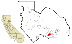
Location in Plumas County and the state of California
|
|
| Country | |
| State | |
| County | Plumas |
| Area | |
| • Total | 11.124 sq mi (28.812 km2) |
| • Land | 11.067 sq mi (28.664 km2) |
| • Water | 0.057 sq mi (0.148 km2) 0.51% |
| Elevation | 4,373 ft (1,333 m) |
| Population
(2020)
|
|
| • Total | 724 |
| • Density | 65.08/sq mi (25.128/km2) |
| Time zone | UTC-8 (Pacific) |
| • Summer (DST) | UTC-7 (PDT) |
| ZIP code |
96103
|
| Area code | 530 |
| FIPS code | 06-30560 |
| GNIS feature IDs | 1659728, 2408311 |
Graeagle is a small town in eastern California, United States. It is located in Plumas County, right by the Middle Fork Feather River. This area is part of the beautiful Northern Sierra Nevada mountains. In 2020, about 724 people lived in Graeagle.
Contents
History of Graeagle
Graeagle started as a town for lumber workers in 1916. A post office opened in 1919, called Davies Mill.
How Graeagle Got Its Name
In the 1920s, the mill got a new owner. They held a contest to choose a new name for the town. A person named Belle Byrne suggested "Graeagle." She got the idea from a nearby place called Gray Eagle Creek. She won the contest and a $5 prize!
The name "Gray Eagle" might have come from Edward D. Baker. He was a politician known as the "Gray Eagle of Republicanism." He visited the mining area in 1856.
Lumber Industry in Graeagle
The Graeagle Lumber Company was a big employer. It was owned by the California Fruit Exchange. Hundreds of people worked there from the 1920s to the 1950s. They cut down trees, made lumber, and built wooden boxes. These boxes were used to pick and ship fruits and vegetables.
New machines meant the mill closed in 1956. The box factory closed in 1957. In 1959, the West family bought the town.
Geography of Graeagle
Graeagle is a small community. It covers about 11.1 square miles (28.8 square kilometers). Most of this area is land. Only a tiny part, about 0.51%, is water.
Economy and Fun Activities in Graeagle
Graeagle's economy mostly depends on visitors. Many people come here for summer vacations. They often have second homes in the area.
Outdoor Fun and Local Spots
There are several golf courses around Graeagle. They are popular places for people to play.
A local brewery called "The Brewing Lair of the Lost Sierra" is nearby. It is located in Blairsden. The main office for the Plumas National Forest's Beckwourth Ranger District is also in Blairsden.
Plumas-Eureka State Park
About 6 miles (10 kilometers) west of Graeagle is Plumas-Eureka State Park. This park has old ghost towns. Mining started there in 1851.
At first, individuals did the mining. Then, companies took over. Later, large corporations ran the mines. The owners of these corporations often lived far away. Some investors for the Graeagle mines were even from London, England!
Population of Graeagle
| Historical population | |||
|---|---|---|---|
| Census | Pop. | %± | |
| U.S. Decennial Census | |||
In 2010, Graeagle had 737 people living there. Most of the people were White. A small number were Native American or from other backgrounds. About 3.7% of the population was Hispanic or Latino.
Age Groups in Graeagle
The population in Graeagle is quite spread out by age. In 2010:
- About 9.5% of people were under 18 years old.
- About 43% of people were 65 years or older.
The average age in Graeagle was 62.4 years old.
Most people in Graeagle own their homes. About 81.8% of the population lived in homes they owned.
Local News in Graeagle
The main local news used to be the Portola Reporter. It was a newspaper published every Wednesday. Now, the news is mostly online. You can find it as the Plumas News.
See also
 In Spanish: Graeagle para niños
 | James B. Knighten |
 | Azellia White |
 | Willa Brown |


