Graham Lake (Maine) facts for kids
Quick facts for kids Graham Lake |
|
|---|---|
| Location | Hancock County, Maine |
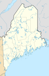
| Coordinates | 44°39′30″N 68°23′57″W / 44.658408°N 68.399188°W |
| Type | eutrophic reservoir |
| Primary inflows | Union River |
| Primary outflows | Union River |
| Catchment area | 499 sq mi (1,290 km2) |
| Basin countries | United States |
| Max. length | 13 miles (21 km) |
| Surface area | 9,383 acres (3,797 ha) |
| Average depth | 17 ft (5.2 m) |
| Max. depth | 47 ft (14 m) |
| Water volume | 105,603 acre⋅ft (130,259,000 m3) |
| Residence time | 3 months |
| Shore length1 | 89.8 mi (144.5 km) |
| Surface elevation | 106 ft (32 m) |
| Settlements | Ellsworth, Waltham, Mariaville |
| 1 Shore length is not a well-defined measure. | |
Graham Lake is a large, man-made lake in Hancock County, Maine. It's a special type of lake called a reservoir, which means it was created by building a dam. This lake is also described as eutrophic, meaning it has a lot of nutrients, which can sometimes make the water less clear.
Contents
Graham Lake: A Man-Made Wonder
Graham Lake was formed in 1922. This happened when a dam was built across the Union River. The main purpose of this dam was to create hydro-electric power. This is a way to make electricity using the force of moving water. The dam is located about 4 miles (6 km) upstream from the town of Ellsworth, Maine.
The First Dam and Its Challenges
The very first dam built for Graham Lake was made quickly. It was mostly an earthen dam, meaning it was built from soil and rocks. The company that built it was called the Bangor Hydro Electric Company.
Sadly, this first dam didn't last long. In 1923, just one year after it was built, the dam broke! This caused a big flood in downtown Ellsworth. The flood caused a lot of damage, nearly $8 million worth.
Rebuilding and Power Generation
After the flood, the dam was rebuilt. The Bangor Hydro Electric Company continued to operate it. They used the dam to generate electricity for many years.
In 1999, the dam was sold. A new company, Pennsylvania Power & Light, bought it. They still use the dam today to produce electricity.
What Lives in Graham Lake?
The water in Graham Lake is not very clear. Scientists measure water clarity using a tool called a secchi disk. In Graham Lake, the average measurements are less than 3 meters. This means you can't see very far down into the water.
Even with the low clarity, many types of fish live in Graham Lake. People who enjoy fishing can find several interesting species here:
- Smallmouth bass
- White perch
- Chain pickerel
- Landlocked salmon (these are salmon that live their whole lives in freshwater lakes)
- Brook trout
 | John T. Biggers |
 | Thomas Blackshear |
 | Mark Bradford |
 | Beverly Buchanan |


