Graham Lakes (Minnesota) facts for kids
Quick facts for kids Graham Lakes |
|
|---|---|
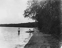
Children wading in Graham Lakes in this 1905 photograph by Emil King
|
|
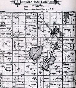
Map of Graham Lakes Township, 1914
|
|
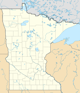
| Location | Nobles County, Minnesota |
| Coordinates | 43°47′35″N 95°30′31″W / 43.79306°N 95.50861°W |
| Type | Glacial lakes |
| Primary inflows | Several small creeks |
| Max. length | West Graham Lake 3⁄4 mile (1.2 km) - East Graham Lake 1+1⁄2 miles (2.4 km) |
| Max. width | West Graham Lake 1⁄2 mile (0.80 km) - East Graham Lake 1⁄2 mile (0.80 km) |
| Surface area | West Graham Lake 519.28 acres (210.15 ha) - East Graham Lake 511.32 acres (206.92 ha) |
| Average depth | 7 ft (2.1 m) |
| Max. depth | 8 ft (2.4 m) |
| Water volume | 10,000 US gal (38,000 L; 8,300 imp gal) |
| Shore length1 | 3 mi (4.8 km) |
| Surface elevation | West Graham Lake 1,438.6 feet (438.5 m) - East Graham Lake 1,435 feet (437 m) |
| Islands | 2 Rock Piles |
| 1 Shore length is not a well-defined measure. | |
The Graham Lakes are two beautiful lakes found in the northeastern part of Nobles County, Minnesota. They are known as West Graham Lake and East Graham Lake. These lakes were formed long ago by glaciers.
West Graham Lake is shaped like an oval. It stretches about one mile (1.6 km) from east to west. Its width from north to south is about 3/4 of a mile. This lake covers an area of about 519 acres (2.1 km²). It is usually about 5 feet (1.5 m) deep, but can be up to 8 feet (2.4 m) deep.
East Graham Lake is longer and narrower. It runs for about 1.5 miles (2.4 km) from northeast to southwest. Its width is less than 1/2 mile. This lake covers about 511 acres (2.07 km²). Like West Graham Lake, its average depth is 5 feet (1.5 m) and its maximum depth is 8 feet (2.4 m).
A small creek connects West Graham Lake to East Graham Lake. Another creek flows out of East Graham Lake and eventually joins the Des Moines River.
Contents
History of Graham Lakes
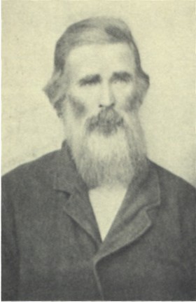
In May 1867, a brave pioneer named Stephen Muck arrived in the Graham Lakes area. He decided to settle on land near West Graham Lake. He built a log cabin using wood from trees near the lake. This was the very first wooden house in Nobles County.
Later that year, in the fall of 1867, Stephen Muck brought his family from Jackson County, Minnesota. For a few years, he made a living by trapping animals. Then, he became a farmer. Stephen Muck lived on his farm from 1867 until he passed away in 1897. He is remembered as the first person to live permanently in Nobles County.
The Imaginary Town of Gretchtown
An interesting fact about the Graham Lakes area is that the first town ever shown on a map of Nobles County was called Gretchtown. This map was made in 1856, which was 11 years before Stephen Muck even arrived! Gretchtown was supposedly located on the south side of West Graham Lake.
People in the 1850s heard rumors that a railroad would be built through southwestern Minnesota. Even though no one had actually planned the railroad route yet, the town of Gretchtown was created on paper. It was meant to be a stopping point for the future train. When Nobles County was officially created in 1857, Gretchtown was even named the county seat. This was quite funny because, at that time, there were no people living in the county at all!
Later Development of the Area
In 1871, when the route for the St. Paul and Sioux City Railway was finally planned, it went far south of the Graham Lakes area. This meant that no big towns grew near the lakes. The towns of Kinbrae and Dundee were started in Graham Lakes Township in 1879. However, they never grew very large. Because of this, the Graham Lakes area has stayed mostly rural. The shores of both East and West Graham Lake are still natural and undeveloped.
Naming the Lakes
The Graham Lakes were first shown on a map made in 1842 by Joseph Nicollet. He explored the area in the late 1830s and early 1840s. Nicollet named the lakes after Joseph Duncan Graham. Joseph Graham was a commissioner who helped survey the border between the United States and Canada from 1840 to 1843.
Fishing in Graham Lakes
The Graham Lakes are well-known for being great places to fish!
Fishing in East Graham Lake
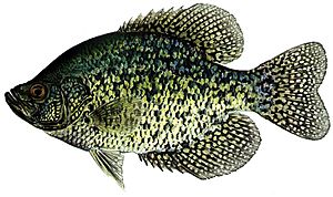
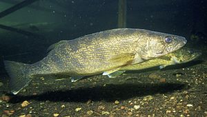
East Graham Lake is mainly managed for fish like walleye and northern pike. Other fish you can find there include black crappie and yellow perch. In June 2007, a study found many black crappies, ranging from 7.4 to 13 inches (188 to 330 mm) long. This was the highest number of crappies ever seen in the lake during a study! Northern pike were also found, measuring from 17.6 to 30 inches (447 to 762 mm). Walleye were also plentiful, with many being 14 inches (356 mm) or longer.
Most fish from East Graham Lake are safe to eat. However, children under 15 years old should not eat walleye from this lake more than once a week. This is because of small amounts of mercury that can be found in the fish.
Fishing in West Graham Lake
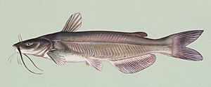
West Graham Lake is mainly managed for walleye. Black crappie and channel catfish are also important fish here. Young walleye are added to the lake every two years. A study in June 2007 showed that walleye in West Graham Lake ranged from 6.9 to 20 inches (175 to 508 mm) long. Black crappies were between 5.8 and 11.9 inches (147 to 302 mm). The average black crappie in West Graham Lake weighs almost half a pound! Channel catfish found there averaged 13.3 inches (338 mm). There are no special warnings about eating fish from West Graham Lake.
Public Access and Parks
You can visit the Graham Lakes at two county parks: Fury Island and Maka-Oicu County Parks.
Maka-Oicu County Park
Maka-Oicu County Park is located on the northeast shore of West Graham Lake. This park is a great place for camping, swimming, and having picnics. It also has natural areas to explore and a historic site. The park offers showers and a large picnic shelter for groups. There's even a small cabin with beds, a table, and a mini-fridge for campers. Campers can also use electricity and water. Maka-Oicu Park covers about 46 acres (18.6 hectares) of developed land.
Fury Island County Park
Fury Island County Park is on the west side of East Graham Lake. It's about one mile (1.6 km) south of Maka-Oicu County Park. This park also offers camping, natural areas, and lake access. It has showers and a big picnic shelter for gatherings. Plus, there's a playground for younger kids to enjoy! Fury Island Park covers about 10 acres (4 hectares) of developed land.


