Nobles County, Minnesota facts for kids
Quick facts for kids
Nobles County
|
|
|---|---|
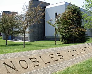
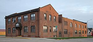
Nobles County Government Center in Worthington
|
|
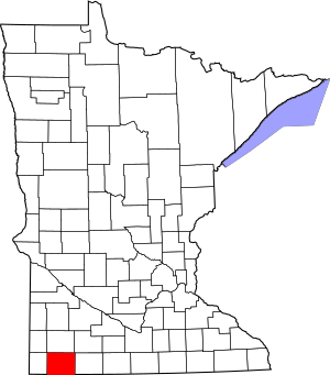
Location within the U.S. state of Minnesota
|
|
 Minnesota's location within the U.S. |
|
| Country | |
| State | |
| Founded | May 23, 1857 (created) October 27, 1870 (organized) |
| Named for | William H. Nobles |
| Seat | Worthington |
| Largest city | Worthington |
| Area | |
| • Total | 722.551 sq mi (1,871.40 km2) |
| • Land | 715.117 sq mi (1,852.14 km2) |
| • Water | 7.434 sq mi (19.25 km2) 1.0%% |
| Population
(2020)
|
|
| • Total | 22,290 |
| • Estimate
(2023)
|
21,727 |
| • Density | 30.381/sq mi (11.730/km2) |
| Time zone | UTC−6 (Central) |
| • Summer (DST) | UTC−5 (CDT) |
| Congressional district | 1st |
Nobles County is a county located in the state of Minnesota, USA. In 2020, about 22,290 people lived there. The main city and government center is Worthington. Nobles County is part of the Worthington, MN area, which is a smaller city area.
Contents
Nobles County: A Look at Its Past
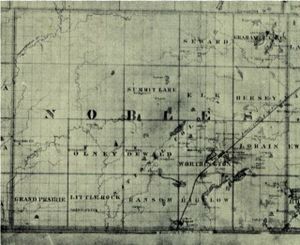
The land that is now Nobles County was first home to the Sisseton Sioux people. The first European to explore the area was Joseph Nicollet in 1842. He came to map the land and named several lakes, like Lake Okabena and Lake Ocheda. He also named the Kanaranzi Creek.
The first small settlement by non-Native Americans was near Graham Lakes in 1846. Nobles County was officially created on May 23, 1857. It was named after William H. Nobles, who was part of Minnesota's government. In 1856, he started building a wagon road for the US government. This road crossed Nobles County and was meant to go all the way to the Rocky Mountains.
However, a financial crisis in 1857, called the Panic of 1857, made it hard for new settlers to come. Also, the Spirit Lake Massacre in 1857, where some Sioux attacked settlers nearby, made people afraid to stay in the area.
Things started to improve in 1867 when a mail route was set up. Post Offices were opened in the settlements by 1868. By the spring of 1870, the population was 117 people, and it nearly doubled by the fall. The county government officially started in 1870.
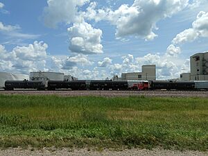
The first railroad, the St. Paul & Sioux City Railway, arrived in 1871. This railroad helped the county grow. Today, this same rail line is used by the Union Pacific Railroad.
In 1871, a group from Toledo, Ohio, decided to start a new community in Nobles County. By 1872, many people moved in and bought land. The city of Worthington was planned in 1871 and became the county seat (the main city for government) in 1873. Another railroad, the Worthington & Sioux Falls Railway, was built in 1876. This led to fast growth in other towns like Rushmore and Adrian.
The population of Nobles County has changed a lot over the years. In 1860, there were only 35 people. By 1880, it grew to 4,435. In 1970, the population reached 23,208. In 2020, it was 22,290.
Nobles County's Economy
Nobles County's economy mainly relies on farming. The top farm products are corn, soybeans, and hogs. Making food products and working with metals are also important industries here. Tourism is also growing, thanks to the county's beautiful lakes, parks, and historical places.
Nobles County's Geography
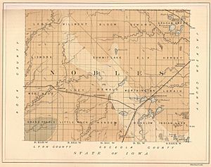
Nobles County is located in the southern part of Minnesota. Its southern border touches the state of Iowa. The county covers about 722.5 square miles. Most of this area, about 715 square miles, is land. The rest, about 7.4 square miles, is water.
Getting Around Nobles County
- Prairieland Transit System
Main Roads in Nobles County
 Interstate 90
 U.S. Highway 59
 Minnesota State Highway 60
 Minnesota State Highway 91
 Minnesota State Highway 264
Neighboring Counties
- Murray County - north
- Cottonwood County - northeast
- Jackson County - east
- Osceola County, Iowa - southeast
- Lyon County, Iowa - southwest
- Rock County - west
Lakes in Nobles County
- East Graham Lake
- Fulda First Lake
- Indian Lake
- Iowa Lake (part)
- Jack Lake
- Kinbrae Lake
- Lake Bella
- Lake Ocheda
- Lake Okabena
- West Graham Lake
- Willow Lake (part)
Protected Natural Areas
- Adrian Spring County Park
- Aid Pit State Wildlife Management Area
- Bigelow State Wildlife Management Area
- Champepadan State Wildlife Management Area
- Compass Prairie Scientific and Natural Area
- Dewald State Wildlife Management Area
- Eagle Lake State Wildlife Management Area
- Ells Pit State Wildlife Management Area
- Fenmont State Wildlife Management Area
- Fulda State Wildlife Management Area
- Fury State Wildlife Management Area
- Groth State Wildlife Management Area
- Hawkeye County Park
- John Erickson State Wildlife Management Area
- Lake Bella State Wildlife Management Area
- Lake Ocheda Game Refuge
- Lone Tree State Wildlife Management Area
- Maka-Oicu County Park
- Midway County Park
- Peterson State Wildlife Management Area
- Pheasant Run State Wildlife Management Area
- Scheuring State Wildlife Management Area
- Schweigert State Wildlife Management Area
- Sherwood State Wildlife Management Area
- Sportsman County Park
- Swessinger State Wildlife Management Area
- West Graham State Wildlife Management Area
Nobles County's Geology
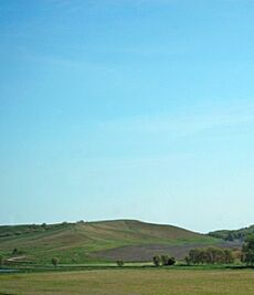
Nobles County is located on top of the Buffalo Ridge. This is a large area of rolling hills in southwestern Minnesota. It reaches a height of about 1,995 feet (608 meters) above sea level. The Buffalo Ridge shows how far the last ice age's glaciers reached. It stretches for about 60 miles through several counties, including Nobles.
The Buffalo Ridge is a drainage divide. This means it separates the areas where water flows into the Mississippi River from areas where water flows into the Missouri River. Because it's high up and often windy, Buffalo Ridge is a great place for wind energy. More than 200 wind turbines stand along the Ridge, creating clean electricity.
The land here is made of old rock layers, including shale, sandstone, and clay. These are covered by thick layers of glacial drift, which is material left behind by glaciers. This glacial material can be up to 800 feet (244 meters) thick. The top layer is a wind-blown silt called loess, which is about 6-15 feet (1.8-4.6 meters) thick. This loess creates long, gently sloping hills. Loess is easily washed away by water, which is why there are not many lakes or wetlands in this area. Instead, water flows into the Missouri River and Minnesota River systems.
Nobles County's Population
| Historical population | |||
|---|---|---|---|
| Census | Pop. | %± | |
| 1860 | 35 | — | |
| 1870 | 117 | 234.3% | |
| 1880 | 4,435 | 3,690.6% | |
| 1890 | 7,958 | 79.4% | |
| 1900 | 14,932 | 87.6% | |
| 1910 | 15,210 | 1.9% | |
| 1920 | 17,917 | 17.8% | |
| 1930 | 18,618 | 3.9% | |
| 1940 | 21,215 | 13.9% | |
| 1950 | 22,435 | 5.8% | |
| 1960 | 23,365 | 4.1% | |
| 1970 | 23,208 | −0.7% | |
| 1980 | 21,840 | −5.9% | |
| 1990 | 20,098 | −8.0% | |
| 2000 | 20,832 | 3.7% | |
| 2010 | 21,378 | 2.6% | |
| 2020 | 22,290 | 4.3% | |
| 2023 (est.) | 21,727 | 1.6% | |
| U.S. Decennial Census 1790-1960 1900-1990 1990-2000 2010-2020 |
|||
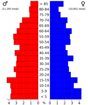
In early 2024, the average home value in Nobles County was about $191,780.
As of 2023, there were an estimated 7,689 households in Nobles County. Each household had about 2.82 people on average. The average household income was about $62,973. About 12.2% of the people in the county lived at or below the poverty line.
About 66.2% of the people in Nobles County have jobs. Also, 17.1% of the population has a college degree or higher, and 79.4% have a high school diploma.
The main backgrounds reported by people in Nobles County include English (67.7%), Spanish (23.8%), Asian (4.7%), and other groups. The average age in the county was 36.4 years.
Population by Race and Ethnicity
The table below shows the different racial and ethnic groups in Nobles County over the years. Please note that the US Census counts Hispanic/Latino as an ethnic group, separate from racial categories.
| Race / ethnicity (NH = non-Hispanic) | Pop. 1980 | Pop. 1990 | Pop. 2000 | Pop. 2010 | Pop. 2020 |
|---|---|---|---|---|---|
| White alone (NH) | 21,492 (98.41%) |
19,318 (96.12%) |
17,232 (82.72%) |
14,365 (67.20%) |
12,147 (54.50%) |
| Black or African American alone (NH) | 30 (0.14%) |
49 (0.24%) |
212 (1.02%) |
727 (3.40%) |
978 (4.39%) |
| Native American or Alaska Native alone (NH) | 52 (0.24%) |
63 (0.31%) |
42 (0.20%) |
67 (0.31%) |
66 (0.30%) |
| Asian alone (NH) | 99 (0.45%) |
399 (1.99%) |
816 (3.92%) |
1,144 (5.35%) |
1,329 (5.96%) |
| Pacific Islander alone (NH) | — | — | 0 (0.00%) |
7 (0.03%) |
41 (0.18%) |
| Other race alone (NH) | 17 (0.08%) |
7 (0.03%) |
10 (0.05%) |
25 (0.11%) |
42 (0.19%) |
| Mixed race or multiracial (NH) | — | — | 195 (0.94%) |
223 (1.04%) |
416 (1.87%) |
| Hispanic or Latino (any race) | 150 (0.69%) |
262 (1.30%) |
2,325 (11.16%) |
4,820 (22.55%) |
7,271 (32.62%) |
| Total | 21,840 (100.00%) |
20,098 (100.00%) |
20,832 (100.00%) |
21,378 (100.00%) |
22,290 (100.00%) |
What the 2020 Census Showed
In 2020, the census counted 22,290 people living in Nobles County. There were 7,851 households and 5,446 families. The population density was about 31.2 people per square mile.
The racial makeup of the county was:
- 58.81% White
- 4.41% African American
- 2.06% Native American
- 6.11% Asian
- 0.18% Pacific Islander
- 19.60% from other races
- 8.83% from two or more races
People of Hispanic or Latino background made up 32.62% of the population. About 28.9% of residents were under 18 years old, and 17.6% were 65 or older.
Communities in Nobles County
Cities in Nobles County
Census-Designated Place
Unincorporated Communities
These are smaller communities not officially organized as cities or towns.
- Org
- Pfingsten
- Ransom
- Reading
- St. Kilian
Townships in Nobles County
- Bigelow Township
- Bloom Township
- Dewald Township
- Elk Township
- Graham Lakes Township
- Grand Prairie Township
- Hersey Township
- Indian Lake Township
- Larkin Township
- Leota Township
- Lismore Township
- Little Rock Township
- Lorain Township
- Olney Township
- Ransom Township
- Seward Township
- Summit Lake Township
- Westside Township
- Wilmont Township
- Worthington Township
See also
 In Spanish: Condado de Nobles para niños
 | Sharif Bey |
 | Hale Woodruff |
 | Richmond Barthé |
 | Purvis Young |


