Wilmont, Minnesota facts for kids
Quick facts for kids
Wilmont
|
|
|---|---|
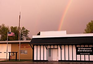
Wilmont in 2016
|
|
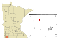
Location of Wilmont, Minnesota
|
|
| Country | United States |
| State | Minnesota |
| County | Nobles |
| Government | |
| • Type | Mayor – Council |
| Area | |
| • Total | 0.69 sq mi (1.80 km2) |
| • Land | 0.69 sq mi (1.80 km2) |
| • Water | 0.00 sq mi (0.00 km2) |
| Elevation | 1,729 ft (527 m) |
| Population
(2020)
|
|
| • Total | 332 |
| • Density | 478.39/sq mi (184.71/km2) |
| Time zone | UTC−6 (Central (CST)) |
| • Summer (DST) | UTC−5 (CDT) |
| ZIP Code |
56185
|
| Area code(s) | 507 |
| FIPS code | 27-70582 |
| GNIS feature ID | 2397329 |
Wilmont is a small city located in Nobles County, Minnesota, in the United States. In 2020, about 332 people lived there. It's a quiet place with a rich history.
Contents
Where is Wilmont?
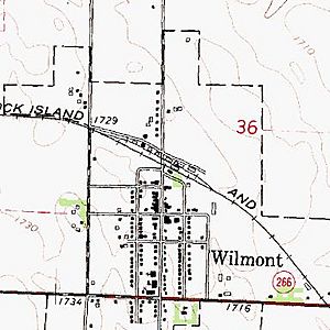
Wilmont covers an area of about 1.8 square kilometers (0.69 square miles). It is all land, with no water areas. Wilmont is the highest town in Nobles County.
Main Roads in Wilmont
The city is connected by several important roads:
 Minnesota State Highway 266 (This road was renamed Nobles County Road 25 in 2003.)
 Nobles County Road 25
 Nobles County Road 16
 Nobles County Road 13
Wilmont's Story: A Look Back in Time
The town of Wilmont was officially started in 1899. Its name came from the township it was in, but with a slight change.
How Wilmont Got Its Name
The township, called Willmont Township (with two "L"s), was created in 1878. People couldn't agree on a name. Some wanted "Willumet," and others liked "Lamont." On November 22, 1878, they decided to combine parts of both, calling it Willmont.
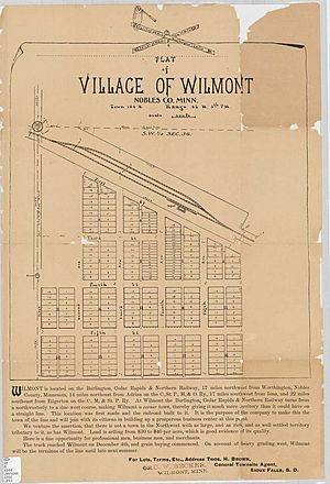
For 21 years, people in Willmont Township didn't have easy access to a railroad. This changed in the summer of 1899. The Burlington Railway planned a new train route. Thomas H. Brown, who worked for the railroad, chose a spot for a new town. He named it Wilmont, but spelled it with one "L" to make it different from the township. The railroad was finished on December 16, 1899. Soon, many new people moved to Wilmont.
Early Days of the Town
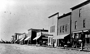
The town's layout was planned on January 22, 1900. A Post Office opened on February 13, 1900. In April 1900, the Stuntebeck Brothers opened the first saloon. A new school was approved in September 1900 and opened two years later. By December 1900, Wilmont was one year old and growing fast. It had two churches (Presbyterian and Catholic), three saloons, and almost two dozen other businesses. It's not clear exactly when the township's name changed from Willmont (double-L) to Wilmont (single-L).
Changes Over the Years
Minnesota State Highway 266 was built in 1949. It connected Worthington, Reading, and Wilmont. In 2003, Nobles County took over this highway, and it became Nobles County Road 25. The Burlington Railway line later became part of the Rock Island Railroad. This train line closed, and the tracks were removed in the 1970s.
Wilmont used to have both public and Catholic schools. However, the last school in town closed in the 1970s. Today, children from Wilmont travel by bus to schools in Worthington, Adrian, or Fulda. Minnesota's open-enrollment law allows families to choose which school district their children attend.
Even without a local school, a railroad, or a state highway connection, Wilmont is still a lively community. Just like in 1900, the town's churches and local businesses are important parts of daily life.
Population of Wilmont
| Historical population | |||
|---|---|---|---|
| Census | Pop. | %± | |
| 1910 | 258 | — | |
| 1920 | 376 | 45.7% | |
| 1930 | 374 | −0.5% | |
| 1940 | 361 | −3.5% | |
| 1950 | 473 | 31.0% | |
| 1960 | 473 | 0.0% | |
| 1970 | 390 | −17.5% | |
| 1980 | 380 | −2.6% | |
| 1990 | 351 | −7.6% | |
| 2000 | 332 | −5.4% | |
| 2010 | 339 | 2.1% | |
| 2020 | 332 | −2.1% | |
| U.S. Decennial Census | |||
Who Lives in Wilmont? (2010 Census)
In 2010, there were 339 people living in Wilmont. These people made up 143 households, with 97 of them being families. The city had about 152 housing units.
Most of the people in Wilmont (95.9%) were White. There were also smaller numbers of African American (2.1%), Native American (0.3%), and Asian (0.6%) residents. About 1.2% of the population identified as Hispanic or Latino.
In terms of households, 30.8% had children under 18 living with them. More than half (53.8%) were married couples. About 11.2% of households were led by a female without a husband present. A small number (2.8%) were led by a male without a wife present. About 28.0% of households were single individuals, and 9.1% of these individuals were 65 or older. The average household had 2.37 people, and the average family had 2.92 people.
The average age of people in Wilmont was 36.9 years old. About 26.8% of residents were under 18. People aged 18 to 24 made up 7.8% of the population. Those aged 25 to 44 were 21.2%, and 30.5% were between 45 and 64. About 13.9% of the population was 65 years or older. The population was almost evenly split between males (49.0%) and females (51.0%).
Images for kids
See also
 In Spanish: Wilmont (Minnesota) para niños
 | Charles R. Drew |
 | Benjamin Banneker |
 | Jane C. Wright |
 | Roger Arliner Young |


