Rushmore, Minnesota facts for kids
Quick facts for kids
Rushmore
|
|
|---|---|
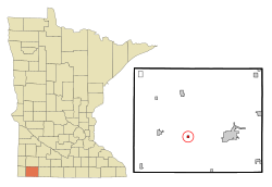
Location of Rushmore, Minnesota
|
|
| Country | United States |
| State | Minnesota |
| County | Nobles |
| Government | |
| • Type | Mayor - Council |
| Area | |
| • Total | 0.25 sq mi (0.66 km2) |
| • Land | 0.25 sq mi (0.66 km2) |
| • Water | 0.00 sq mi (0.00 km2) |
| Elevation | 1,663 ft (507 m) |
| Population
(2020)
|
|
| • Total | 365 |
| • Density | 1,437.01/sq mi (554.95/km2) |
| Time zone | UTC-6 (Central (CST)) |
| • Summer (DST) | UTC-5 (CDT) |
| ZIP code |
56168
|
| Area code(s) | 507 |
| FIPS code | 27-56338 |
| GNIS feature ID | 2396451 |
Rushmore is a small town in Nobles County, Minnesota, United States. In 2020, about 365 people lived there.
Contents
Geography of Rushmore
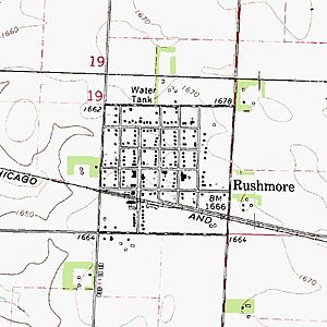
Rushmore covers about 0.25 square miles (0.66 square kilometers) of land. It is located in a part of Minnesota called Dewald Township.
The town sits on the Buffalo Ridge. This is a high area of land that divides where water flows. Rainwater on one side of the ridge flows towards the Mississippi River. Water on the other side flows towards the Missouri River.
Major Roads in Rushmore
You can reach Rushmore using these main highways:
 Interstate 90
 Nobles County Road 35
 Nobles County Road 13
History of Rushmore
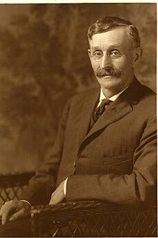
Rushmore was named after S.M. Rushmore, one of the first people to settle there. The town grew because of a new railroad line. This line was called the Worthington and Sioux Falls Railway.
How Rushmore Started
In 1878, a rich businessman from New York, George I. Seney, bought a lot of land nearby. He wanted to bring settlers to this part of Minnesota.
The railroad planned a station in Dewald Township. It was first called Miller Station. For two years, no one lived there.
Then, in May 1878, S. M. Rushmore arrived with his family. He opened a store at Miller Station. This store served the many new settlers Mr. Seney was bringing in.
A train station was also built, and the town was planned out. In August 1878, the town was renamed Rushmore to honor the shopkeeper.
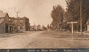
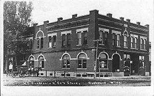
The community grew quickly! By the fall of 1879, Rushmore had many businesses. These included a general store, a hotel, a hardware store, and two blacksmiths. It also had a new church and a new school.
On March 27, 1900, Rushmore officially became an incorporated village. This means it formed its own local government. At that time, 204 people lived there. S. B. Bedford became the first president of the village government.
Population Information
| Historical population | |||
|---|---|---|---|
| Census | Pop. | %± | |
| 1880 | 99 | — | |
| 1910 | 237 | — | |
| 1920 | 313 | 32.1% | |
| 1930 | 332 | 6.1% | |
| 1940 | 423 | 27.4% | |
| 1950 | 368 | −13.0% | |
| 1960 | 382 | 3.8% | |
| 1970 | 394 | 3.1% | |
| 1980 | 387 | −1.8% | |
| 1990 | 381 | −1.6% | |
| 2000 | 376 | −1.3% | |
| 2010 | 342 | −9.0% | |
| 2020 | 365 | 6.7% | |
| U.S. Decennial Census | |||
Rushmore in 2010
The census in 2010 counted 342 people living in Rushmore. There were 154 households, which are groups of people living together. About 87 of these were families.
The population density was about 1,368 people per square mile (528 people per square kilometer). This means how many people live in a certain area.
Most people in Rushmore (90.6%) were White. A smaller number were African American (0.9%) or Asian (3.8%). About 9.6% of the population was Hispanic or Latino.
Households and Age
Out of 154 households, 27.9% had children under 18 living there. About 39.6% were married couples. Some households had a single parent, either a mother (11.0%) or a father (5.8%).
The average household had 2.22 people. The average family had 2.83 people.
The median age in Rushmore was 41.5 years old. This means half the people were younger than 41.5, and half were older.
- 22.8% of residents were under 18 years old.
- 8.2% were between 18 and 24 years old.
- 22.6% were between 25 and 44 years old.
- 29.6% were between 45 and 64 years old.
- 17% were 65 years old or older.
More males lived in Rushmore than females. About 54.1% of the population was male, and 45.9% was female.
See also
 In Spanish: Rushmore (Minnesota) para niños
 | Calvin Brent |
 | Walter T. Bailey |
 | Martha Cassell Thompson |
 | Alberta Jeannette Cassell |


