Granite Creek (Arizona) facts for kids
Quick facts for kids Granite Creek |
|
|---|---|

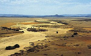
Granite Creek in July
|
|
|
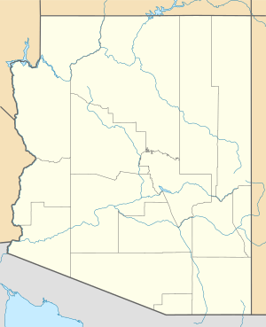
Location of the mouth of Granite Creek
|
|
| Country | United States |
| State | Arizona |
| County | Yavapai |
| City | Prescott |
| Physical characteristics | |
| Main source | Wolverton Mountain Bradshaw Mountains, Prescott National Forest 6,292 ft (1,918 m) 34°29′58″N 112°30′34″W / 34.49944°N 112.50944°W |
| River mouth | Verde River 4,236 ft (1,291 m) 34°51′46″N 112°25′55″W / 34.86278°N 112.43194°W |
| Length | 38 mi (61 km) |
| Basin features | |
| Basin size | 359 sq mi (930 km2) |
Granite Creek is a stream in the state of Arizona, United States. It is about 38 miles (61 kilometers) long. This creek is a tributary of the Verde River. A tributary is a smaller stream or river that flows into a larger one. Granite Creek flows mostly north and northeast. It starts in the Bradshaw Mountains and goes through the city of Prescott. It also passes through a cool area called the Granite Dells. Finally, it joins the Verde River.
Contents
The Journey of Granite Creek
Granite Creek starts its journey in the Prescott National Forest. This forest is located in the Bradshaw Mountains in west-central Arizona. At first, it's an intermittent stream. This means it doesn't always have water flowing in it, especially during dry times.
The creek first flows southeast for a short distance. Then, it turns and flows generally north. It passes under Arizona State Route 89, a major road. This road then runs alongside the creek for a while.
Flowing Through Prescott
As Granite Creek gets closer to Prescott, it leaves the national forest. Other smaller streams, like Bannon Creek and Manzanita Creek, join it. When the creek enters the city of Prescott, it goes under Route 89 again. Another stream, Aspen Creek, adds its water to Granite Creek.
Further north in Prescott, Miller Creek also flows into Granite Creek. The creek then turns northeast. It flows through the Yavapai-Prescott Indian Reservation. It crosses under Arizona State Route 89 one more time.
Past Lakes and Dells
As Granite Creek continues northeast, Slaughterhouse Gulch joins it. The stream then reaches Watson Lake. This is a popular spot for recreation. After leaving Watson Lake, Granite Creek flows through a unique area called the Granite Dells. This area has amazing rock formations.
The creek then passes under Arizona State Route 89A. Willow Creek joins Granite Creek from the left. From this point, the creek winds its way north-northeast. It flows through the Little Chino Valley. It passes by Prescott Municipal Airport.
Finally, Bottleneck Wash adds its water to the creek. Granite Creek flows past the town of Chino Valley. Its long journey ends when it flows into the Verde River. This meeting point is between Sullivan Lake and Muldoon Canyon.
What is a Watershed?
A watershed is like a giant bowl or basin. All the rain and snow that falls within this area drains into a specific river or stream. The Granite Creek watershed is the entire area of land where water flows into Granite Creek.
The land in this watershed has different heights. The highest point is on Mount Union, which is about 7,979 feet (2,432 meters) high. The lowest point is where Granite Creek meets the Verde River, at about 4,236 feet (1,291 meters).
 | George Robert Carruthers |
 | Patricia Bath |
 | Jan Ernst Matzeliger |
 | Alexander Miles |


