Grayridge, Missouri facts for kids
Quick facts for kids
Grayridge, Missouri
|
|
|---|---|

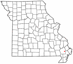
Location of Grayridge in Missouri
|
|
| Country | United States |
| State | Missouri |
| County | Stoddard |
| Area | |
| • Total | 1.02 sq mi (2.64 km2) |
| • Land | 1.02 sq mi (2.64 km2) |
| • Water | 0.00 sq mi (0.00 km2) |
| Elevation | 299 ft (91 m) |
| Population
(2020)
|
|
| • Total | 87 |
| • Density | 85.46/sq mi (32.99/km2) |
| FIPS code | 29-28864 |
| GNIS feature ID | 2587076 |
Grayridge is a small community in eastern Stoddard County, Missouri, United States. It is known as a census-designated place. This means it is an area that the government counts people in for official records.
Grayridge is located about ten miles southwest of Sikeston. You can find it just south of U.S. Route 60.
Contents
The Story of Grayridge's Name
The community of Grayridge got its name from an early settler named W. C. Gray. The first post office in the area opened in 1879. It was originally called Gray's Ridge.
Later, in 1887, the name was changed to Gray Ridge. Finally, in 1894, the name became Grayridge, which is what it is called today.
What Happens in Grayridge?
Grayridge is home to a special business called Stoddard County Oilseed Crushing. This company is working on something important for the environment. They are developing biodiesel.
Biodiesel is a type of fuel that is made from plants, like soybeans or other oilseeds. It is a cleaner-burning fuel compared to regular diesel. Using biodiesel can help reduce pollution and is a step towards more sustainable energy.
How Many People Live in Grayridge?
The number of people living in a place is called its population. The United States government counts everyone every ten years. This is called a census.
According to the 2020 census, 87 people lived in Grayridge. This makes it a very small community.
| Historical population | |||
|---|---|---|---|
| Census | Pop. | %± | |
| 2020 | 87 | — | |
| U.S. Decennial Census | |||
See Also
 Would you like to learn about Grayridge in Spanish? You can find more information here: Grayridge (Misuri) para niños
 | Emma Amos |
 | Edward Mitchell Bannister |
 | Larry D. Alexander |
 | Ernie Barnes |

