Grays Bay facts for kids
Quick facts for kids Grays Bay |
|
|---|---|
| Location | Coronation Gulf |
| Coordinates | 67°49′N 111°00′W / 67.817°N 111.000°W |
| River sources | Tree River, Annielik River |
| Basin countries | Canada |
| Settlements | Uninhabited |
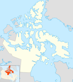
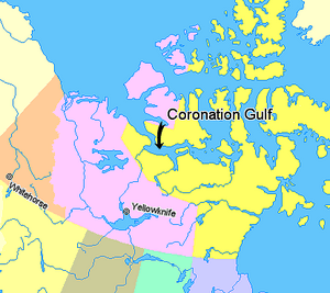
Grays Bay is a bay located in the Arctic region of Canada. It is found in the Kitikmeot Region of Nunavut, a large territory in northern Canada. The bay is part of the Coronation Gulf. Hepburn Island is located at the entrance to the bay. Two rivers, the Tree River and the Annielik River, flow into Grays Bay.
This area is the traditional home of the Kogluktuaryumiut people. They are a subgroup of the Copper Inuit. The Copper Inuit are Indigenous people who have lived in the Arctic for a very long time.
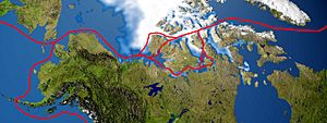
Grays Bay is also important because it is on the famous Northwest Passage route.
Grays Bay and the Northwest Passage
Grays Bay has been considered as a possible location for a large dock. This dock would be used to ship minerals. In 2007, a company called Wolfden Resources wanted to build a copper and zinc mine. Their plan included a 53-kilometre (about 33-mile) road. This road would lead to a dock at Grays Bay. The Nunavut Impact Review Board (NIRB) checked their plan. The NIRB is a group that reviews big projects. They make sure these projects are safe for the environment and local people.
Another company, MMG Minerals, also proposed a port at Grays Bay. This company is owned by the Chinese government. Their plan was for a port that could handle very large ships. These ships would travel through the Northwest Passage. They would make about 16 trips each year. The company also proposed a very long road. This road would be 350-kilometres (about 217-miles) long. It would have 70 bridges. This road would connect a mine at Izok Lake to Grays Bay.
This large project, called the Izok Corridor project, would produce many tonnes of zinc and copper each year. To do this, Izok Lake would need to be drained. Its water would be moved to another lake. Three smaller lakes at High Lake would also be drained. A large part of Grays Bay would also be filled in.
In 2012, MMG Minerals shared more details about their plans. The Grays Bay port would include a dock and storage buildings. It would also have fuel storage and a camp for workers. These facilities would help store the minerals. They would also allow large ships to load the minerals. The port would also help bring in fuel and supplies for the project. The Grays Bay port would be open for three months each year. During this time, ships would carry the minerals through the Northwest Passage.
 | James Van Der Zee |
 | Alma Thomas |
 | Ellis Wilson |
 | Margaret Taylor-Burroughs |


