Great Camanoe facts for kids

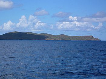
View of the eastern (uninhabited) side of Great Camanoe, from the east
|
|
|
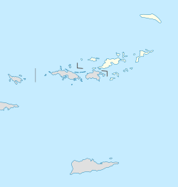
The location of Great Camanoe within the British Virgin Islands
|
|
| Geography | |
|---|---|
| Location | Caribbean Sea |
| Coordinates | 18°28′30″N 64°31′55″W / 18.47500°N 64.53194°W |
| Archipelago | Virgin Islands |
| Administration | |
|
United Kingdom
|
|
| British Overseas Territory | British Virgin Islands |
| Demographics | |
| Population | 6 (2010) |
| Additional information | |
| Time zone | |
| ISO code | VG |
Great Camanoe is a small island in the British Virgin Islands. It is located north of Beef Island and northeast of Tortola. These islands are part of the Virgin Islands group, found in the Atlantic Ocean and Caribbean Sea.
Most of Great Camanoe is a residential island, meaning people live there. It has two main communities on its southern side: Indigo Plantation and The Privateers. You can only reach the island by boat. Many visitors like to anchor their boats at Lee Bay or Cam Bay. Cam Bay is a national park and a great spot for snorkeling.
Island History and Name Origins
The name of Great Camanoe island has an interesting past. In 1793, a Spanish map of the Virgin Islands called this island "Cayman Grande." A nearby smaller island was called "Caiman Chico."
These names likely refer to American crocodiles, also known as caymans or caimans. These animals lived in the area when Christopher Columbus first explored the islands. Even today, you can still find caymans on islands like Cuba and Hispaniola. In Italian, which was Columbus's native language, the word for cayman is caimano. This is how the island might have gotten its name.
See also
 In Spanish: Gran Camanoe para niños
 | Aurelia Browder |
 | Nannie Helen Burroughs |
 | Michelle Alexander |


