Great Chagos Bank facts for kids
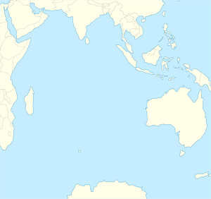
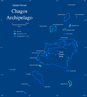
The Great Chagos Bank is the largest atoll structure in the world. It is located in the Chagos Archipelago, about 500 km (310 mi) south of the Maldives. This huge atoll covers a total area of 12,642 square kilometers (4,881 sq mi). The United Kingdom manages the atoll through the British Indian Ocean Territory (BIOT).
Islands of the Great Chagos Bank
Even though the Great Chagos Bank is very large, most of it is underwater. It is mainly a submarine structure. Only four reefs rise above the water. Most of these are on the western side of the atoll. Nelson Island is an exception. It sits alone in the middle of the northern edge.
These reefs have seven or eight small, sandy islands. Their total land area is about 5.6 square kilometers (2.2 sq mi). Since 1998, all these islands and the waters around them are a Strict Nature Reserve. This means they are protected areas. The eastern and southern parts of the bank, and the reefs in its center, are completely underwater.
The islands of the Great Chagos Bank are listed below, starting from the south and moving clockwise:
- Danger Island
- This island is a bit more than 2 km (1.2 mi) long from north to south.
- It is about 1 km (0.62 mi) wide.
- Its land area is 0.66 square kilometers (0.25 sq mi).
- It has many palm trees, some as tall as 12 meters (39 ft).
- Eagle Islands
- Île Aigle (Eagle Island) is covered with tall coconut trees. Its land area is 2.45 square kilometers (0.95 sq mi).
- Sea Cow Island (Île Vache Marine) also has trees. Its land area is 18 hectares (44 acres).
- Three Brothers (Trois Frères) and Resurgent Islands
- These islands are covered with tall coconut trees. Their total land area is 0.4 square kilometers (0.15 sq mi).
- Île du Sud (South Island) is the largest of this group, at 23 hectares (57 acres).
- Île du Milieu (Middle Island) is 8 hectares (20 acres).
- There is also an unnamed rocky islet.
- Île du Nord (North Island) is 6 hectares (15 acres).
- Nelson Island
- This island is 2 km (1.2 mi) long from east to west.
- It is up to 0.41 km (0.25 mi) wide.
- Its land area is 0.4 square kilometers (0.15 sq mi).
- It has bushy plants about 3 meters (9.8 ft) high.
Mapping the Underwater Reefs
The Great Chagos Bank was first mapped in 1837 by Commander Robert Moresby. He was part of the Indian Navy. For over 150 years, all other maps were based on his work.
Mapping atolls with many islands above water, like Peros Banhos and Diego Garcia, was fairly easy. However, mapping the huge underwater reefs of the Great Chagos Bank was very difficult. The true shape of these sunken reefs was not fully known until satellites began taking pictures in the late 1900s.
Moresby's first drawings of the underwater areas were not completely accurate. This was especially true for parts where there were no islands nearby, like in the southeast of the bank. On navigation maps from the 1980s, the outlines from these early surveys were marked with a dotted line. They also had a note saying "existence doubtful" until the 1998 map edition.
See also
 In Spanish: Gran Banco de Chagos para niños
 | Janet Taylor Pickett |
 | Synthia Saint James |
 | Howardena Pindell |
 | Faith Ringgold |


